
When wildfire season looms, especially in a state as vast and fire-prone as California, staying informed about the current fire situation is not just a matter of curiosity; it’s a crucial element of responsible travel, planning, and ensuring the safety of loved ones. The question, “Where are the California fires right now?” is a pressing one for residents, tourists, and anyone with a stake in the Golden State. This guide aims to equip you with the knowledge and resources to access real-time information, understand the impact on travel and tourism, and navigate the complexities of wildfire preparedness in California.
The dynamic nature of wildfires means that static information quickly becomes obsolete. Therefore, understanding where to find up-to-the-minute data is paramount. This involves not only knowing which official agencies provide the most accurate maps and incident reports but also comprehending how these fires can affect your travel plans, from booking a stay at a resort to exploring iconic landmarks.
Navigating the Blaze: Real-Time Fire Mapping and Incident Reports
The most critical aspect of understanding the current fire situation is accessing reliable, real-time mapping tools. Several official and reputable sources provide detailed information that can help you visualize the extent of the fires, their containment status, and their proximity to populated areas and key travel routes.
Official Fire Mapping Resources
The primary source for wildfire information in California is typically the state’s own emergency management agencies and forestry departments. These organizations are on the front lines of fire suppression and data collection.
-
CAL FIRE (California Department of Forestry and Fire Protection): This agency is instrumental in managing and responding to wildfires across the state. Their website is a treasure trove of information, often featuring interactive maps that display active incidents, including fire perimeters, containment percentages, and estimated acreage burned. These maps are usually updated frequently, reflecting the latest reports from incident commanders. You can expect to find details on evacuation zones, road closures, and resource deployment. For travelers, understanding CAL FIRE’s reporting is key to assessing potential disruptions. For example, a fire near Yosemite National Park could necessitate rerouting your drive or even impact your planned accommodation at a nearby lodge.
-
U.S. Forest Service (USFS) and Bureau of Land Management (BLM): For fires occurring on federal lands, such as national forests and parks, the USFS and BLM are the lead agencies. Their websites will also offer incident maps and reports, often coordinating with CAL FIRE for a unified view of the statewide situation. These maps are invaluable for understanding the potential impact on popular destinations like Lake Tahoe or the Sierra Nevada.
-
National Interagency Fire Center (NIFC): NIFC provides a national overview of wildfire activity and serves as a hub for information from various federal and state agencies. While they may not offer the hyper-local detail of CAL FIRE, their national fire map can provide a broader context of wildfire activity in the western United States, including California.
Understanding Fire Maps: Key Features
When you access these fire maps, you’ll encounter several important elements:
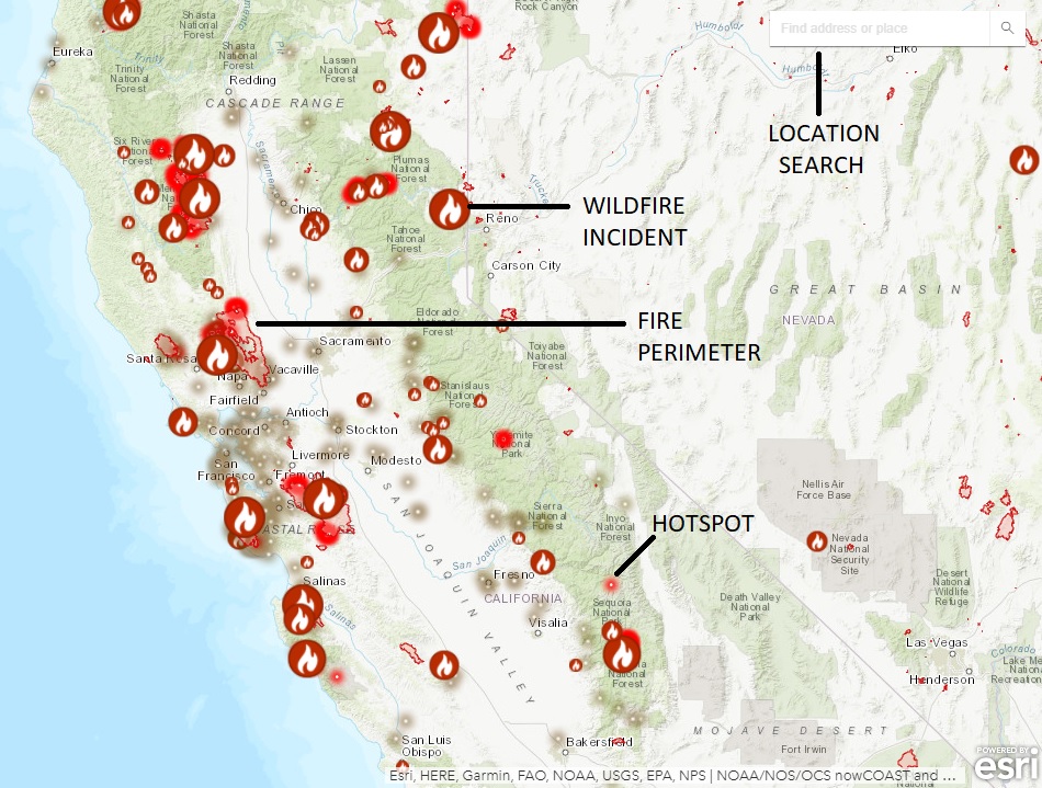
- Active Incidents: These are clearly marked on the map, often with icons representing the type and size of the fire. Clicking on an icon usually reveals more detailed information.
- Fire Perimeter: This line or shaded area indicates the current known boundary of the fire. It’s crucial to note that this is an estimate and can change rapidly.
- Containment: This percentage indicates how much of the fire’s perimeter has been secured by firefighters, preventing further spread. A higher containment percentage generally means the fire is becoming more controlled.
- Acreage: This provides an estimate of the total land area affected by the fire.
- Evacuation Orders and Warnings: These are critical for safety. Maps will often show zones under evacuation orders (requiring immediate departure) and evacuation warnings (advising residents to be prepared to leave). This information is vital for anyone considering travel to or through affected areas.
- Road Closures: Wildfires can lead to the closure of major highways and local roads, significantly impacting travel plans. Maps often highlight these closures, helping you find alternative routes.
Impact on Travel and Tourism: Adapting Your Itinerary
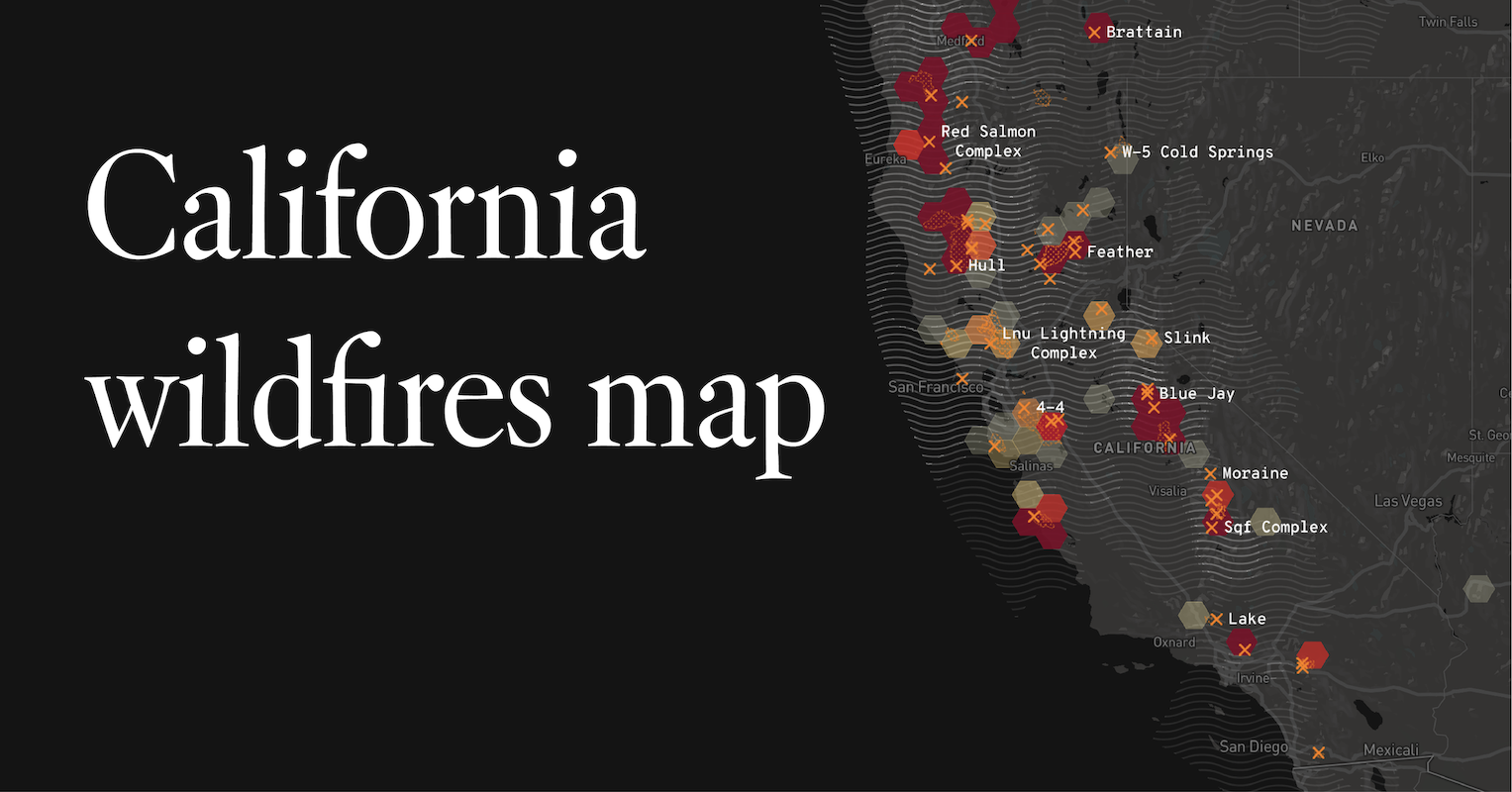
The presence of wildfires can have a profound impact on travel and tourism in California. From impacting the accessibility of iconic attractions to influencing the availability and pricing of hotels, understanding these effects is essential for a smooth trip.
Planning Your Journey Amidst Fire Concerns
When planning a trip to California during fire season, flexibility and proactive research are key.
- Destination Choice: Consider destinations that are less likely to be directly affected by fires. While California is a large state, certain regions might experience more severe fire activity than others depending on the year’s weather patterns. Coastal areas, for instance, might sometimes be less prone to large-scale wildfires compared to inland forests. However, smoke can travel long distances, so air quality should also be a consideration.
- Accommodation Bookings: If you are booking accommodation such as hotels, resorts, or vacation rentals, check their proximity to known fire areas and potential evacuation zones. Some booking platforms may offer flexible cancellation policies in case of fire-related disruptions, so it’s worth inquiring. Look for places that offer amenities like air purifiers if smoke is a concern.
- Itinerary Adjustments: Be prepared to alter your itinerary. Road closures are common, and access to national parks and other outdoor attractions can be restricted or completely shut down. Having backup plans for activities and sightseeing is crucial. For instance, if a planned hike in Joshua Tree National Park is impossible due to fire, have an alternative like exploring the museums in Los Angeles or a scenic drive along the coast.
- Air Quality and Health: Wildfires produce smoke, which can significantly impact air quality. Check air quality indexes (AQI) for your destination and any areas you plan to travel through. Areas with high AQI may be hazardous for outdoor activities, especially for individuals with respiratory conditions. This can influence your decision to engage in outdoor tourism activities or even the choice of hotel amenities, like rooms with good ventilation.
- Transportation: Air travel can also be affected by wildfires due to smoke impacting visibility at airports. Flights might be delayed or canceled. Driving routes can be rerouted or blocked entirely. Always check real-time traffic and flight information before heading to the airport or embarking on a road trip.
Experiencing California Responsibly
Beyond immediate safety and travel logistics, a mindful approach to experiencing California during fire season is important.
- Respect Evacuation Orders: If you are in an area with evacuation orders, comply immediately. Your safety is the absolute priority.
- Fire Safety: Be extra vigilant about fire safety yourself. During dry conditions, even small actions like properly disposing of cigarettes or ensuring campfires are completely extinguished can prevent new fires from starting. This aligns with responsible lifestyle choices, especially when enjoying the natural beauty of California.
- Support Local Businesses: When it’s safe to do so, continue to support local businesses, including restaurants and shops, as they often face significant economic challenges during fire events. This is part of experiencing the local culture and contributing to the resilience of communities.
- Stay Informed: Continuously monitor fire maps and official updates from CAL FIRE and other relevant agencies. Information changes rapidly, and staying informed allows you to make the best decisions for your safety and your travel plans.
Preparedness and Safety Tips for Residents and Travelers
Understanding where the fires are is only one part of the equation. Being prepared and knowing how to stay safe is equally vital, whether you’re a lifelong resident of California or a visitor exploring its diverse landscapes.
Essential Preparedness Measures
- Emergency Kit: Pack an emergency kit with essentials like water, non-perishable food, a first-aid kit, medications, a flashlight, extra batteries, a multi-tool, and personal hygiene items. For travelers, this can be a scaled-down version of a home emergency kit.
- Communication Plan: Establish a communication plan with your family or travel companions. Know how you will contact each other if separated and have an out-of-state contact person who can relay messages.
- Know Your Evacuation Routes: If you are staying in an area known for wildfire risk, familiarize yourself with the designated evacuation routes. Have multiple options in mind.
- Sign Up for Alerts: Register for local emergency alert systems in the areas you are visiting or living in. This can provide direct notifications about fire activity and evacuation orders.
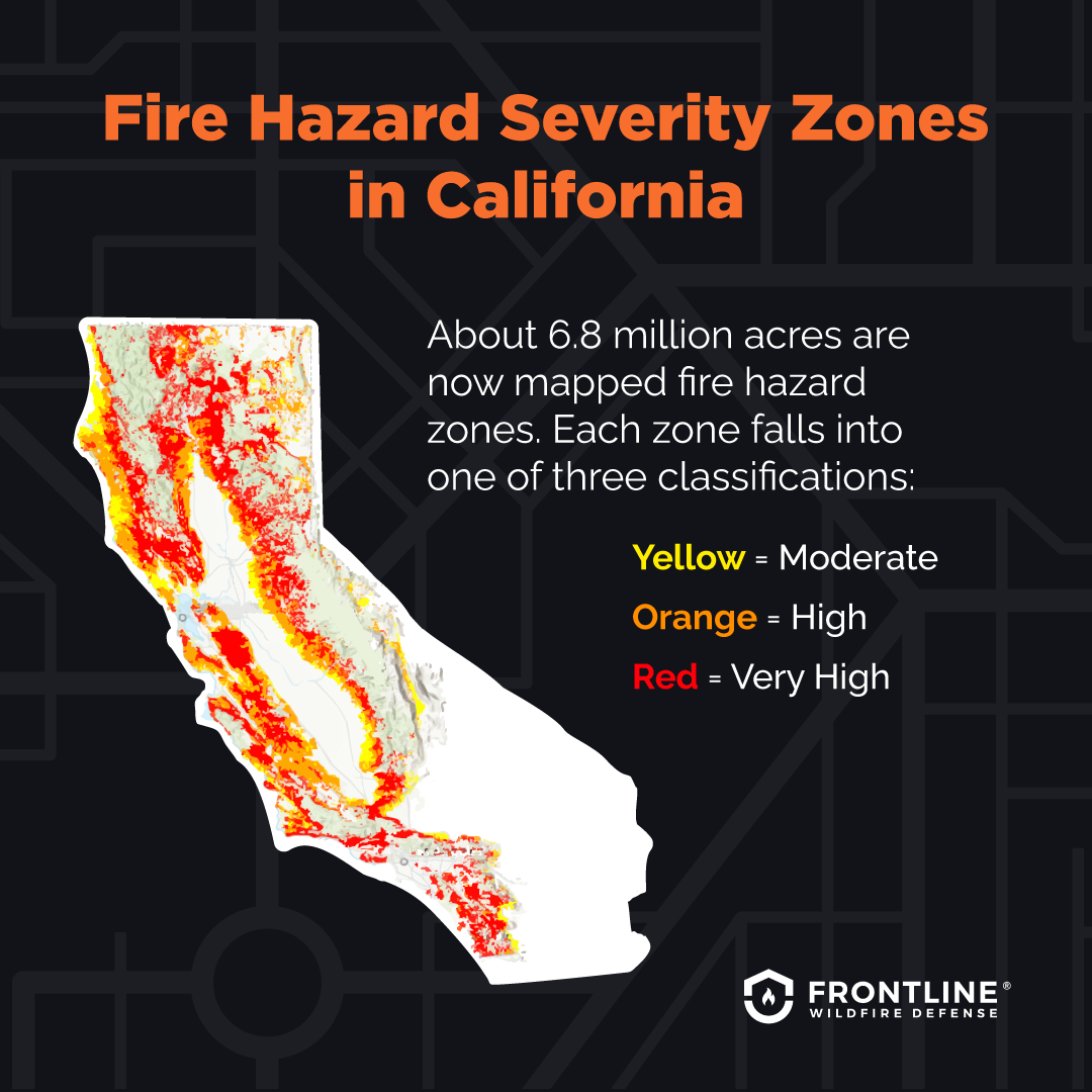
- Home Preparedness (for residents): For those living in high-risk areas, take steps to “harden” your home against wildfire. This includes clearing brush and vegetation from around your property, ensuring your roof and gutters are clear of debris, and using fire-resistant building materials.
Safety in the Face of Wildfires
- Listen to Authorities: Always follow the instructions of emergency personnel and local officials.
- Evacuate When Advised: Do not wait to be told twice to evacuate if an order is issued. Your life is more valuable than any possession.
- Avoid Fire Areas: Stay away from active fire zones and areas where firefighting operations are underway. This includes staying off roads that have been closed due to the fires.
- Be Aware of Air Quality: If smoke is present, stay indoors as much as possible, close windows and doors, and use air purifiers if available. If you must go outside, wear an N95 respirator mask.
- Drive Safely: If you must drive through smoky areas, reduce your speed, use your headlights, and be aware that visibility can be extremely poor. Watch out for emergency vehicles and personnel.
By combining access to real-time fire mapping with thorough preparedness and a commitment to safety, individuals can navigate the challenges posed by wildfires in California more effectively, ensuring both personal well-being and the ability to continue experiencing the state’s remarkable attractions and natural beauty in a responsible manner.
LifeOutOfTheBox is a participant in the Amazon Services LLC Associates Program, an affiliate advertising program designed to provide a means for sites to earn advertising fees by advertising and linking to Amazon.com. Amazon, the Amazon logo, AmazonSupply, and the AmazonSupply logo are trademarks of Amazon.com, Inc. or its affiliates. As an Amazon Associate we earn affiliate commissions from qualifying purchases.