
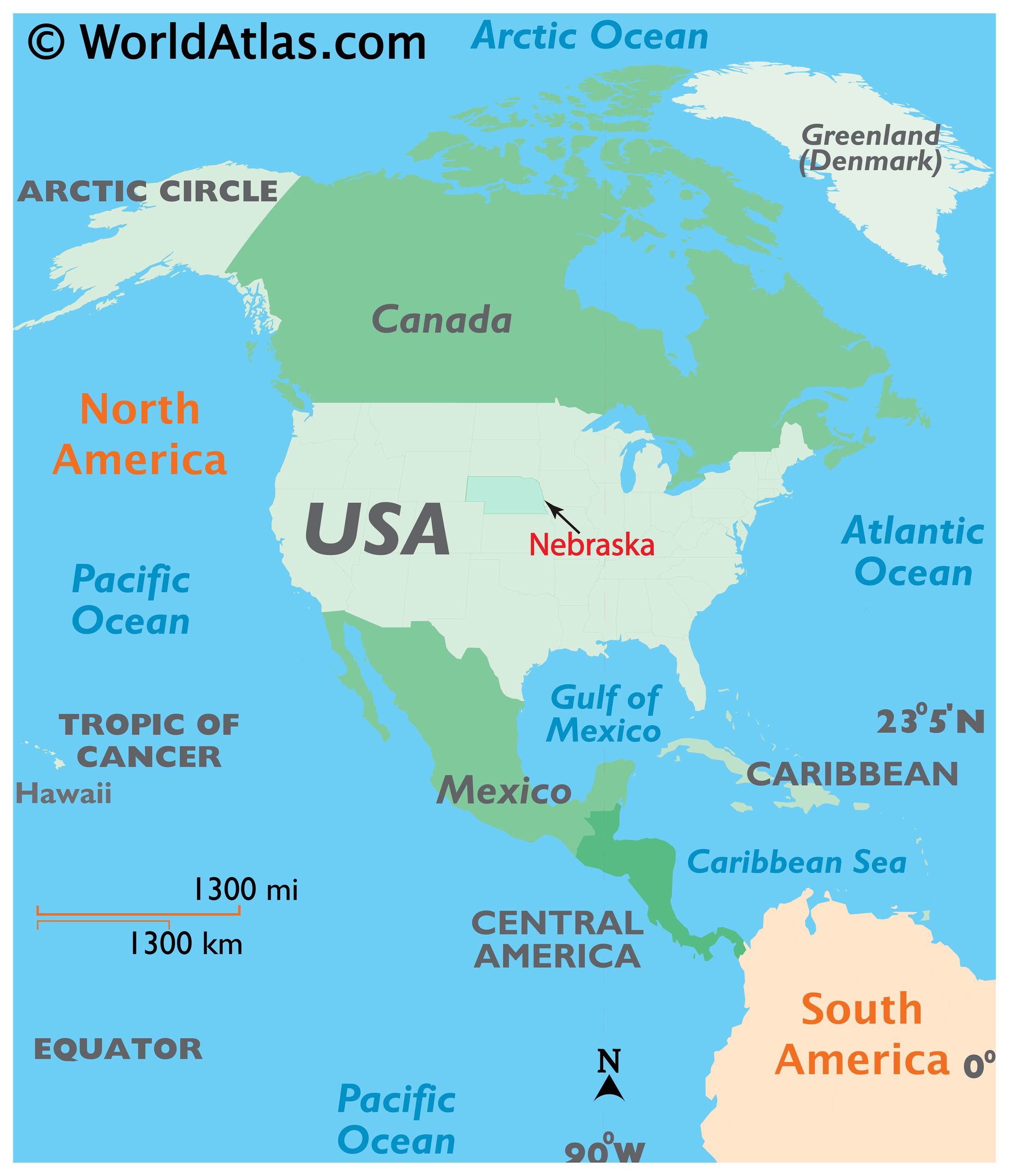
Geographically positioned at the very heart of the United States, Nebraska serves as the quintessential American crossroads. Often categorized as part of the Great Plains, this landlocked state offers a diverse landscape that transitions from the rolling, forested hills of the east to the high, arid plains of the west. Understanding its location is the first step in appreciating why it has historically functioned as the gateway to the West, serving as a critical corridor for pioneers, explorers, and modern-day travelers alike.
The Geographical Coordinates and Regional Context
Nebraska occupies a central location in the North American continent, bounded by six states that each contribute to the region’s unique cultural and geographical identity. To the north lies South Dakota, while the southern border is shared with Kansas. To the east, the state is separated from Iowa and Missouri by the meandering Missouri River. To the west, it borders Colorado and Wyoming.
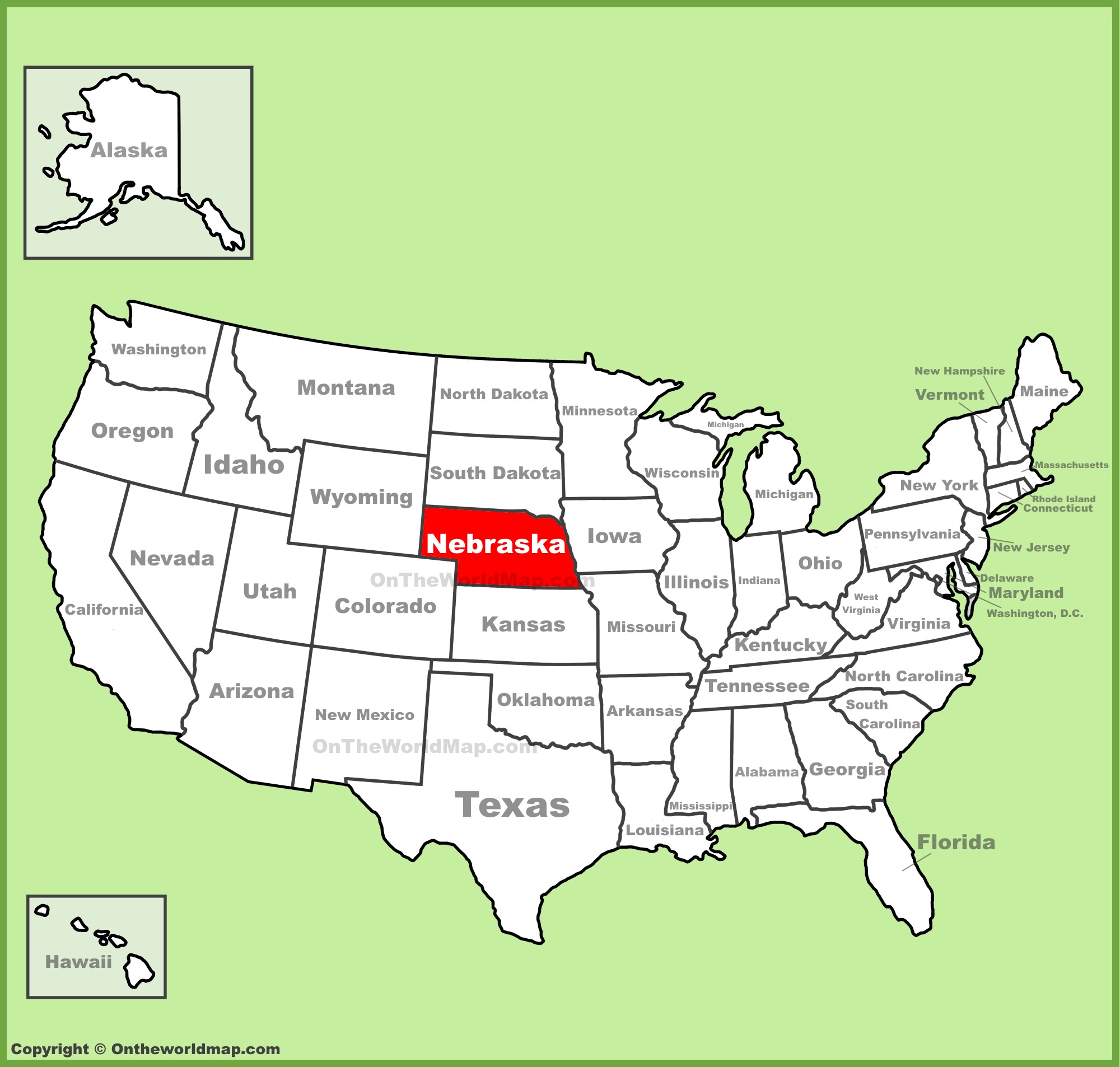
The Great Plains Transition
The state’s geography is marked by a dramatic shift in elevation and terrain. As one moves from the eastern border along the Missouri River toward the western reaches near the Rocky Mountains, the elevation rises significantly. This transition creates distinct ecological zones, moving from the lush, fertile farmlands of the Platte River Valley to the dramatic, jagged escarpments found in the Panhandle. This steady climb is perhaps the most defining characteristic of the state’s interior location, influencing everything from local weather patterns to the types of agriculture that have sustained the region for generations.
Major Cities and Navigational Hubs
Because of its strategic location in the center of the country, Nebraska serves as a vital transit point for interstate commerce and transcontinental travel. Major cities in the state are primarily located along major river arteries and historical travel corridors, reflecting the state’s reliance on geography for growth and development.
The Eastern Corridor: Omaha and Lincoln
Omaha is situated on the easternmost edge of the state, directly along the Missouri River. As the largest city in Nebraska, it acts as a cultural and economic gateway. Lincoln, the state capital, lies roughly 50 miles to the southwest of Omaha. Both cities sit within the fertile “Dissected Till Plains,” a region characterized by rolling hills that stand in stark contrast to the flatter plains of the western part of the state. These two metropolitan centers provide the primary urban infrastructure for the region, housing the majority of the state’s population and serving as the focal point for education and government.
Central and Western Connectivity
Further inland, the Platte River provides a natural highway that has guided travelers for centuries. Cities like Kearney and North Platte are strategically positioned along this waterway. These cities have historically been vital stops for those moving toward the Rocky Mountains. In the far western portion of the state, the landscape changes entirely, giving way to the Pine Ridge Escarpment and the Wildcat Hills, showcasing a topography that feels more aligned with the rugged American West than the agricultural heartland of the east.
Historical Significance of the Location
The location of Nebraska has always been its greatest asset. Before the advent of modern highways, the state was the literal “bridge” that connected the Atlantic and Pacific coasts.
Gateway for Westward Expansion
During the 19th century, the Oregon Trail, Mormon Trail, and California Trail all funneled travelers directly through the river valleys of Nebraska. The proximity to the Platte River provided a reliable water source and a relatively flat path for pioneers. This migration not only settled the land but also established the state as a critical logistical hub. Later, the construction of the First Transcontinental Railroad further solidified this role, ensuring that the state remained at the center of the country’s infrastructure network.
Cultural Intersection
Because it sits at the crossroads of different regions, the culture found within the state’s borders is a fascinating blend of various influences. Elements of the Midwest are heavily present in the eastern cities, while the western regions feel a stronger pull from the Mountain West. This intersection creates a unique atmosphere where visitors can experience both the refined urban life of Omaha and the rugged, wide-open expanses of the Sandhills, all within a single day’s travel.
Navigating Nebraska Today
For the modern traveler, Nebraska is easily accessible via major interstate highways such as Interstate 80, which spans the entire length of the state. This highway essentially traces the historical path of the pioneers, offering a seamless journey across the Great Plains.
Reaching the Heart of the Plains
Most visitors access the state through Eppley Airfield in Omaha, which serves as the primary international gateway. From there, the vast network of state and federal highways allows travelers to explore deeper into the interior. Whether one is driving toward the Scotts Bluff National Monument to see the dramatic geological formations or visiting the Henry Doorly Zoo and Aquarium in the east, the state’s central location makes it a logical stop for those traversing the United States.
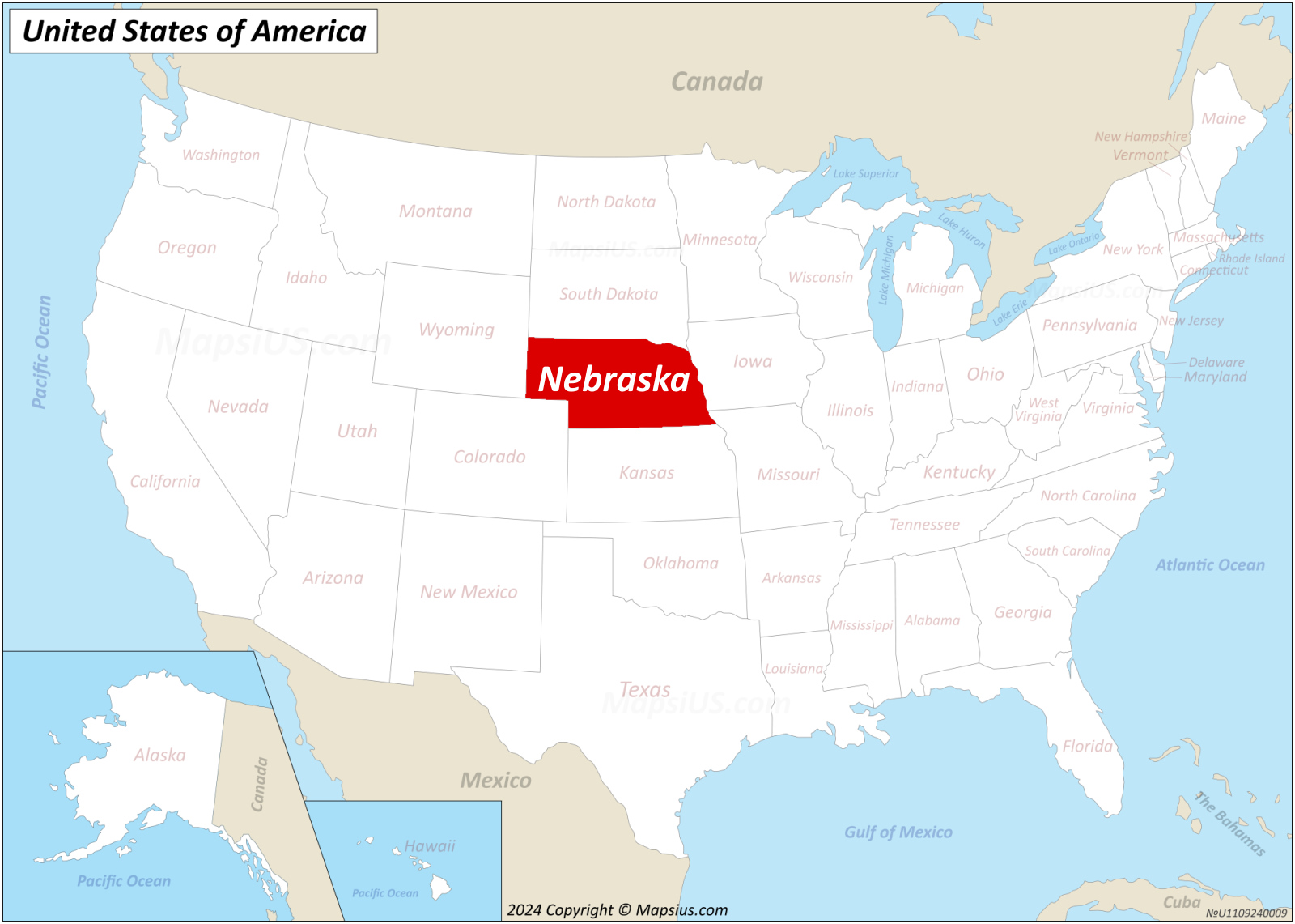
Tips for Travelers
While the state’s location is perfect for transit, it is also a destination in its own right. Travelers should be prepared for the vast distances between cities. Because the state is so expansive, planning a route that takes advantage of the Platte River Valley is recommended for those who want to see the most iconic historical sites. It is also important to note the seasonal shifts; the climate changes rapidly as one moves across the various zones of the state, making layered clothing essential for anyone planning an extended road trip across these vast, central plains.
By understanding where Nebraska is located—not just on a map, but in the context of history, commerce, and culture—one gains a deeper appreciation for this often-overlooked center of the North American continent. It is far more than just a “flyover” state; it is a vital hinge upon which the story of American travel and expansion turns.
LifeOutOfTheBox is a participant in the Amazon Services LLC Associates Program, an affiliate advertising program designed to provide a means for sites to earn advertising fees by advertising and linking to Amazon.com. Amazon, the Amazon logo, AmazonSupply, and the AmazonSupply logo are trademarks of Amazon.com, Inc. or its affiliates. As an Amazon Associate we earn affiliate commissions from qualifying purchases.