
The question of current wildfires in California is one of critical importance, not only for residents and emergency responders but also for travelers planning visits to the Golden State. Understanding the landscape of active fire incidents, their proximity to popular tourist destinations, and the potential impact on travel plans is paramount for ensuring safety and maximizing the enjoyment of a trip. This article aims to provide an overview of how to stay informed about ongoing fire activity and its implications for tourism and travel across California.
While the immediate concern surrounding wildfires is understandably focused on containment and public safety, their presence can significantly influence travel decisions. Areas that are typically vibrant hubs for tourism might face temporary closures, altered accessibility, or advisories due to smoke or direct fire threats. Conversely, many of California’s renowned attractions, from national parks to coastal cities, remain open and unaffected. The key lies in accessing reliable, up-to-date information.
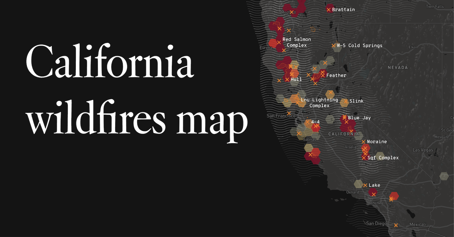
Understanding California’s Fire Season
California’s fire season is a complex phenomenon influenced by a confluence of environmental factors. Typically, the dry summer months, coupled with high temperatures and strong winds, create conditions ripe for ignition and rapid fire spread. However, the specific timing and intensity of these fire events can vary annually, making real-time information crucial.
Key Contributing Factors
- Climate: California experiences a Mediterranean climate, characterized by dry, hot summers and mild, wet winters. This natural pattern means that vegetation becomes increasingly parched as the summer progresses, serving as abundant fuel for fires.
- Topography: The state’s diverse topography, including vast mountainous regions, deep canyons, and dense forests, can funnel winds and accelerate fire movement. Steep slopes also make firefighting efforts more challenging.
- Vegetation: Decades of fire suppression have, in some areas, led to an overabundance of dry, dead vegetation, increasing the potential for larger and more intense wildfires. Drought conditions exacerbate this, drying out plant life further.
- Weather Patterns: Santa Ana winds in Southern California and Diablo winds in Northern California are notorious for their ability to rapidly spread fires due to their high speeds and low humidity.
The notion of a distinct “fire season” has become increasingly blurred in recent years, with fire activity occurring outside traditional months. This necessitates a year-round awareness of potential risks, especially for travelers who may be visiting during shoulder seasons or unexpected periods of heightened fire danger.
Resources for Real-Time Fire Information
For travelers, staying informed about current fire activity is not just a matter of convenience but a critical safety measure. Fortunately, a variety of official and reliable sources provide up-to-the-minute information.
Official Agencies and Websites
The most authoritative sources for wildfire information are state and federal agencies responsible for land management and emergency services.
- CAL FIRE (California Department of Forestry and Fire Protection): This agency is the primary source for wildfire information within California. Their website, often featuring an interactive map, details active incidents, including the fire’s location, size, containment percentage, and estimated time of full containment. They also issue evacuation orders and advisories. Travelers can visit the CAL FIRE website for the most current data.
- National Interagency Fire Center (NIFC): NIFC provides a national overview of significant wildfire activity. While more focused on large, complex incidents, it can offer a broader context for understanding fire situations across the Western United States, including California.
- InciWeb (Incident Information System): This interagency platform is a central hub for information on significant wildfires across the United States. It aggregates data from various agencies and provides detailed incident reports, maps, and public information statements.
Local and Regional Alerts
Beyond state and federal resources, local emergency management agencies and county sheriffs’ offices often issue immediate alerts and evacuation notices for their specific jurisdictions. These are critical for understanding localized impacts.
- County Emergency Websites: Many counties in California have dedicated emergency management websites that provide real-time updates on local incidents, road closures, and evacuation zones.
- Local News Outlets: Reputable local news stations and newspapers are invaluable for timely reporting on fires affecting specific communities and tourist areas.
Mobile Apps and Social Media
In an increasingly connected world, mobile applications and official social media channels have become vital tools for rapid dissemination of information.
- Emergency Alert Apps: Many government agencies and private companies offer apps that can push alerts directly to your phone based on your location or saved areas of interest.
- Official Social Media Accounts: CAL FIRE and local fire departments often maintain active social media presences, particularly on platforms like Twitter, where they post rapid updates, photos, and advisories.
When planning a trip, it is advisable to bookmark these resources and check them regularly, especially if your itinerary includes areas known for fire activity or if weather forecasts indicate high fire danger.
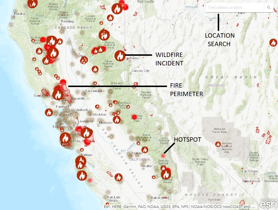
Impact on Travel and Tourism
Wildfires can have a multifaceted impact on travel and tourism in California, affecting everything from accessibility to the overall visitor experience.
National Parks and Forests
California’s vast network of national parks and forests, including iconic destinations like Yosemite National Park, Sequoia and Kings Canyon National Parks, and the Angeles National Forest, are often at the forefront of fire impacts.
- Closures and Evacuations: During significant fire events, park and forest roads, campgrounds, and even entire areas may be temporarily closed to the public for safety reasons. Evacuations can occur with little notice.
- Smoke Impact: Even if a park is not directly threatened by fire, smoke from distant fires can drift into an area, significantly reducing visibility and impacting air quality. This can diminish the visual appeal of scenic vistas and pose health risks.
- Trail and Activity Disruptions: Trails may be closed due to fire or fire suppression activities. Backcountry access can be restricted, affecting hikers and campers.
Travelers planning to visit these natural attractions should always check the official park or forest service websites for current conditions and alerts before and during their visit.
Coastal and Urban Destinations
While inland natural areas are more directly prone to wildfires, coastal and urban destinations can also be affected, primarily by smoke and air quality issues.
- Air Quality Advisories: Smoke can travel hundreds of miles, leading to unhealthy air quality even in areas far from active fires. This can affect outdoor activities, from sightseeing to dining al fresco. Travelers should monitor air quality indexes (AQI) provided by local health departments or environmental agencies.
- Event Cancellations: Large outdoor events, festivals, or sporting competitions might be canceled or postponed due to poor air quality or the need to divert resources for fire response.
- Transportation: While major transportation networks are generally resilient, localized road closures can occur if fires encroach upon highways or access routes. Airports can experience delays or cancellations due to smoke affecting visibility for pilots.
Even if your intended destination is not experiencing direct fire impacts, it is prudent to be aware of regional fire activity and its potential to affect air quality and travel conditions.
Planning and Flexibility
The unpredictable nature of wildfires underscores the importance of flexible travel planning.
- Build in Buffer Time: If your trip involves areas with a history of fire activity, consider building some flexibility into your schedule to accommodate potential disruptions.
- Have Alternative Plans: It’s wise to have a few alternative activities or destinations in mind that are less likely to be affected by wildfires, should your primary plans need to change.
- Travel Insurance: For significant trips, consider travel insurance that may cover non-refundable expenses incurred due to unforeseen events like widespread wildfires that lead to closures or travel cancellations.
By staying informed and adopting a flexible approach, travelers can still experience the beauty and attractions of California while navigating the challenges posed by wildfire season.
Preparing for Fire-Prone Areas
For travelers intending to visit or travel through areas known to be susceptible to wildfires, proactive preparation can significantly enhance safety and peace of mind. This preparation extends beyond simply checking fire maps to understanding broader risk mitigation strategies.
Pre-Trip Preparations
- Research Your Destination: Before booking, research the specific region’s fire history and typical fire season. Websites of national parks, state parks, and local tourism boards often provide this information.
- Review Travel Advisories: Pay attention to any travel advisories issued by your home country’s state department or foreign affairs ministry, especially if traveling internationally.
- Pack Accordingly: While not directly fire-fighting gear, consider packing items that can be useful in poor air quality conditions, such as N95 masks. Comfortable walking shoes are always recommended, and if venturing into natural areas, durable clothing suitable for varying conditions is beneficial.
- Vehicle Preparedness: Ensure your vehicle is in good working order. If traveling through remote areas, carry a full tank of gas, water, and non-perishable food. Ensure your mobile phone is fully charged and consider a portable power bank.
During Your Trip
- Stay Informed Continuously: Don’t rely on information gathered before your trip. Check local news, official fire websites, and weather forecasts daily. If you are in a hotel in Los Angeles or a vacation rental in San Diego, make it a habit to check these resources each morning.
- Heed Evacuation Orders Immediately: If evacuation orders are issued for your area, do not delay. Follow the instructions of emergency personnel and have a pre-determined safe route and destination.
- Understand Air Quality: Be aware of the Air Quality Index (AQI). If the AQI is unhealthy, limit outdoor activities, especially strenuous ones. Sensitive groups, including children, the elderly, and those with respiratory or heart conditions, should take extra precautions.
- Respect Road Closures: Never drive through closed roads or disregard barricades. These closures are in place for your safety and the safety of emergency responders.
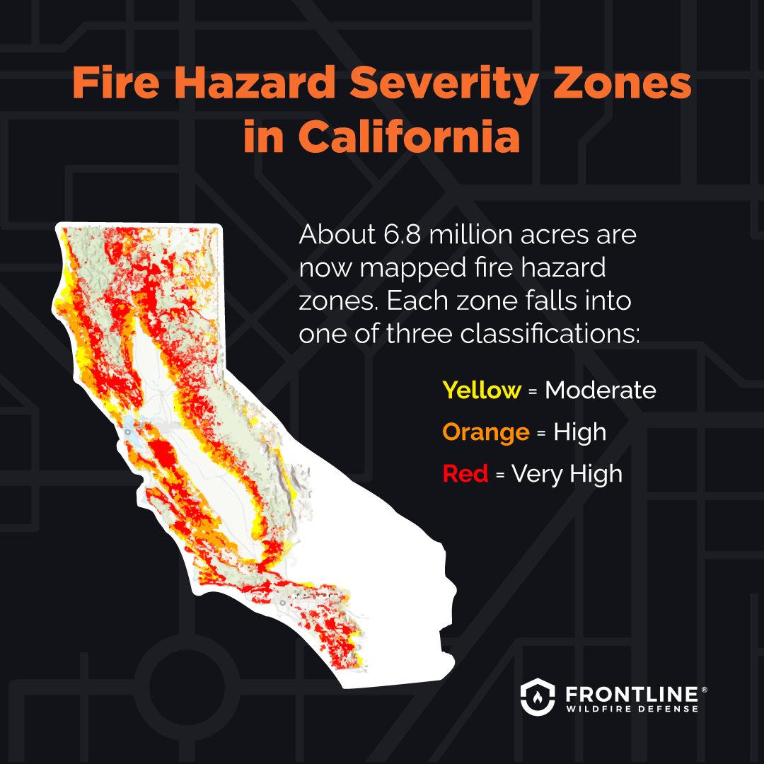
- Fire Safety in Natural Areas: If camping or visiting parks, strictly adhere to all fire restrictions. Be aware of the “red flag” warnings, which indicate extreme fire danger. Never leave a campfire unattended.
By incorporating these preparation steps into your travel plans, you can significantly reduce risks and ensure a safer and more enjoyable experience when exploring the diverse landscapes of California, even during periods of heightened wildfire activity.
LifeOutOfTheBox is a participant in the Amazon Services LLC Associates Program, an affiliate advertising program designed to provide a means for sites to earn advertising fees by advertising and linking to Amazon.com. Amazon, the Amazon logo, AmazonSupply, and the AmazonSupply logo are trademarks of Amazon.com, Inc. or its affiliates. As an Amazon Associate we earn affiliate commissions from qualifying purchases.