
The journey between Los Angeles and San Diego is one of the most iconic travel corridors in the United States. Spanning the sun-drenched coastline of California, this route connects two of the nation’s most vibrant metropolitan areas. Whether you are a local looking for a weekend getaway or a visitor exploring the West Coast for the first time, understanding the nuances of the distance, the geography, and the transit options is essential for a seamless experience. While the physical distance remains constant, the “travel distance” in terms of time and effort can vary wildly depending on your chosen mode of transport and the infamous regional traffic.
The Geography of the South Coast: Measuring the Distance
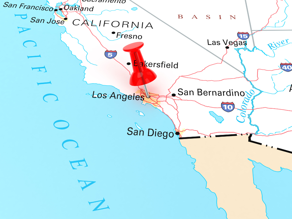
To answer the question of how far it is from Los Angeles to San Diego, one must first define the starting and ending points. If you are measuring from city center to city center, the straight-line distance is approximately 112 miles (180 kilometers). However, very few travelers have the luxury of flying a private helicopter directly between City Hall in Los Angeles and the Civic Center in San Diego.
Straight-Line vs. Driving Distance
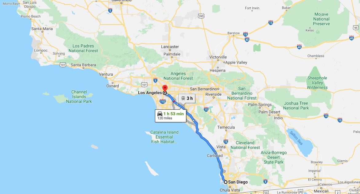
The actual driving distance is typically between 120 and 130 miles, depending on the specific neighborhood from which you depart. For instance, if you are starting in Santa Monica or Beverly Hills, your journey will be slightly longer than if you were departing from Long Beach or Anaheim. The route primarily follows the coastline, weaving through Orange County before entering San Diego County. This geographical stretch is characterized by a mix of dense urban development, military installations, and breathtaking ocean vistas.
Navigating Southern California Geography
The trip essentially moves you from the sprawling Los Angeles Basin into the more rugged, mesa-filled terrain of the South Coast. As you head south, you leave behind the towering skyscrapers of Downtown Los Angeles and transition into the suburban beach towns of the OC. Understanding this geography is vital because the terrain dictates the flow of traffic. The Santa Ana Mountains to the east and the Pacific Ocean to the west create a natural funnel, meaning there are limited major highways to choose from, which directly impacts your travel time.
Navigating the Corridor: Primary Modes of Transportation
When planning your travel between these two hubs, you have several distinct options. Each offers a different perspective on the Southern California landscape and caters to different priorities, whether they be speed, cost, or scenery.
Driving via Interstate 5 and I-405
The most common way to traverse this distance is by car. The Interstate 5, often referred to by locals as “the 5,” is the primary artery connecting the two cities. If you are starting on the west side of Los Angeles, you will likely begin on the I-405 before merging with the Interstate 5 in Irvine. Under ideal conditions—which usually occur in the middle of the night—the drive takes about two hours. However, during peak hours, this same journey can easily stretch to three or even four hours. The drive is straightforward but requires a high degree of alertness due to the sheer volume of traffic.
Taking the Pacific Surfliner Train
For those who prefer to leave the driving to someone else, Amtrak operates the Pacific Surfliner. This is widely considered one of the most beautiful train rides in the North America. The train departs from Union Station in Los Angeles and arrives at the Santa Fe Depot in Downtown San Diego. The journey takes approximately 2 hours and 45 minutes. The tracks run directly alongside the beach for long stretches, particularly through San Clemente and Del Mar, offering views that are completely inaccessible by car.
Bus and Shuttle Services
Budget-conscious travelers often opt for bus services such as Greyhound or FlixBus. These services are frequent and affordable, often departing from various points including Hollywood and Downtown Los Angeles. While the travel time is subject to the same traffic conditions as a private car, it allows passengers to relax, work, or enjoy the view without the stress of navigating the freeway.
The Art of the Road Trip: Iconic Stops Between the Two Cities

While many people treat the trip as a point-to-point commute, the 120-mile stretch is filled with incredible destinations that make the journey part of the experience. Turning the drive into a day-long road trip allows you to see the diversity of the California coast.
The Charm of San Juan Capistrano
Located roughly halfway between the two cities, San Juan Capistrano is a historical gem. It is home to the Mission San Juan Capistrano, a landmark founded in 1776. Walking through the ruins of the “Great Stone Church” and the lush gardens provides a peaceful respite from the hum of the highway. The nearby Los Rios Historic District is the oldest neighborhood in California, featuring quaint cottages, cafes, and a petting zoo that is perfect for families.
Exploring Carlsbad and Oceanside
As you cross the border into San Diego County, the vibe becomes noticeably more relaxed. Oceanside offers a classic California beach experience with its long pier and the California Surf Museum. Just south of it lies Carlsbad, a city famous for its flower fields and the immensely popular Legoland California. If you are traveling in the spring, the The Flower Fields at Carlsbad Ranch offer a spectacular display of giant tecolote ranunculus that cover the hillside in a rainbow of colors.
Coastal Beauty in La Jolla
Before reaching the heart of San Diego, a stop in La Jolla is highly recommended. Known as the “Jewel” of San Diego, this upscale seaside community features the stunning La Jolla Cove, where seals and sea lions bask on the rocks. The Torrey Pines State Natural Reserve is also nearby, offering hiking trails that wind along cliffs overlooking the Pacific Ocean. It is a perfect spot to stretch your legs and breathe in the salty sea air before the final leg of the journey.
Factors Influencing Your Travel Time
The question “how far is it?” is often a proxy for “how long will it take?” In Southern California, time and distance are frequently disconnected. To plan an effective trip, one must account for several external factors that can turn a short hop into a marathon.
The Impact of Los Angeles Traffic
It is impossible to discuss travel in this region without mentioning traffic. Los Angeles is world-renowned for its congestion. The segment of the Interstate 5 through Commerce and Santa Fe Springs is a notorious bottleneck. Similarly, the “Y” merge where the I-405 meets the Interstate 5 in south Orange County can cause significant delays. Travelers are advised to use real-time navigation apps and to avoid the 7:00 AM – 10:00 AM and 3:00 PM – 7:00 PM windows if possible.
Weekend vs. Weekday Commutes
The day of the week significantly alters the travel experience. A Friday afternoon departure from Los Angeles toward San Diego is perhaps the most challenging time to travel, as commuters mix with weekend travelers. Conversely, a Sunday morning drive is often breezy and quick. Interestingly, San Diego also has its own rush hours, particularly around the UTC area and the merge of Interstate 5 and Interstate 805, which should be factored into your arrival time.
Strategic Planning for Your Southern California Journey
To make the most of your trip between these two iconic cities, a bit of strategy goes a long way. This isn’t just about getting from A to B; it’s about optimizing your time to enjoy what both regions have to offer.
Best Times to Depart
For the smoothest driving experience, aim to leave Los Angeles before 6:00 AM or after 7:30 PM. If you are traveling on a weekday and cannot avoid peak hours, consider the Pacific Surfliner, as it is unaffected by freeway accidents or rush-hour slowdowns. For those driving, Tuesday and Wednesday are typically the “lightest” traffic days, though in California, “light” is a relative term.
Navigating Regional Airports
For international travelers or those coming from further afield, the distance between the two cities is often bridged via regional airports. While Los Angeles International Airport (LAX) is the largest hub, John Wayne Airport in Santa Ana serves as a convenient middle ground. If your destination is specifically the northern part of San Diego, flying into San Diego International Airport is the most direct route, but McClellan-Palomar Airport in Carlsbad offers an even closer alternative for North County destinations.
Once you arrive in San Diego, a wealth of attractions awaits, from the historic Gaslamp Quarter to the sprawling Balboa Park. Similarly, Los Angeles offers everything from the cinematic history of Hollywood to the world-class art at the Getty Center. The distance between them is more than just miles; it is a transition between two distinct lifestyles—one fast-paced and cinematic, the other relaxed and coastal. By understanding the distance and planning accordingly, you can ensure that your journey across Southern California is as memorable as the destinations themselves.
LifeOutOfTheBox is a participant in the Amazon Services LLC Associates Program, an affiliate advertising program designed to provide a means for sites to earn advertising fees by advertising and linking to Amazon.com. Amazon, the Amazon logo, AmazonSupply, and the AmazonSupply logo are trademarks of Amazon.com, Inc. or its affiliates. As an Amazon Associate we earn affiliate commissions from qualifying purchases.