
Arizona, a state synonymous with breathtaking desert landscapes and vibrant cultural heritage, beckons travelers from across the globe. Understanding its geographical context is the first step in planning an unforgettable journey to the Grand Canyon State. This exploration delves into Arizona’s position within the United States and its proximity to major international hubs, framing it as an accessible yet distinct travel destination.
Geographical Positioning and Major Gateways
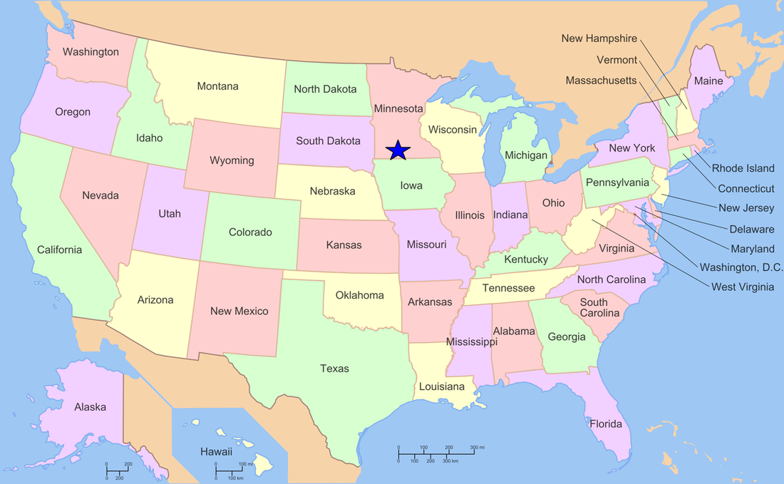
Arizona, located in the Southwestern United States, is a landlocked state bordered by six other U.S. states and Mexico. Its vast expanse covers over 113,990 square miles, making it the sixth-largest state by area. This considerable size means that “how far away” Arizona is can vary significantly depending on your starting point within the state and your mode of transportation. However, for international and long-haul domestic travelers, the primary consideration is often the accessibility via major airports.
Proximity to International Airports
The most common entry points for visitors flying into Arizona are through its two major international airports: Phoenix Sky Harbor International Airport (PHX) in Phoenix and Tucson International Airport (TUS) in Tucson.
-
Phoenix Sky Harbor International Airport (PHX): This is the busiest airport in Arizona and one of the largest hubs in the southwestern United States. PHX offers numerous direct flights from major cities across the U.S., including New York City, Los Angeles, Chicago, and Dallas. For international travelers, PHX serves as a gateway with direct flights from cities such as London, Vancouver, and Mexico City. Its central location makes it ideal for exploring northern Arizona’s attractions like the Grand Canyon National Park or the red rocks of Sedona.
-
Tucson International Airport (TUS): Located in southern Arizona, TUS is smaller than PHX but still offers significant domestic connectivity. It is a primary entry point for those wishing to explore southern Arizona’s unique desert culture, the Sonoran Desert National Monument, and the historic city of Tucson. While TUS has fewer international flights compared to PHX, it provides convenient access to destinations within Mexico and is well-served by domestic carriers.
Distance from Major U.S. Cities
The travel time to Arizona from other parts of the United States is a critical factor for many planning their trip.
-
West Coast: From cities like Los Angeles, San Diego, or San Francisco, Arizona is relatively close. Driving times can range from 5-6 hours to Phoenix from Los Angeles, and it’s a similar or slightly longer drive from San Diego. Flights are plentiful and short, often under 1.5 hours.
-
Rocky Mountains: Cities like Denver are a manageable flight of about 1.5-2 hours to Phoenix or Tucson. Driving is a more significant undertaking, typically over 10 hours.
-
Midwest: From cities like Chicago or Minneapolis, direct flights to Phoenix are common and usually range from 3 to 4 hours. Driving is a multi-day journey.
-
East Coast: From New York City or Washington D.C., direct flights to Phoenix are generally around 4.5 to 5 hours. This makes a cross-country trip feasible for a long weekend or a more extended vacation.
-
South: From Texas cities like Dallas or Houston, flights to Arizona are efficient, typically under 2 hours.
Traveling to Arizona: By Air, Road, and Rail
The journey to Arizona can be as much a part of the experience as the destination itself. Understanding the various modes of transportation available helps in accurately gauging the “distance” and planning the most suitable travel strategy.

Air Travel: The Fastest Route
For most travelers, particularly those coming from distant locations, flying is the most practical and time-efficient method of reaching Arizona. As mentioned, PHX and TUS are the primary gateways, but smaller regional airports, such as Grand Canyon National Park Airport (GCN) in Grand Canyon Village, also exist for those looking to get closer to specific attractions immediately upon arrival, though these often rely on connecting flights. The extensive network of direct and connecting flights ensures that Arizona is accessible from virtually any corner of the world.
Road Trips: Embracing the Journey
Arizona’s vast and varied landscapes make it a prime destination for road trips.
-
Driving from the West Coast: Interstates 10 and 40 are major arteries that connect Arizona to California and beyond. I-40 runs east-west across the northern part of the state, linking Flagstaff to California and New Mexico. I-10 runs east-west across the southern part, connecting Phoenix and Tucson to California and New Mexico.
-
Driving from the East: From states like Texas, I-10 and I-40 also serve as key routes, offering a scenic drive through diverse terrains. Travelers from states further east will often connect via major interstates that lead into these primary routes.
-
The Scenic Route: For those with more time, embracing a multi-day road trip allows for exploration of roadside attractions and smaller towns that might otherwise be missed. The journey itself becomes an integral part of the Arizona experience.
Rail Travel: A Nostalgic Perspective
While less common for primary long-distance travel to Arizona than air or road, Amtrak does offer passenger rail services. The Texas Eagle route connects Chicago to San Antonio, with a branch line extending to Los Angeles, passing through Tucson and introducing a different perspective on the American landscape. This option is best suited for travelers who prioritize the journey and have a more relaxed pace, offering a nostalgic and potentially more environmentally friendly alternative.
Factors Influencing Perceived Distance
The “distance” to Arizona isn’t solely a matter of mileage; several factors can influence how far away it feels.
Time Zones
Arizona observes Mountain Standard Time (MST) year-round, meaning it does not participate in Daylight Saving Time. This can affect perceived travel time and adjustment upon arrival, especially when traveling from regions that do observe DST. For example, during the summer months, Arizona is three hours behind New York but only one hour behind Pacific Time.
Connectivity and Infrastructure
Arizona boasts a well-developed infrastructure, particularly in its major metropolitan areas and tourist corridors. The presence of reliable highways, extensive airline services, and readily available rental car options means that once you arrive, navigating the state and reaching your desired destinations is generally straightforward. This ease of access can make a geographically distant location feel more immediate and manageable.

The Appeal of the Destination
Ultimately, how far away Arizona feels can also depend on the traveler’s desire and motivation. For those yearning for the iconic vistas of the Grand Canyon, the mystical energy of Sedona, the vibrant desert flora of the Saguaro National Park, or the historical charm of Tombstone, the perceived distance often diminishes in the face of such compelling attractions. Arizona’s unique allure makes the journey, regardless of its length, a worthwhile endeavor for millions of visitors each year.
LifeOutOfTheBox is a participant in the Amazon Services LLC Associates Program, an affiliate advertising program designed to provide a means for sites to earn advertising fees by advertising and linking to Amazon.com. Amazon, the Amazon logo, AmazonSupply, and the AmazonSupply logo are trademarks of Amazon.com, Inc. or its affiliates. As an Amazon Associate we earn affiliate commissions from qualifying purchases.