
California, a state synonymous with sunshine and diverse landscapes, often surprises visitors and residents alike with its persistent and sometimes powerful winds. Far from being a random occurrence, the aerodynamic character of California is a complex interplay of its unique geography, vast topography, and dynamic atmospheric conditions. Understanding why the Golden State is so windy requires delving into the intricate natural systems that shape its climate and environment, from towering mountain ranges to expansive coastlines and arid deserts. These winds are not merely atmospheric phenomena; they are integral to the state’s natural history, influencing everything from its ecosystems to its famed landmarks.

The Geographical Tapestry of California’s Wind Systems
California’s distinctive geography is the primary architect of its complex wind patterns. Positioned along the western edge of the North American continent, the state is a dramatic collage of coastal plains, fertile valleys, rugged mountains, and vast deserts, each contributing to a localized yet interconnected wind system.
The Pacific Ocean’s Influence
The vast Pacific Ocean serves as the primary engine for many of California’s winds. Its cool waters generate high-pressure systems offshore, leading to a consistent onshore flow of marine air. This prevailing westerly wind is especially noticeable along the coast, where it moderates temperatures and often creates a refreshing, if sometimes bracing, breeze. This marine layer also plays a crucial role in the state’s famous coastal fog and upwelling phenomena, which bring nutrient-rich waters to the surface, supporting a diverse marine ecosystem. The thermal contrast between the cooler ocean and the warmer land mass is a constant driver of air movement, especially during the day.
Mountain Ranges as Wind Barriers and Accelerators
California is defined by its impressive mountain ranges, most notably the Sierra Nevada to the east and the various Coastal Ranges running parallel to the Pacific Ocean. These colossal geological features act as formidable barriers to air masses, fundamentally altering wind direction and speed. When air encounters these mountains, it is forced to ascend, cool, and often release moisture on the windward side. As it descends on the leeward side, it compresses, warms, and dries, leading to strong, often gusty, downslope winds. The passes and gaps within these ranges, such as the Tehachapi Pass, act as natural funnels, accelerating wind speeds dramatically through what is known as the Venturi effect, turning a gentle breeze into a powerful gale.
Valley and Desert Dynamics
Between the mountain ranges lie expansive valleys and arid deserts, each with unique wind characteristics. The Central Valley, encompassing the Sacramento Valley and San Joaquin Valley, is a prime example. Its flat, low-lying terrain funnels marine air inland, creating persistent winds that are vital for agriculture. To the east, the vast desert regions, including the Mojave Desert and the Colorado Desert, experience extreme temperature fluctuations. The intense daytime heating creates low-pressure areas that draw in air, often leading to strong, dusty winds, while cooler nights can reverse these dynamics or create localized breezes. The juxtaposition of these varied landscapes ensures a constant, often vigorous, air circulation throughout the state.
Understanding California’s Prevailing Wind Patterns
Beyond the general geographical influences, California experiences several distinct and famous wind patterns that contribute to its reputation as a windy state. These specific wind events are often seasonal and can have profound impacts on local weather, ecology, and human activities.
The Santa Ana Winds: A Notorious Phenomenon
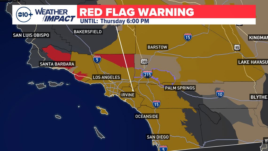
Perhaps the most infamous of California’s winds are the Santa Ana Winds. These strong, extremely dry, and often hot winds typically occur during autumn and winter in Southern California. They originate from high-pressure systems over the Great Basin, where cold, dense air sinks and then flows westward, compressed and heated as it descends the mountain slopes of the Sierra Nevada and other transverse ranges. As these winds rush through mountain passes and canyons, they gain immense speed, sometimes reaching hurricane force. Their low humidity rapidly dries vegetation, significantly elevating the risk of wildfires, making them a critical natural hazard in the region, particularly around cities like Los Angeles and San Diego.
The Diablo Winds and Nor’easters
Similar to the Santa Ana Winds, the Diablo Winds affect Northern California, particularly the San Francisco Bay Area. These downslope winds also originate from interior high-pressure systems and funnel through mountain gaps, bringing hot, dry air to the coastal regions. They are equally notorious for exacerbating wildfire conditions, especially in the wine country regions. Conversely, the term “Nor’easter” in California typically refers to a less common but significant storm system that brings strong winds and heavy precipitation from the northeast, impacting coastal and mountain areas, though distinct from the East Coast phenomenon. These systems are critical for replenishing the state’s water supply but can also bring destructive winds and flooding.
Coastal Breezes and Upwelling
Along the extensive coastline of California, daily thermal differences between the land and the Pacific Ocean generate consistent sea breezes. As the sun warms the land, the air above it heats and rises, creating a localized low-pressure area. The cooler, denser air from over the ocean then rushes in to fill this void, creating the familiar onshore breeze. This phenomenon is particularly pronounced in coastal cities like San Francisco, where the iconic fog often accompanies these winds. These persistent sea breezes are also intrinsically linked to coastal upwelling, where strong northerly winds push surface water away from the shore, allowing cold, nutrient-rich water from the deep ocean to rise to the surface. This process is vital for the region’s marine biodiversity and fishing industries, making the California Current one of the most productive marine ecosystems globally.
The Science Behind California’s Aerodynamic Landscape
The consistent windiness in California is not a mere accident of geography but a direct consequence of fundamental meteorological and topographical principles. The interaction of large-scale atmospheric patterns with the state’s diverse physical features creates a dynamic environment for air movement.
Pressure Gradients and Atmospheric Circulation

At the heart of California’s winds are pressure gradients—differences in atmospheric pressure between two locations. Air naturally flows from areas of high pressure to areas of low pressure. Over California, these gradients are frequently pronounced due to the juxtaposition of the stable Pacific High (a semi-permanent high-pressure system over the Pacific Ocean) and thermal lows that develop over the warm inland valleys and deserts. The strength of the wind is directly proportional to the steepness of this pressure gradient. Large-scale atmospheric circulation patterns, such as the jet stream, also play a role, steering weather systems and influencing the overall wind regime across the state.
Topographic Steering and Venturi Effect
The effect of California’s mountains and valleys on wind is a prime example of topographic steering. Air masses are not merely blocked by mountains; they are channeled and accelerated. When wind flows through narrow gaps or passes, its speed increases significantly, much like water speeding up when flowing through a constricted pipe – a phenomenon known as the Venturi effect. This is why areas like the Altamont Pass in the Livermore Valley or mountain passes in Southern California are notoriously windy and often chosen for wind energy production. The complex arrangement of peaks and valleys creates countless microclimates where wind behavior can vary dramatically over short distances.
Thermal Inversions and Sea Breezes
Thermal inversions, where a layer of warm air sits above cooler air, are common in California, particularly along the coast. This inversion layer can trap marine air and pollutants below it, but it also influences wind patterns. Below the inversion, the cool marine air, driven by the land-sea thermal contrast, flows inland as sea breezes. This phenomenon is most evident in the San Francisco Bay Area, where the cool, dense air from the bay is pulled inland over the warmer land, creating the famous afternoon winds that sweep through the city and the Golden Gate, often accompanied by the iconic fog. These inversions can act as a lid, confining wind effects to lower altitudes while the upper atmosphere experiences different flows.
Regional Wind Variations Across the Golden State
The vastness of California means that its wind patterns are not uniform but vary significantly from north to south and from coast to interior, creating distinct regional wind climates.
Northern California’s Distinct Patterns
Northern California, particularly the coastal regions and the San Francisco Bay Area, experiences a consistent, strong westerly flow, particularly during the summer. This is due to the persistent Pacific High pressure system and the thermal low that develops over the Central Valley. The gap in the Coastal Ranges at the Golden Gate acts as a wind tunnel, making San Francisco one of the windiest major cities in the United States. Inland, the Sacramento Valley also sees steady winds as marine air pushes eastward. Further north, towards the Redwood Coast and Oregon border, the winds can be less consistent but still influenced by frontal systems moving in from the Pacific.
Central California’s Agricultural Winds
The Central Valley, a massive agricultural powerhouse, is characterized by its own set of wind patterns. While generally protected from extreme coastal storms by the Coastal Ranges, it experiences persistent, moderate winds, primarily a result of the pressure gradient between the cool ocean and the hot valley interior. These winds, often southerly, are crucial for air circulation within the valley, helping to disperse pollutants and regulate temperatures for agriculture. In certain areas, such as the Tehachapi Pass leading into the San Joaquin Valley, strong localized winds are common due to the Venturi effect from mountain gaps, making it a prime location for wind farms.
Southern California’s Desert and Mountain Interactions
Southern California’s wind environment is heavily defined by the interactions between its expansive deserts, transverse mountain ranges, and the Pacific Ocean. The Santa Ana Winds are the most dominant and impactful wind phenomenon here, bringing dry, hot conditions and extreme fire risk. Beyond the Santa Anas, the desert regions, like the Mojave Desert, experience frequent gusty winds due to intense solar heating and the resulting thermal lows, which draw in air from surrounding higher pressure areas. Coastal areas, from Santa Barbara down to San Diego, benefit from daily sea breezes, which moderate the climate, but these can also intensify with the influence of local topography.
The Impact and Significance of California’s Winds
The pervasive winds of California are far more than just a weather feature; they are a fundamental component of the state’s natural identity, influencing its ecosystems, shaping its landforms, and playing an increasingly vital role in its energy future.
Ecological Roles and Challenges
Winds in California play a critical ecological role. Coastal breezes drive the upwelling of nutrient-rich waters, supporting a thriving marine food web and commercial fisheries. Inland, winds aid in seed dispersal and pollination, essential for many plant species across diverse habitats. However, the stronger, drier winds, particularly the Santa Ana and Diablo Winds, pose significant ecological challenges. They are primary drivers of devastating wildfires, altering landscapes, destroying habitats, and impacting air quality across vast regions. Wind erosion can also be a concern in arid and agricultural areas, leading to soil degradation.
Human Adaptation and Renewable Energy
Humans in California have long adapted to its windy conditions, from architectural designs that withstand gusts to agricultural practices that account for wind exposure. In modern times, the state’s powerful and consistent winds have positioned it as a leader in renewable energy. Expansive wind farms, such as those in Altamont Pass, Tehachapi Pass, and San Gorgonio Pass, harness this natural force to generate clean electricity, contributing significantly to California’s ambitious renewable energy goals. These iconic wind turbine fields are now prominent landmarks in their own right, symbolizing the state’s innovative approach to sustainability.
Wind as a Defining Natural Feature
Ultimately, the wind is an indelible part of California’s natural character. From the blustery afternoons in San Francisco to the scorching gusts of the Santa Anas and the constant breezes across the Central Valley farmlands, wind shapes the daily experience of its inhabitants and visitors. It influences the growth of trees, sculpts coastal dunes, and dictates the severity of fire seasons. Far from being a mere inconvenience, the complex and varied winds of California are a testament to the state’s extraordinary natural diversity and the powerful forces that continue to shape its remarkable landscapes.
LifeOutOfTheBox is a participant in the Amazon Services LLC Associates Program, an affiliate advertising program designed to provide a means for sites to earn advertising fees by advertising and linking to Amazon.com. Amazon, the Amazon logo, AmazonSupply, and the AmazonSupply logo are trademarks of Amazon.com, Inc. or its affiliates. As an Amazon Associate we earn affiliate commissions from qualifying purchases.