
Nestled in the rolling hills and expansive wetlands of the United States, the city of Umatilla serves as a serene departure from the high-octane energy typically associated with the Sunshine State. To understand where Florida transitions from suburban sprawl into true wilderness, one must look toward the northern reaches of Lake County. Known affectionately as the “Nature’s Hometown,” this destination occupies a unique geographical niche in Central Florida, acting as the southern sentinel to one of the state’s most precious natural resources.
The Geographic Coordinates and Regional Context
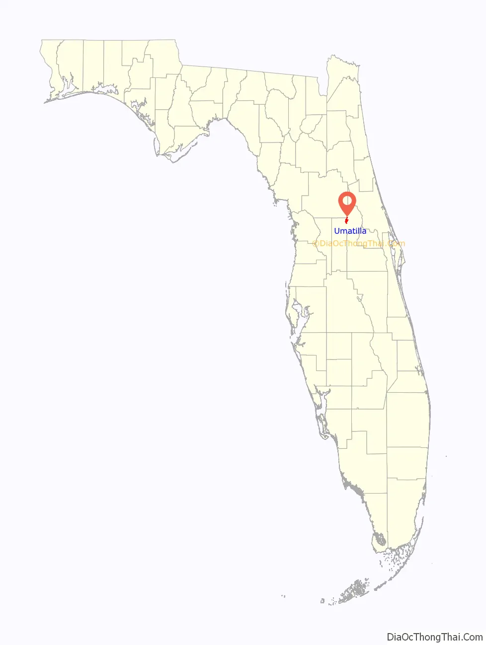
Geographically, the city is situated at approximately 28.9 degrees north latitude and 81.6 degrees west longitude. This positioning places it roughly 40 miles north of Orlando, making it an accessible retreat for those navigating the metropolitan corridors of the I-4 expressway. While Orlando is defined by its theme parks and urban development, the landscape shifts dramatically as travelers head north. The flat, sandy plains give way to more varied elevations and an abundance of freshwater bodies, which define the aesthetic of this region.
The city is hemmed in by water and woods. To its immediate north lies the southern boundary of the Ocala National Forest, the southernmost forest in the continental United States. This proximity dictates the local climate and the pace of travel, as the city serves as the last major stop for supplies and navigation before entering the dense pine scrub and oak hammocks of the forest. To the south and west, the city is part of a larger cluster of towns that make up the rural and residential heart of the county, providing a buffer between the wilderness and the growing coastal developments.

Navigating the Gateway: Access and Arteries
For the modern traveler, reaching this destination involves traversing some of the most scenic backroads in the state. The primary artery serving the area is State Road 19. This north-south highway is the lifeline of the community, connecting it to Eustis to the south and leading directly into the heart of the national forest to the north. Travelers often find themselves on this route when seeking a more contemplative journey through the interior of the peninsula, bypassing the heavy traffic of Interstate 75.
Coming from the Major Hubs
If you are starting your journey from Orlando International Airport, the drive typically takes about an hour, depending on traffic. The route generally involves taking Florida’s Turnpike north before branching off onto state roads that wind through Apopka and eventually Eustis. As you cross into the city limits, the change in atmosphere is palpable; the buildings become lower, the trees become taller, and the presence of Lake Umatilla provides an immediate sense of coastal calm in an inland setting.
From the west, specifically from the city of Ocala, the drive is approximately 45 minutes. Travelers move eastward, often passing through Silver Springs State Park before dipping south toward the city. This approach offers a glimpse into the equestrian culture of the region, with horse farms lining the perimeter of the route. For those coming from the east coast, such as Daytona Beach, the journey involves cutting across the state on State Road 40 or State Road 44, passing through the St Johns River basin, which highlights the area’s connectivity to the Atlantic waterways.
The Proximity to the Golden Triangle
The city is frequently discussed in the context of the “Golden Triangle,” a regional designation that includes the nearby towns of Eustis, Tavares, and Mount Dora. While not officially one of the three points of the triangle, it serves as the northern extension of this cluster. This proximity allows travelers to enjoy the sophisticated dining and shopping of Mount Dora or the seaplane activities in Tavares while staying or passing through the quieter, more nature-focused environs of the north.
A Landscape Defined by Water and Wilderness
Understanding where this city is located requires an appreciation for the aquatic geography of Central Florida. It is situated in a region characterized by the Harris Chain of Lakes, a series of massive freshwater lakes that are interconnected by canals and rivers. While the city itself sits slightly north of the primary chain, it is surrounded by smaller, pristine lakes like Lake Yale and Lake Griffin.
The Influence of the Ocala National Forest
The most defining characteristic of the city’s location is its role as the “Gateway to the Ocala National Forest.” This massive expanse of protected land covers over 600 square miles and is the northern neighbor of the city. Because of this, the area is a hub for eco-tourism. Travelers looking for Alexander Springs, one of the most famous first-magnitude springs in the state, will find it just a short drive north of the city center.
The location is also pivotal for those exploring the Florida National Scenic Trail. This long-distance hiking trail winds through the area, offering hikers a chance to experience the diverse ecosystems of the state, from scrubby flatwoods to swampy marshes. The city serves as a critical resupply point for these adventurers, bridging the gap between the developed world and the wild interior.
The St. Johns River Connection
To the east of the city lies the St Johns River, the longest river in the state and one of the few in the United States that flows north. The river expands into Lake George northeast of the city. This proximity means that while the city is inland, it is deeply connected to the maritime history and riverine travel routes that once served as the primary means of transportation in the 19th century. Today, this location offers world-class fishing and boating opportunities that are distinct from the coastal experiences of the Gulf of Mexico or the Atlantic Ocean.
Regional Importance for Travelers and Day-Trippers
Beyond its natural allure, the city’s location makes it a strategic base for exploring the broader Central Florida landscape. It is centrally located between several major points of interest, allowing for diverse day-trip possibilities.
Exploring Nearby State Parks
Within a 30-to-40-minute radius of the city center, travelers can reach several iconic state parks. DeLeon Springs State Park, famous for its historical sugar mill and pancake house, is located to the east. To the west lies Silver Springs State Park, known for its glass-bottom boat tours and crystal-clear waters. These parks, combined with the multiple springs within the Ocala National Forest like Juniper Springs and Salt Springs, create a “springs hopping” circuit for which the city is a perfectly positioned starting point.
Connectivity to Growing Communities
The city also sits on the edge of significant regional growth. To the west is The Villages, one of the fastest-growing master-planned communities in the country. This provides the area with access to modern medical facilities, shopping centers, and entertainment venues while allowing the city to maintain its rural, small-town character. The nearby city of Leesburg further complements this by offering additional commercial infrastructure and historical sites.
For those traveling by rail or bus, the larger hubs of Wildwood and Orlando provide the nearest major transit connections. However, the true essence of the city is best experienced via a personal vehicle or bicycle, as the winding roads and scenic vistas are the primary draw for those visiting the area.

The Environmental and Climatic Setting
Where a city is located also dictates what one experiences during different seasons. Being in the heart of the peninsula, the city experiences a humid subtropical climate. Its inland location means it can be slightly warmer in the summer and cooler in the winter than coastal cities like Miami or Tampa.
The presence of the surrounding lakes and the massive forest canopy creates a microclimate that is often several degrees cooler than the urban heat islands of Orlando. During the winter months, the area is a popular destination for birdwatchers and wildlife enthusiasts, as the location serves as a stopover for migratory species traveling along the Atlantic Flyway. The nearby North Lake Park and various conservation areas provide ample space for observing sandhill cranes, bald eagles, and the occasional Florida black bear.
In summary, when asking “Where is Umatilla, Florida?” the answer is more than just a set of coordinates. It is a destination defined by its boundary-like existence—sitting at the crossroads of civilization and the untamed wilderness of the Ocala National Forest. It is a central hub for those who seek the authentic, natural beauty of the Florida interior, offering a strategic and scenic location that bridges the gap between the state’s famous springs, its historic riverways, and its bustling metropolitan centers. Whether viewed as a gateway, a retreat, or a jumping-off point for adventure, its location remains one of the most strategically beautiful spots in Lake County.
LifeOutOfTheBox is a participant in the Amazon Services LLC Associates Program, an affiliate advertising program designed to provide a means for sites to earn advertising fees by advertising and linking to Amazon.com. Amazon, the Amazon logo, AmazonSupply, and the AmazonSupply logo are trademarks of Amazon.com, Inc. or its affiliates. As an Amazon Associate we earn affiliate commissions from qualifying purchases.