
Oklahoma, often referred to as the “Sooner State,” occupies a distinctive and strategically important position within the United States of America. Its location is not merely a geographical fact but a cornerstone of its rich history, diverse economy, and vibrant culture. Understanding Oklahoma’s placement within the continental landscape is key to appreciating its unique identity and its role in the broader American narrative.
Central Plains and Southern Roots
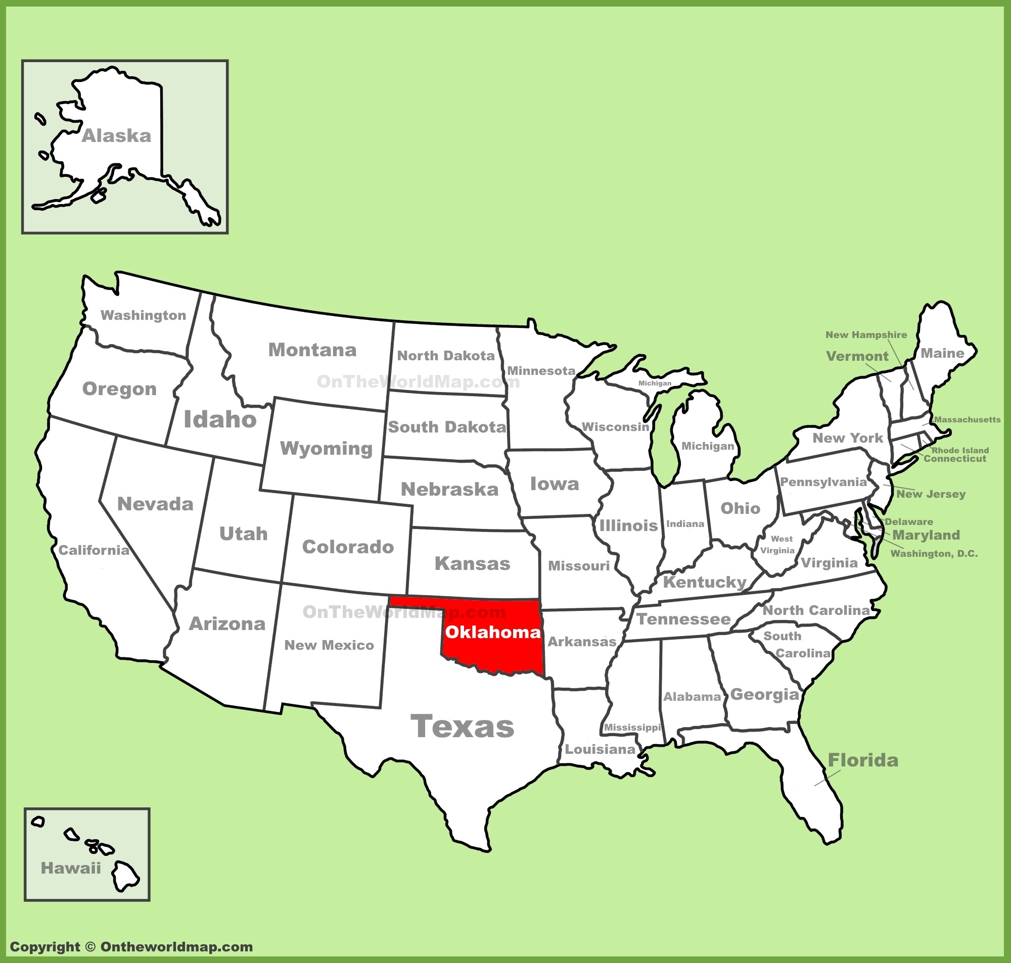
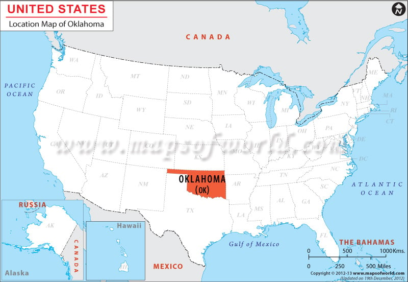
Oklahoma is situated in the South Central region of the United States. This placement is crucial to understanding its climatic, cultural, and economic characteristics, as it bridges the arid West with the more humid East, and the agricultural Plains with the Southern traditions. It is bordered by several states, each contributing to its unique geographical context. To the north lies Kansas, to the east are Missouri and Arkansas, to the south is Texas, and to the west are New Mexico and Colorado. This central positioning makes it a crossroads of sorts, influencing its transportation networks and the flow of people and goods.
Geographic Coordinates and Cardinal Directions
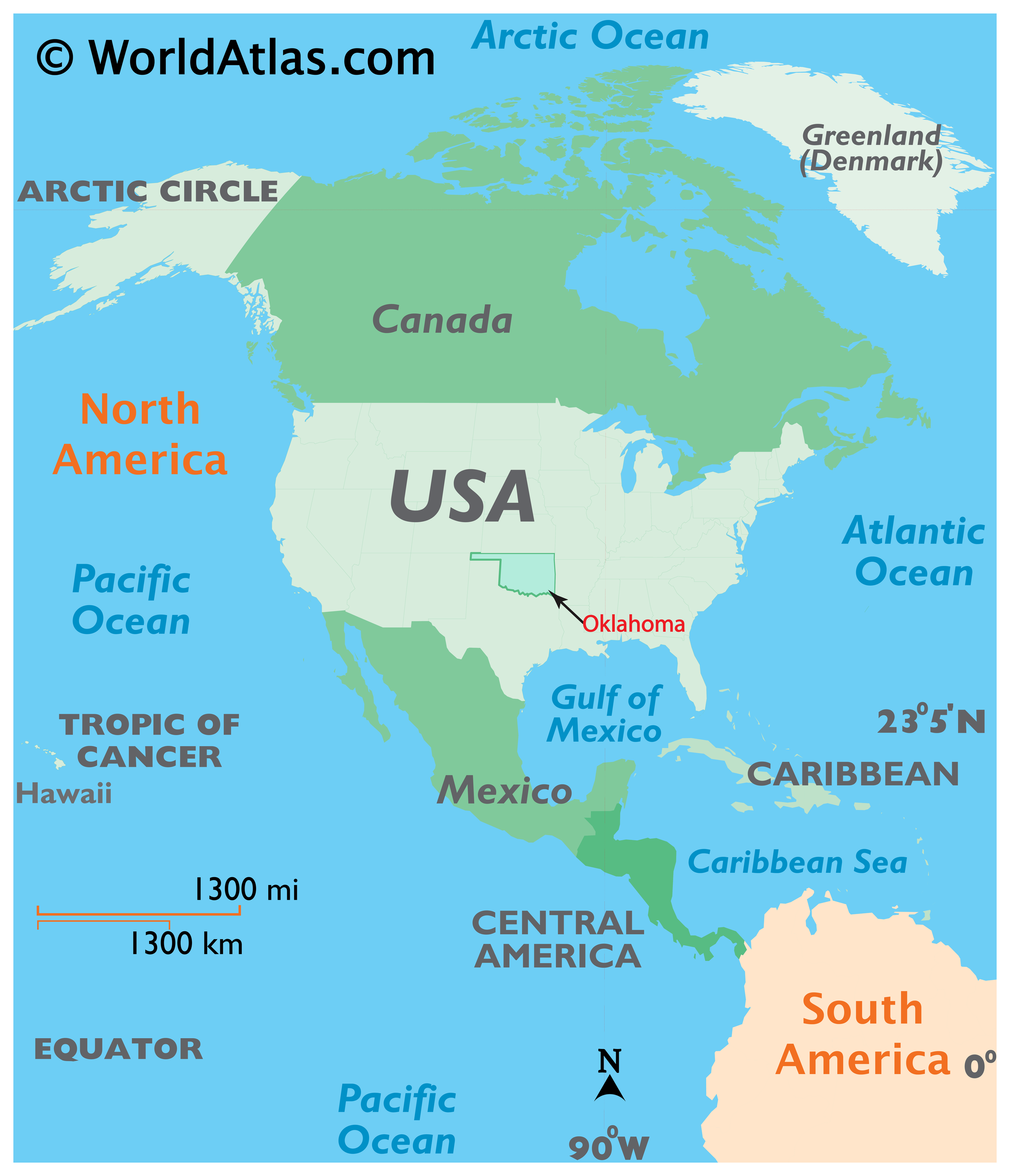
Oklahoma’s geographical coordinates place it roughly between 33.5° and 37° North latitude and 94.5° and 103° West longitude. This range means it experiences a variety of weather patterns, from the continental climate of the north to the subtropical influences from the south. Its position within the central United States is often visualized on maps, highlighting its role as a connecting point between different geographical and cultural zones. The state’s shape itself, somewhat rectangular, further emphasizes its defined boundaries within the nation’s map.
Influence of Neighboring States
The interaction with its neighboring states has profoundly shaped Oklahoma. Its northern border with Kansas connects it to the vast Great Plains, influencing its agricultural heritage, particularly wheat farming. To the east, Missouri and Arkansas introduce Ozark Mountain influences and a stronger Southern cultural connection, evident in cuisine and music. The long southern border with Texas is perhaps the most defining, historically and economically. This proximity has led to significant cultural exchange, economic ties, and even some shared historical narratives, particularly concerning the oil and gas industry. The western borders with New Mexico and Colorado hint at the transition into the high plains and the Rocky Mountain West, contributing to the state’s diverse topography and its western heritage.
Topography and Natural Features
Oklahoma’s location dictates its diverse topography, a blend of rolling plains, mountainous regions, and significant bodies of water. This natural landscape has not only influenced settlement patterns but also provided rich resources that have driven its development.
The Cross Timbers and Prairies
A distinctive geographical feature is the Cross Timbers, a vast belt of dense woodland stretching from north to south across the state. This natural barrier historically divided the prairies to the west from the forests to the east and played a significant role in early settlement and travel. West of the Cross Timbers lie the expansive Great Plains, characterized by rolling grasslands, fertile soil, and a climate suited for agriculture and cattle ranching. This iconic prairie landscape is central to the American West’s identity, and Oklahoma is a prominent part of it.
The Ozark Plateau and Ouachita Mountains
In the northeastern part of the state, the landscape shifts dramatically with the elevation and rugged beauty of the Ozark Plateau and the Ouachita Mountains. These regions offer a stark contrast to the western plains, with their forested hills, clear streams, and scenic vistas. The Ouachita Mountains are unique in that they run east-west, a rarity in the North American continent, offering hiking, camping, and a retreat from the heat of the plains. These areas are rich in natural beauty and provide opportunities for outdoor recreation, drawing visitors seeking tranquility and adventure.
Waterways and Reservoirs
Oklahoma is home to an extensive network of rivers and an abundance of man-made lakes, largely a result of extensive dam-building projects. Major rivers like the Arkansas River and the Red River flow through the state, historically serving as important transportation routes and sources of irrigation. The construction of numerous reservoirs, such as Lake Texoma, Lake Eufaula, and Grand Lake o’ the Cherokees, has transformed the state’s geography, creating popular recreational areas for boating, fishing, and water sports. These lakes are vital for water supply, flood control, and supporting the state’s tourism industry.
Historical Significance of Location
Oklahoma’s geographical position has made it a pivotal stage for significant historical events, from Native American migrations to the expansion of the American frontier and the development of the oil industry.
The Trail of Tears and Indian Territory
One of the most profound historical impacts of Oklahoma’s location relates to the forced removal of Native American tribes from their ancestral lands in the Southeast. The area that became Oklahoma was designated as Indian Territory, a place where numerous tribes were relocated during the 19th century. Its central location made it a logical, albeit tragic, destination for these displaced peoples. This history is deeply ingrained in the state’s identity, with many tribes maintaining a strong presence and cultural heritage. The eventual opening of Indian Territory to non-Native settlement in the late 19th century, through land runs and lotteries, further cemented its role as a critical point in the westward expansion of the United States.
The Dust Bowl and Great Depression
During the 1930s, Oklahoma, particularly its western plains, became the epicenter of the devastating Dust Bowl. The combination of drought, unsustainable farming practices, and the inherent climate of the Great Plains led to severe dust storms that ravaged the land and forced thousands of families to abandon their homes, often migrating west to California in search of work and a better life. This period of hardship is a somber but significant chapter in Oklahoma’s history, deeply tied to its agricultural landscape and its location on the plains.
The Rise of the Oil Industry
Oklahoma’s position over vast underground reserves of oil and natural gas has dramatically shaped its economy and its modern identity. The discovery of significant oil fields in the early 20th century, particularly around Tulsa and Oklahoma City, led to a boom that transformed the state from primarily agricultural to an industrial powerhouse. The state’s strategic location facilitated the transportation of these resources, making it a key player in the national energy market. This “oil patch” culture continues to influence the state’s economy and its people.
Oklahoma as a Crossroads
Ultimately, Oklahoma’s location in the United States positions it as a dynamic crossroads, a place where diverse landscapes, cultures, and histories converge. Its central placement facilitates transportation and commerce, connecting the East and West, the North and South.
Transportation and Infrastructure
The state’s central position makes it a vital hub for national transportation networks. Major interstate highways, such as Interstate 35 (running north-south through Oklahoma City and Norman) and Interstate 40 (running east-west across the state), converge here, making Oklahoma a key thoroughfare for cross-country travel and freight. The state also benefits from significant rail infrastructure and a robust network of airports, with Will Rogers World Airport in Oklahoma City and Tulsa International Airport serving as major gateways. This connectivity underscores its role as a logistical center.
Cultural Melting Pot
The historical influx of various Native American tribes, coupled with westward expansion, Southern migration, and economic development driven by agriculture and energy, has created a unique cultural tapestry in Oklahoma. Influences from Native American traditions, Southern hospitality, and Western resilience blend together, forming a distinct Oklahoman identity. This cultural confluence is evident in its music, food, arts, and the general disposition of its people, making it a fascinating destination for those interested in experiencing the diverse expressions of American culture.
Economic Diversity
While historically known for agriculture and later oil and gas, Oklahoma’s location has also allowed for economic diversification. Its central position and accessibility make it attractive for manufacturing, logistics, aerospace, and technology sectors. The state’s resources, combined with its strategic placement within the national market, continue to foster economic growth and opportunity, solidifying its importance within the broader American economic landscape.
In conclusion, understanding where Oklahoma is located in the USA is to grasp its multifaceted identity. It is a state defined by its position in the South Central region, a land of diverse topography from the Great Plains to the Ozarks, a site of profound historical events, and a vibrant crossroads of American culture and commerce. Its placement is not just a point on a map but a dynamic force that has shaped its past, present, and future.
LifeOutOfTheBox is a participant in the Amazon Services LLC Associates Program, an affiliate advertising program designed to provide a means for sites to earn advertising fees by advertising and linking to Amazon.com. Amazon, the Amazon logo, AmazonSupply, and the AmazonSupply logo are trademarks of Amazon.com, Inc. or its affiliates. As an Amazon Associate we earn affiliate commissions from qualifying purchases.