
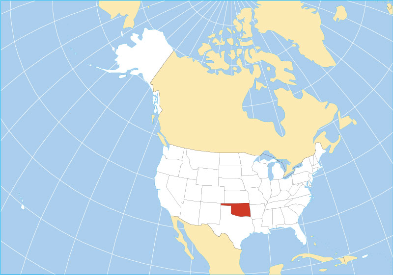
Calculating the distance to the “Sooner State” is a journey that begins with understanding your own geographical coordinates. Whether you are planning a cross-country road trip, a quick weekend getaway, or simply mapping out the expansive heart of the United States, Oklahoma sits at a strategic crossroads. Centrally located, it serves as a gateway between the lush, rolling hills of the Southeast and the high-plains grandeur of the American West.
The Geography of Centrality
Understanding your proximity to this state requires looking at the diverse landscape that surrounds it. To the south lies Texas, a massive neighbor that dictates many of the travel routes moving northward. To the north, Kansas offers a straight shot into the Great Plains, while to the east, the humid, forested border of Arkansas provides a scenic entry point.
When asking how far you are from Oklahoma City, the answer depends heavily on your mode of transport and your starting point. If you are traveling from the coastal regions, you are looking at a multi-day expedition. If you are positioned in the Midwest, you might find yourself within a manageable day’s drive.
Mapping the Driving Distances
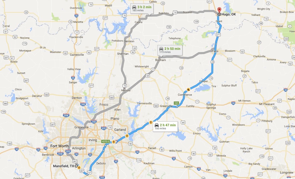
Driving remains the most popular way to experience the transition of scenery as one approaches the state lines. From Dallas, you are merely a three-hour drive away, crossing the Red River into a landscape that quickly shifts from urban sprawl to the red-dirt rolling plains characteristic of the region.
If you are coming from Denver, expect a longer haul of approximately 10 to 11 hours. This trek takes you through the sweeping vistas of Colorado, eventually dipping down into the panhandle. For those starting in Chicago, the journey is closer to 12 or 13 hours, traversing the heartland of the American Midwest before reaching the state’s northeastern corner.
Air Travel and Major Hubs
For international or long-distance domestic travelers, flying is the most efficient way to bridge the distance. Will Rogers World Airport serves as the primary gateway for the capital, while Tulsa International Airport handles a significant portion of traffic in the eastern part of the state.
Most major airlines offer connecting flights from primary hubs like Atlanta, Dallas-Fort Worth, and Denver International Airport. If you are flying from the East Coast, such as New York City, the flight time typically ranges from four to six hours, depending on layovers.
Traveling Through the Heartland
Distance is more than just a number on a GPS; it is an experience of culture and terrain. As you move closer to the state, the vegetation begins to change, the sky appears wider, and the highway signs shift to reflect the heritage of the Native American tribes that have shaped the region’s identity.
The Route 66 Connection
One of the most iconic ways to gauge your distance to this state is by following the legendary Route 66. Known as the “Mother Road,” this historic highway cuts a diagonal path across the state. Travelers often use this route as a benchmark for their progress. If you are driving along this historic stretch, the distance becomes secondary to the attractions—the roadside diners, the vintage gas stations, and the sense of nostalgia that defines the journey.
From Tulsa, moving westward toward Amarillo, you gain a deep appreciation for the vastness of the American landscape. Every mile covered on this historic road is a step into the past, making the “distance” feel much shorter than the odometer suggests.
Scenic Approaches
If your travel plans allow for flexibility, consider the scenic route. Traveling from Missouri into the northeastern corner brings you through the Ozark Mountains. This region, known as Green Country, offers a lush, forested contrast to the western plains. The drive is winding and picturesque, providing a slow-motion introduction to the state’s ecological diversity.
Alternatively, approaching from New Mexico offers a desert-to-prairie transition that is breathtaking during sunset. As you cross the border into the panhandle, the terrain flattens, and the vast, unobstructed horizon of the plains takes over, offering a profound sense of scale that travelers rarely experience in more densely populated regions of the country.
Logistics for Your Trip
Calculating the distance is only the first step. To ensure a smooth arrival, consider the seasonal factors that impact your travel time. The weather in this part of the country can be unpredictable.
Best Times to Visit
The spring months, particularly April and May, are beautiful but necessitate caution due to volatile weather patterns. The autumn months—September through November—are widely considered the best time for road trips. The air is crisp, the heat of the summer has dissipated, and the highways are generally less crowded.
Preparation Checklist
Regardless of how far you are, preparation is key:
- Vehicle Maintenance: Ensure your tires and cooling systems are in top condition, especially if you are traveling during the summer heat.
- Connectivity: While the major highways are well-connected, remote sections of the state can have limited cellular service. Downloading offline maps is highly recommended.
- Route Planning: Decide whether you prefer the speed of the Interstate 35 corridor or the cultural immersion of smaller state highways. Interstate 35 serves as the primary artery, linking Minnesota in the north to the southern border of the country, making it the most direct route for north-south travelers.

A Destination Worth the Miles
Whether you are just a few hundred miles away or embarking on a cross-country trek, Oklahoma is a destination that rewards the effort of travel. From the vibrant arts scene in the Paseo Arts District to the rich history preserved in the National Cowboy and Western Heritage Museum, the distance you travel is returned in experiences.
If you find yourself wondering “how far am I,” don’t let the mileage deter you. The journey is an essential part of the story. Whether you are driving through the wheat fields, flying into the major hubs, or tracing the historic paths of settlers and explorers, the act of approaching this unique state is the beginning of an unforgettable adventure. The map may show points and lines, but your experience will be defined by the roads you choose to take and the sights you discover along the way. Every mile brings you closer to the unique warmth and expansive spirit that characterizes this central jewel of the nation.
LifeOutOfTheBox is a participant in the Amazon Services LLC Associates Program, an affiliate advertising program designed to provide a means for sites to earn advertising fees by advertising and linking to Amazon.com. Amazon, the Amazon logo, AmazonSupply, and the AmazonSupply logo are trademarks of Amazon.com, Inc. or its affiliates. As an Amazon Associate we earn affiliate commissions from qualifying purchases.