
The allure of both Las Vegas‘ vibrant energy and California‘s diverse landscapes often leads travelers to consider a journey between these two iconic Western destinations. While often perceived as being “next door” to each other, the exact distance from Las Vegas to California can vary dramatically depending on the specific point of entry or destination within the Golden State. Understanding this geographical relationship, along with the various travel options and key routes, is fundamental for planning an efficient and enjoyable trip.
The Geographical Proximity: Understanding the Border
Las Vegas, situated in Southern Nevada, is remarkably close to the California state line. In fact, the southwestern edge of Nevada directly borders California for a significant stretch. This proximity means that entering California by car from Las Vegas can take as little as an hour, depending on the chosen route and exact border crossing.

However, California is a massive state, stretching over 700 miles from north to south and boasting an incredibly varied topography, from sun-drenched beaches to towering mountain ranges and arid deserts. Consequently, while the border itself is near, the distance to major California cities like Los Angeles or San Francisco, or natural wonders like Yosemite National Park or Lake Tahoe, requires a more substantial commitment of time and travel. This article will delve into specific distances and estimated travel times to help demystify the journey.
Key Californian Destinations and Their Distances from Las Vegas
The “how far” question is best answered by looking at specific destinations within California. The state’s diverse geography offers a range of experiences, each at a unique distance from Las Vegas.
Southern California Hubs
Southern California is the most popular and accessible region for travelers departing from Las Vegas, primarily via Interstate 15 (I-15).
- Los Angeles: The sprawling metropolis of Los Angeles is approximately 270 miles southwest of Las Vegas. A typical drive takes between 4 to 5 hours, though this can extend significantly during peak traffic hours, especially on weekends or holidays. Key attractions like Hollywood, Santa Monica Pier, and Universal Studios Hollywood are well within reach for a multi-day visit or even a long day trip for the most determined.
- Orange County: Home to Disneyland in Anaheim, Orange County is roughly 260-280 miles from Las Vegas, with travel times similar to Los Angeles (4-5 hours), depending on the specific city and traffic conditions.
- San Diego: Located further south along the coast, San Diego is about 330 miles from Las Vegas. The drive typically takes 5 to 6 hours, often requiring navigation through parts of Los Angeles traffic, making it a slightly longer journey. Its famous Gaslamp Quarter, Balboa Park, and pristine beaches are compelling reasons for the extra miles.
- Palm Springs: For a desert oasis experience, Palm Springs is approximately 270 miles east of Las Vegas. The drive typically takes 4 to 4.5 hours, offering a more direct route with less heavy traffic compared to coastal cities.
- Death Valley National Park: Uniquely, Death Valley National Park offers the closest major California experience to Las Vegas. Depending on the park entrance, it’s roughly 140 miles, taking about 2.5 to 3 hours to reach this otherworldly landscape.
Central Coast Escapes
Venturing towards California’s Central Coast from Las Vegas typically means passing through or bypassing Los Angeles.
- Santa Barbara: Known for its Spanish colonial architecture and beautiful beaches, Santa Barbara is approximately 300 miles from Las Vegas. The drive can take 5 to 6 hours, depending on traffic through the Los Angeles area.
- San Luis Obispo: Further north on the Central Coast, San Luis Obispo is about 350 miles from Las Vegas, generally requiring a 6 to 7-hour drive. This scenic route offers access to wine country and coastal towns.
Northern California Adventures
Northern California presents a significantly longer journey from Las Vegas, often warranting a flight or a multi-day road trip.
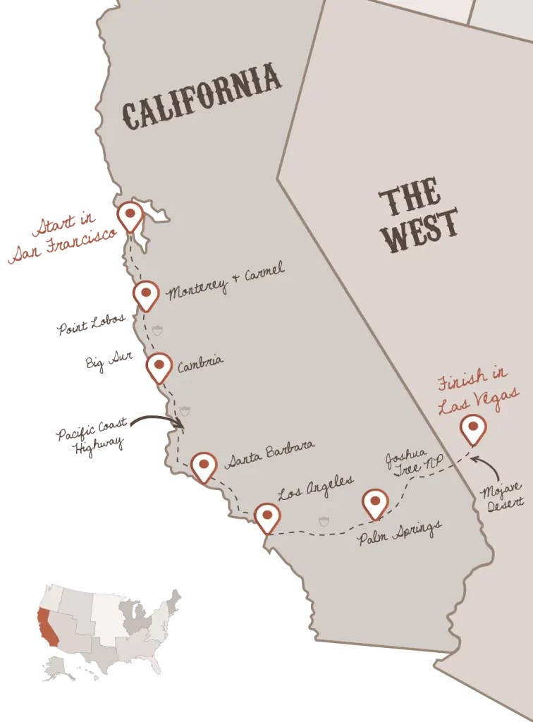
- San Francisco: The iconic city by the bay, San Francisco, is roughly 560 miles northwest of Las Vegas. Driving this route typically consumes 8 to 9 hours of travel time, making it a full day on the road.
- Sacramento: California’s capital, Sacramento, is approximately 500 miles from Las Vegas, with an estimated drive time of 7 to 8 hours.
- Yosemite National Park: A natural marvel, Yosemite National Park is about 450 miles from Las Vegas. The drive can take 7 to 8 hours, depending on the specific entrance and road conditions, which can be affected by snow in winter months.
- Lake Tahoe: Straddling the California-Nevada border, Lake Tahoe is approximately 450 miles from Las Vegas. The drive to the South Lake Tahoe area is around 7-8 hours, offering a quicker access point than other Northern California destinations. Travelers often combine this trip with a visit to Reno, Nevada.
Modes of Transportation: Choosing Your Journey
The choice of transportation from Las Vegas to California significantly impacts the travel time, cost, and overall experience. Each mode offers distinct advantages for different types of journeys.
Driving: The Classic Road Trip
Driving is the most common and often preferred method for traveling between Las Vegas and California, especially for destinations within Southern California.
- Advantages: Unmatched flexibility to stop at points of interest along the way, such as the eerie ghost town of Calico or scenic vistas within the Mojave Desert. It allows for carrying more luggage and is ideal for family trips or those exploring multiple locations within California.
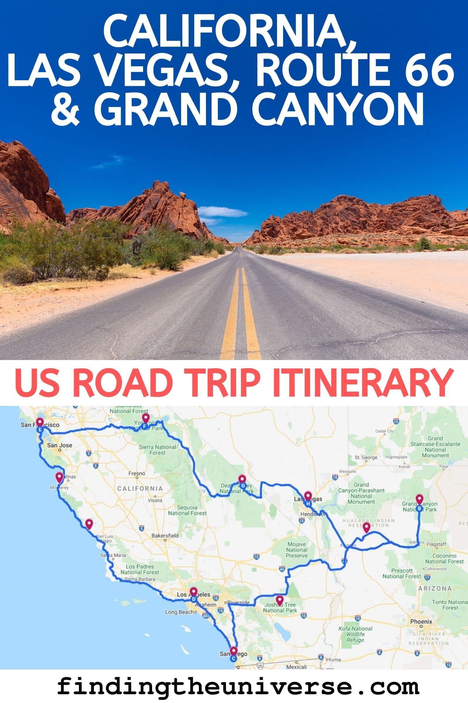
- Routes: The primary route for Southern California is I-15, a well-maintained interstate. For those seeking a more adventurous path, parts of historic Route 66 can be incorporated. For Northern California, I-15 eventually connects to other interstates like I-5, leading north.
- Considerations: Traffic, particularly around Los Angeles, can be notorious. Fuel costs can add up, especially for longer distances. Drivers should also be prepared for extreme desert temperatures during summer months and potential winter weather in mountain passes when heading north.
Flying: Quickest Way to Traverse
For travelers with limited time or those heading to Northern California destinations, flying is often the most efficient option.
- Major Airports: Harry Reid International Airport (LAS) in Las Vegas offers numerous direct flights to major California airports, including Los Angeles International Airport (LAX), San Francisco International Airport (SFO), San Diego International Airport (SAN), Oakland International Airport (OAK), and Sacramento International Airport (SMF).
- Flight Times: A flight from Las Vegas to Los Angeles typically takes about 1 hour. To San Francisco, it’s around 1.5 hours. While the flight itself is quick, travelers must factor in time for airport security, check-in, and transit to and from the airports, which can add 2-3 hours to the overall journey.
- Benefits: Saves significant time, especially for long distances. Can sometimes be cost-effective if booked in advance, particularly for the Las Vegas to Los Angeles corridor, which is one of the busiest air routes in the US.
Bus and Train: Budget-Friendly Options
For budget-conscious travelers or those who prefer not to drive, bus and train services offer viable alternatives.
- Bus Services: Companies like Greyhound and FlixBus provide regular service from Las Vegas to various California cities. A bus trip from Las Vegas to Los Angeles typically takes 5 to 7 hours, depending on stops. This is often the most economical choice.
- Train Services: While Amtrak does not have a direct station in Las Vegas, travelers can connect via a bus service to nearby Amtrak stations in Kingman, Arizona, or Needles, California, to access routes like the Southwest Chief. However, this often makes the journey considerably longer and more indirect than driving or flying, typically appealing to niche travelers who prioritize the train experience itself.
Planning Your Trip: Essential Travel Tips
Regardless of your chosen mode of transport, a well-planned trip enhances the overall experience of traveling from Las Vegas to California.
- Best Time to Travel: Spring and fall offer the most comfortable driving conditions, avoiding the extreme heat of the Mojave Desert in summer and potential snow or ice in mountain passes during winter. Always check weather and road conditions before embarking, especially for longer drives.
- Traffic Management: If driving to Southern California, try to avoid traveling during peak rush hour (typically 6-9 AM and 3-6 PM on weekdays) and on Sunday afternoons, when many weekenders return from Las Vegas to Los Angeles. Utilize navigation apps for real-time traffic updates.
- Accommodation and Bookings: Especially during peak season or for popular destinations like Disneyland or Yosemite National Park, book flights, rental cars, and accommodations well in advance to secure the best rates and availability.
- Vehicle Preparation: For road trips, ensure your vehicle is in good condition. Carry plenty of water, snacks, a first-aid kit, and consider a roadside assistance plan, as stretches of I-15 through the desert are remote.
- Scenic Detours: While the main routes are efficient, don’t hesitate to research and incorporate scenic detours if time allows. The journey itself can be part of the adventure, revealing hidden gems off the main highway.
The distance from Las Vegas to California is not a single number but a spectrum of possibilities, each offering unique travel times and experiences. By understanding these variables and planning accordingly, travelers can seamlessly transition from the excitement of Las Vegas to the diverse attractions of California.
LifeOutOfTheBox is a participant in the Amazon Services LLC Associates Program, an affiliate advertising program designed to provide a means for sites to earn advertising fees by advertising and linking to Amazon.com. Amazon, the Amazon logo, AmazonSupply, and the AmazonSupply logo are trademarks of Amazon.com, Inc. or its affiliates. As an Amazon Associate we earn affiliate commissions from qualifying purchases.