
The journey from the neon-soaked streets of Las Vegas to the granite cathedrals of Yosemite National Park represents one of the most dramatic transitions in the American West. Travelers moving from the desert floor to the high Sierra experience a radical shift in climate, landscape, and pace of life. Understanding the distance, the seasonal constraints, and the optimal routes is essential for anyone planning this cross-state adventure.
Understanding the Logistics and Distance
The driving distance between Las Vegas and Yosemite National Park typically ranges between 350 and 450 miles, depending entirely on which entrance you intend to use and, more importantly, the time of year. Because Yosemite is nestled high in the Sierra Nevada mountains, the geography dictates your path.
The Summer Route: The Tioga Pass
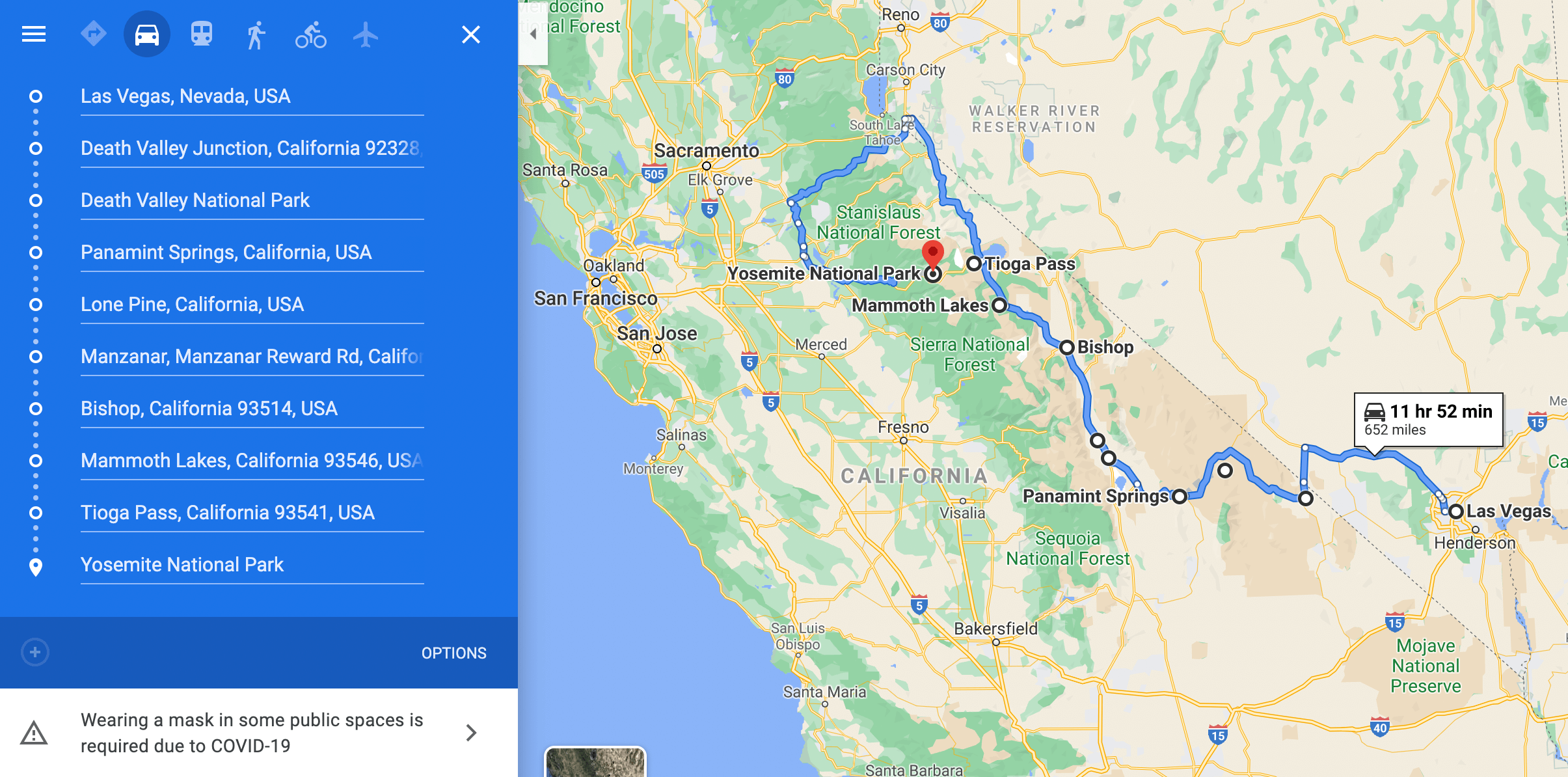
From late spring through early autumn, the most direct route involves crossing the Eastern Sierra. You travel north from Las Vegas on U.S. Route 95 toward Tonopah, eventually connecting to U.S. Route 395. This scenic highway runs along the spine of the mountains, passing through Bishop and Lee Vining. From there, you enter the park via Tioga Pass, which delivers you directly into the high-alpine beauty of Tuolumne Meadows. This drive usually takes about 6 to 7 hours of pure driving time, excluding necessary stops.
The Winter Route: Avoiding Snow Closures
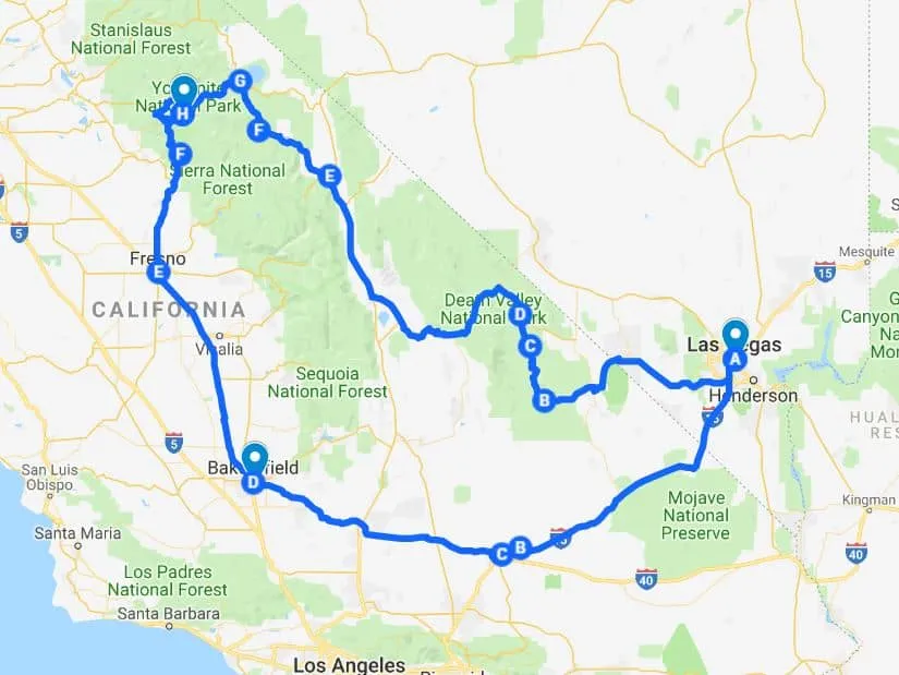
During the winter months, Tioga Pass is closed due to heavy snowpack. This forces travelers to take a significantly longer route around the southern edge of the Sierra Nevada. You must drive south through Bakersfield and up into the Central Valley before turning toward the western entrances, such as Highway 41 or Highway 140. This journey can easily stretch to 9 or 10 hours, turning a single-day trip into a multi-day commitment.
Strategic Stops Along the Way
Because the distance is substantial, incorporating stops along your route transforms the drive from a chore into a curated road trip. Whether you choose the quick summer route or the long-haul winter detour, the surrounding regions offer incredible variety.
The Eastern Sierra Highlights
If you are traveling the U.S. Route 395 corridor, you are passing through some of the most geologically interesting territory in the country. Lone Pine serves as a gateway to the Alabama Hills, a site famous for its appearance in countless Western films. Further north, the Mono Lake Tufa State Natural Reserve offers an otherworldly landscape of limestone towers rising from a salt lake, located just minutes from the Yosemite National Park eastern entrance.
Southern California Transit
If your itinerary takes you through the southern route, you will likely traverse the Mojave National Preserve. This expansive desert environment provides a stark contrast to the verdant, waterfall-laden valleys of the national park. Making a stop in Bakersfield or Fresno allows you to restock supplies and experience the agricultural heart of California before the steep ascent into the mountains.
Essential Travel Tips for the Trans-State Drive
Driving through remote high-desert and mountain regions requires preparation that differs significantly from driving between major metropolitan hubs.
Seasonal Planning and Road Conditions
Never attempt to drive into the high mountains without verifying road conditions. The National Park Service provides real-time updates on closures for Tioga Pass and other high-elevation roads. During the spring, even if the road is technically “open,” conditions can shift rapidly. Always carry tire chains in your vehicle if you are traveling between November and May, as law enforcement may require them regardless of whether you have four-wheel drive.
Fuel and Supplies
Between Las Vegas and the mountain passes, you will encounter vast stretches of sparsely populated desert. Tonopah and Bishop are vital refueling points. It is highly recommended to keep your gas tank at least half full at all times during the remote segments of the drive. Additionally, mobile service is spotty or nonexistent in many parts of the Eastern Sierra; downloading offline maps is a mandatory safety measure for any traveler.
Maximizing Your Time in Yosemite Valley
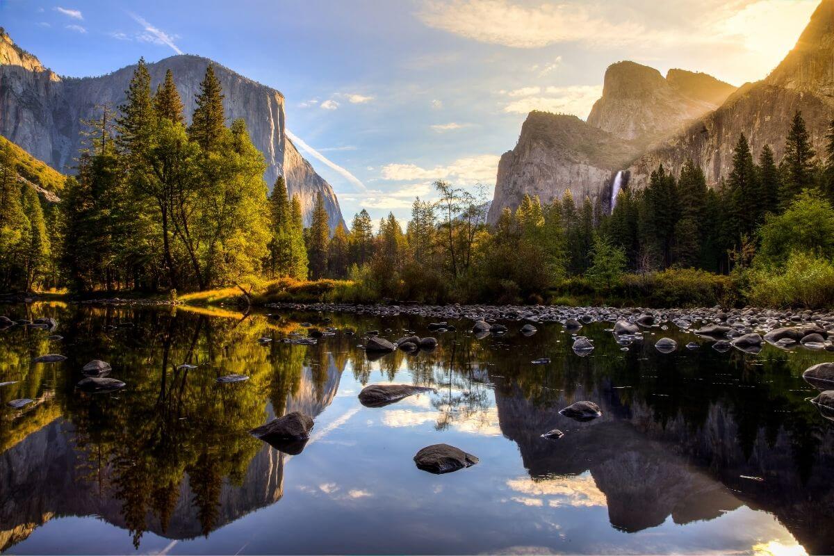
Once you reach your destination, the transition from the arid Nevada landscape to the towering cliffs of Yosemite Valley is nothing short of breathtaking.
Navigating the Valley Floor
Upon arrival, the most recognizable landmarks are El Capitan and Half Dome. Whether you enter from the west or the east, the Yosemite Valley acts as the central hub for tourism. During peak season, traffic can be intense, so consider using the free Yosemite Valley Shuttle to access trailheads like Lower Yosemite Fall and Vernal Fall.
Extending the Adventure
Many travelers, after making the journey from Las Vegas, choose to extend their stay to explore beyond the valley floor. A drive up to Glacier Point offers the most expansive view of the park’s granite peaks, while a trip south leads to Mariposa Grove, home to some of the world’s largest Giant Sequoia trees.
The journey from the desert to the peaks is more than just a commute; it is a highlight of any tour of the American West. By planning for the seasonal variations of the Sierra Nevada and acknowledging the significant distance involved, you can ensure that your transition from the high-energy atmosphere of Las Vegas to the quiet majesty of Yosemite National Park is smooth, safe, and deeply rewarding. Whether you are chasing the summer sun on the Tioga Pass or taking the scenic southern route through the heart of California, the experience offers a profound look at the diverse natural beauty of the western United States.
LifeOutOfTheBox is a participant in the Amazon Services LLC Associates Program, an affiliate advertising program designed to provide a means for sites to earn advertising fees by advertising and linking to Amazon.com. Amazon, the Amazon logo, AmazonSupply, and the AmazonSupply logo are trademarks of Amazon.com, Inc. or its affiliates. As an Amazon Associate we earn affiliate commissions from qualifying purchases.