
The journey between Los Angeles and Las Vegas is one of the most iconic travel corridors in the United States. Connecting the sprawling entertainment capital of the world with the sun-drenched coast of Southern California, this route represents a transition from the urban rhythm of the Pacific Ocean to the neon-lit energy of the Mojave Desert. Whether you are a tourist looking to combine a beach vacation with a high-stakes weekend or a local traversing the Interstate 15, understanding the distance, timing, and logistics is essential for a seamless experience.
Understanding the Distance and Geographical Context
To answer the fundamental question of how far Las Vegas is from Los Angeles, one must consider the mode of transport and the specific starting point. Geographically, the two cities are separated by approximately 270 miles (435 kilometers) when measured from downtown to downtown. This stretch of land encompasses some of the most unique terrain in North America, moving from the coastal basin, through rugged mountain passes, and finally into the vast expanse of the High Desert.
Total Miles and Average Drive Time
For most travelers, the drive takes between four and five hours. However, this is heavily dependent on the departure point within the massive Los Angeles County. If you are leaving from Santa Monica, you can add an extra hour of city traffic before even reaching the outskirts of the desert. Conversely, starting from San Bernardino or Ontario can shave significant time off the trip. The route is almost entirely served by Interstate 15, a major highway that facilitates millions of travelers annually.
The Desert Landscape of the Southwestern United States
The geography of this trip is more than just a measurement of miles; it is a visual evolution. Leaving California, travelers ascend the Cajon Pass, which sits between the San Bernardino Mountains and the San Gabriel Mountains. Once over the pass, the landscape opens into the Victor Valley. The vegetation shifts from palm trees and coastal sage to the iconic Joshua Tree and creosote bushes. Understanding this change in elevation is crucial for travelers, as the High Desert can experience drastically different weather patterns than the coast.
Travel Options Between the Two Cities
While driving is the most common way to bridge the gap between Los Angeles and Nevada, it is by no means the only option. The popularity of this route has given rise to a variety of transit methods catering to different budgets and time constraints.
Driving via Interstate 15
The road trip is a rite of passage for many. It offers the flexibility to stop at quirky roadside attractions and the freedom to have a vehicle once you arrive at The Strip. Most drivers will pass through Barstow, a central hub where the Interstate 15 meets Interstate 40. For those driving electric vehicles like a Tesla, the route is well-equipped with supercharging stations, particularly in Baker and Primm.
Flying from LAX to Harry Reid International Airport
If time is of the essence, flying is the fastest way to cover the distance. A direct flight from Los Angeles International Airport to Harry Reid International Airport (formerly McCarran International Airport) takes approximately 60 to 75 minutes in the air. Major carriers such as Southwest Airlines, Delta Air Lines, United Airlines, and American Airlines operate dozens of daily flights. Additionally, regional airports like Hollywood Burbank Airport and John Wayne Airport in Orange County offer convenient alternatives that often bypass the congestion of LAX.
Luxury Bus Services and Rail Alternatives
For those who prefer to leave the driving to professionals, luxury bus services like FlixBus or the high-end Lux Express provide comfortable reclining seats and Wi-Fi. While there is currently no direct high-speed rail, the Brightline West project is underway, promising to connect Rancho Cucamonga to Las Vegas in a fraction of the time it takes to drive. Until then, the bus remains the primary ground-based public transit option.
Key Stopovers and Points of Interest
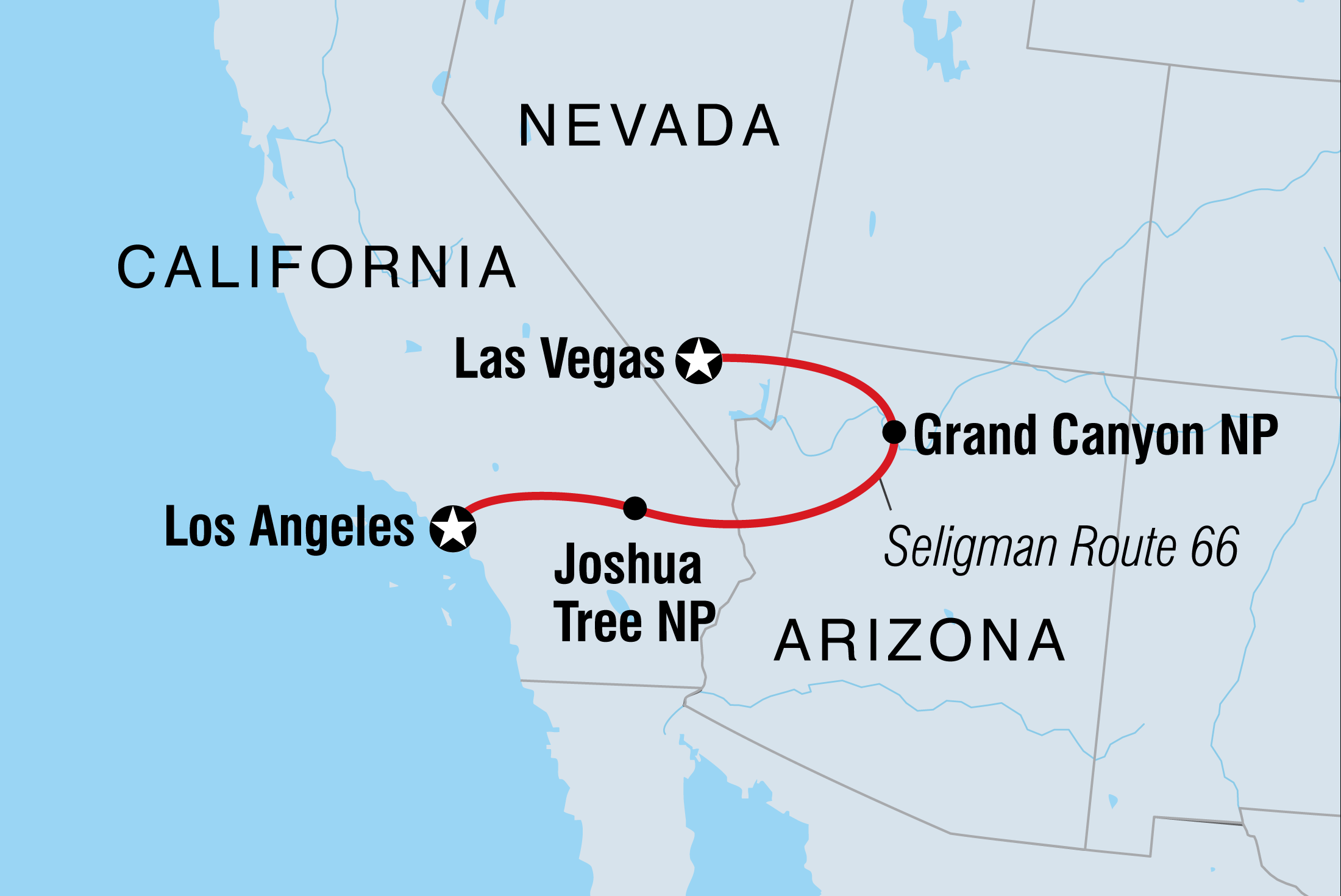
The journey is as much about the “middle of nowhere” as it is about the destination. The stretch of Interstate 15 through the Mojave Desert is home to several landmarks that make the 270-mile trip feel shorter and more engaging.
Exploring the Mojave National Preserve
Just off the main highway lies the Mojave National Preserve, a massive protected area featuring the Kelso Dunes and volcanic cinder cones. It is a stark contrast to the neon lights of Caesars Palace. For nature lovers, a quick detour can provide a serene moment of desert silence and the chance to see rare desert tortoises or bighorn sheep.
The Seven Magic Mountains Installation
About 30 minutes south of Las Vegas, travelers are greeted by the vibrant Seven Magic Mountains. Created by Swiss artist Ugo Rondinone, these towering, neon-painted boulders stacked in the desert have become a viral sensation and a mandatory photo stop for anyone making the trek from California.
Shopping and Quirky Landmarks in Baker and Primm
No trip is complete without a stop in Baker to see the World’s Tallest Thermometer, which stands 134 feet tall to commemorate the record high temperature in Death Valley. Further north, on the state line, Primm offers the Prizm Outlets and the Buffalo Bills Resort and Casino, featuring the Desperado Roller Coaster. This area serves as the gateway to Nevada and the first taste of the casino culture that defines the region.
Planning Your Trip: Timing and Logistics
While the distance between Las Vegas and Los Angeles is fixed, the “time distance” is highly variable. Successful travel depends on strategic planning to avoid the pitfalls of desert travel and regional traffic patterns.
Navigating Traffic in Southern California and Nevada
Traffic is the single biggest factor in the length of your trip. The “Friday Exodus” from Los Angeles can turn a four-hour drive into an eight-hour ordeal. Similarly, the return trip on Sunday afternoon can see massive bottlenecks at the Primm agricultural inspection station and through the Cajon Pass. To optimize your time, it is highly recommended to leave either very early in the morning (before 6:00 AM) or late at night. Monitoring apps like Google Maps or Waze is essential for real-time updates on accidents or construction.
Seasonal Weather Considerations
The Mojave Desert is a land of extremes. In the summer months, temperatures regularly exceed 110 degrees Fahrenheit (43 degrees Celsius). It is vital to ensure your vehicle’s cooling system is in top shape and that you carry extra water. In the winter, although the desert is generally dry, the Cajon Pass can occasionally see snow or heavy fog, leading to highway closures. Checking the California Department of Transportation (Caltrans) website before departure is a wise habit for any seasonal traveler.
Preparation and Safety Tips
Given the long stretches of uninhabited land, safety is paramount. Cell service can be spotty in certain areas of the Mojave Desert, specifically between Baker and Primm. Always ensure you have a full tank of gas before leaving Barstow, as the next reliable fuel stops can be far apart. If you are traveling with pets, remember that the pavement at rest stops can become hot enough to burn paws during the peak of summer.
By understanding the nuances of the distance between Los Angeles and Las Vegas, you can transform a standard commute into an enjoyable part of your travel experience. Whether you choose the efficiency of Harry Reid International Airport or the scenic beauty of a desert road trip, the journey between these two iconic cities remains a quintessential American experience. From the luxury of the Bellagio Las Vegas to the historic charm of the Santa Monica Pier, the road connecting them is a gateway to endless adventure.
LifeOutOfTheBox is a participant in the Amazon Services LLC Associates Program, an affiliate advertising program designed to provide a means for sites to earn advertising fees by advertising and linking to Amazon.com. Amazon, the Amazon logo, AmazonSupply, and the AmazonSupply logo are trademarks of Amazon.com, Inc. or its affiliates. As an Amazon Associate we earn affiliate commissions from qualifying purchases.