
The journey from the sprawling coastal metropolis of Los Angeles to the sun-drenched heart of Phoenix is more than just a transition between two major cities; it is a transformative passage through some of the most iconic landscapes in the United States. Whether you are planning a swift business trip or a leisurely road adventure, understanding the distance, the terrain, and the logistical options is essential for a seamless experience.
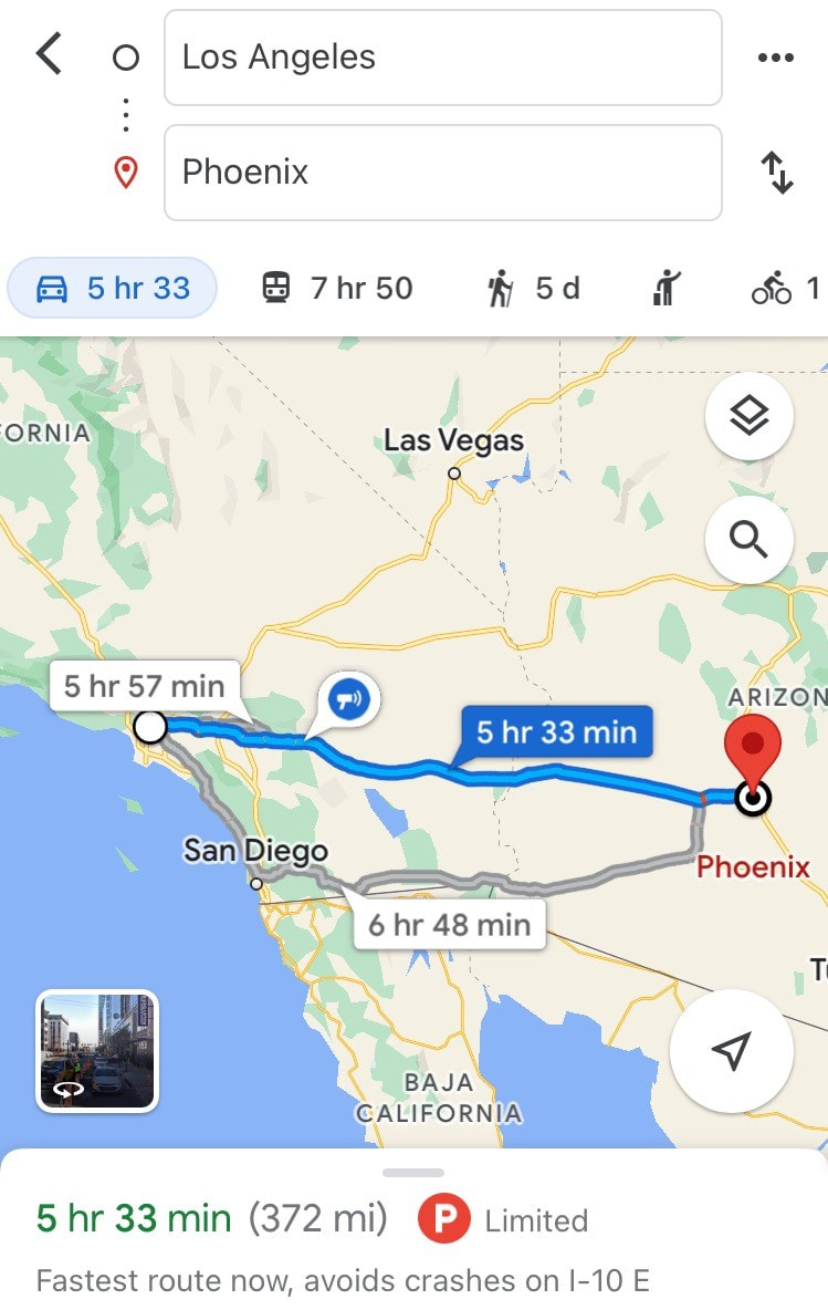
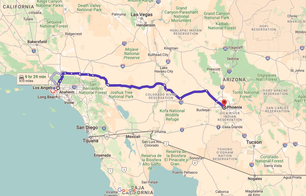
Geographically, the distance between these two Southwestern hubs is approximately 370 to 375 miles, depending on your specific starting and ending points. For travelers in California, this trek represents a move from the Pacific Ocean breeze toward the rugged, arid beauty of the Sonoran Desert in Arizona. While the mileage might seem modest, the diversity of the scenery—from mountainous passes to vast desert basins—makes every mile a story in itself.
The Classic Road Trip: Navigating the Interstate 10
The most common and direct way to traverse the distance is by driving along Interstate 10. This major artery connects the West Coast to the Southern United States, providing a straightforward route that typically takes between five and a half to seven hours, depending on the notorious traffic of Southern California.
Leaving the Coastal Basin
As you depart from Los Angeles, the first leg of the journey involves navigating the Inland Empire. Passing through cities like San Bernardino and Ontario, you will notice the skyline shift from high-rises to the towering peaks of the San Bernardino Mountains. This section is often the most time-consuming due to traffic density, but it sets the stage for the wide-open spaces ahead.
Traversing the San Gorgonio Pass
One of the most visually striking portions of the drive is the San Gorgonio Pass. This wind-swept corridor is famous for the thousands of wind turbines that line the hillsides, creating a futuristic landscape against the backdrop of Mount San Jacinto. As you descend through the pass, the air becomes drier and the temperature begins to rise, signaling your official entry into the Coachella Valley.
The Mid-Way Mark: Blythe and the Colorado River
Located roughly halfway between the two cities is the town of Blythe. This is a popular spot for travelers to refuel and stretch their legs. Blythe sits on the banks of the Colorado River, which serves as the natural border between California and Arizona. Crossing the bridge here is a milestone in the journey, as you transition into Mountain Standard Time (though Arizona does not observe Daylight Saving Time, so the time difference fluctuates throughout the year).
Scenic Stops and Hidden Gems Along the Route
While the goal may be to reach Phoenix, the path is peppered with attractions that turn a routine drive into a memorable travel experience. Embracing the “slow travel” philosophy allows you to appreciate the unique culture and ecology of the desert.
Desert Modernism and Natural Wonders
Just a short detour from the Interstate 10 lies Palm Springs, a haven for mid-century modern architecture and luxury. Even a quick drive through the city offers a glimpse of its sophisticated charm. For those seeking a deeper connection with nature, Joshua Tree National Park is accessible via a northern detour through Yucca Valley. The park’s surreal rock formations and namesake trees are world-renowned and well worth the extra hour of travel.
Quirky Roadside Attractions
No trip through the Mojave Desert is complete without a stop at the Cabazon Dinosaurs. These massive steel-and-concrete sculptures have been a staple of California road culture for decades. Further east, history buffs might enjoy the General Patton Memorial Museum at Chiriaco Summit, which commemorates the desert training centers used during World War II.
The Arizona Outback
Once you enter Arizona, the landscape shifts into what locals call the “Arizona Outback.” The town of Quartzsite is a fascinating stop, especially in the winter months when it becomes a global hub for gem and mineral enthusiasts. The surrounding Kofa National Wildlife Refuge offers rugged mountain vistas that are particularly beautiful during the “golden hour” of sunset.
Alternative Travel Options: Air, Bus, and Rail
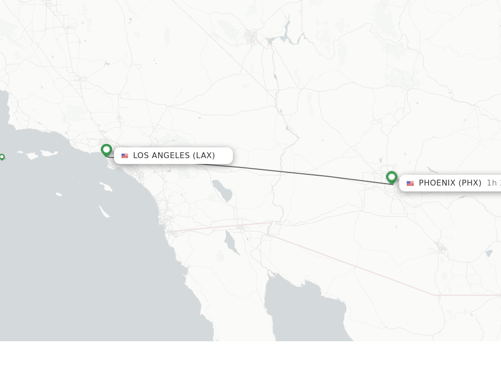
While driving provides the most flexibility, other modes of transport offer convenience, speed, or a different perspective on the landscape.
Flying Between the Hubs
For those short on time, flying is the most efficient option. A direct flight from Los Angeles International Airport to Phoenix Sky Harbor International Airport takes approximately one hour and fifteen minutes. Major carriers like American Airlines, Southwest Airlines, and United Airlines operate frequent daily flights, making it easy to commute between the two cities for business or weekend getaways. Hollywood Burbank Airport also offers a convenient alternative for those looking to avoid the congestion of LAX.
Bus and Motorcoach Services
Several bus companies provide reliable service between Los Angeles and Phoenix. Greyhound and FlixBus are the primary operators, offering multiple departures daily. This is a budget-friendly option that allows travelers to relax and enjoy the scenery without the stress of driving. Most modern motorcoaches are equipped with Wi-Fi and power outlets, catering to the needs of the digital traveler.
The Rail Experience
While there is no direct high-speed rail, Amtrak offers a unique way to travel through its Sunset Limited and Texas Eagle lines. The train departs from the historic Union Station in downtown Los Angeles and stops in Maricopa, which is about 35 miles south of downtown Phoenix. From Maricopa, travelers can take a shuttle or rideshare into the city. Though it takes longer than driving, the train offers a nostalgic and scenic perspective of the American Southwest.
Best Time to Travel and Seasonal Considerations
The climate of the Southwest plays a major role in planning your trip. The distance remains the same, but the “feel” of the journey changes dramatically with the seasons.
Winter and Spring: Peak Season
The months from November to April are arguably the best times to travel between Los Angeles and Phoenix. The weather is mild and pleasant, with daytime temperatures in the desert ranging from 65°F to 75°F. This is the peak season for tourism in the Valley of the Sun, as visitors flock to the region for golf, hiking, and events like the Barrett-Jackson Collector Car Auction or the Waste Management Phoenix Open in Scottsdale.
Summer: The Desert Heat
Traveling in the summer (June through September) requires careful preparation. Temperatures in the Sonoran Desert frequently exceed 110°F. If you are driving, it is vital to ensure your vehicle’s cooling system is in top condition and that you carry plenty of water. While the heat is intense, summer travel often comes with lower prices for those looking to explore the city’s indoor attractions, such as the Heard Museum or the Musical Instrument Museum.
Monsoon Season
From July through September, the region experiences the North American Monsoon. This season brings sudden, heavy downpours and spectacular lightning storms. While these storms provide a refreshing break from the heat, they can cause flash flooding and dust storms, known as “haboobs.” Travelers should stay informed via National Weather Service alerts and be prepared for brief delays.
Practical Tips for the Journey
To make the most of your trip from Los Angeles to Phoenix, a bit of foresight goes a long way. Whether you are a local or a visitor from Europe or Asia, these tips will help you navigate the route with ease.
Timing Your Departure
To avoid the worst of Los Angeles traffic, aim to leave either very early in the morning (before 6:00 AM) or after the evening rush hour. Friday afternoons are notoriously difficult, as many Angelenos head to Las Vegas or Palm Springs, clogging the same eastward arteries you will be using.
Connectivity and Navigation
While Interstate 10 is well-maintained, there are stretches of the desert where cell service can be spotty. It is wise to download offline maps on your device. Additionally, keep an eye on your fuel gauge; while there are service stations in towns like Indio, Blythe, and Quartzsite, the gaps between them can be significant.
Exploring the Destination
Upon arriving in Phoenix, you will find a city that has evolved into a sophisticated urban center. From the vibrant arts district of Roosevelt Row to the scenic hiking trails of Camelback Mountain, the destination is just as rewarding as the journey. The city serves as an excellent base for further exploration of Arizona, including trips to the Grand Canyon National Park or the red rocks of Sedona.
In conclusion, the distance from Los Angeles to Phoenix is more than a measurement of miles; it is an invitation to explore the heart of the American Southwest. Whether you choose the speed of a flight or the adventure of the open road, the transition from the Pacific Coast to the Valley of the Sun remains one of the most classic travel experiences in North America.
LifeOutOfTheBox is a participant in the Amazon Services LLC Associates Program, an affiliate advertising program designed to provide a means for sites to earn advertising fees by advertising and linking to Amazon.com. Amazon, the Amazon logo, AmazonSupply, and the AmazonSupply logo are trademarks of Amazon.com, Inc. or its affiliates. As an Amazon Associate we earn affiliate commissions from qualifying purchases.