
Traveling across the Sunshine State is a quintessential American experience, yet few realize the sheer scale of Florida. While many visitors envision the state as a compact peninsula, the distance between its northwestern jewel, Pensacola, and the vibrant metropolis of Miami, tells a different story. Understanding this geographical expanse is essential for any traveler planning a comprehensive road trip or considering domestic connections between these two iconic destinations.
The Geographical Reality: Distance and Driving Time
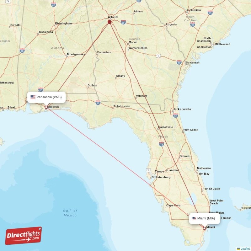
When planning a journey from the emerald waters of the Gulf Coast to the turquoise tides of the Atlantic, one must look at the numbers. The distance between Pensacola and Miami is significant, spanning nearly the entire length of the state.
Miles and Kilometers
By road, the shortest distance between these two cities covers approximately 670 to 700 miles, depending on the specific route taken. In kilometers, this translates to roughly 1,080 to 1,125 kilometers. Because Florida is geographically shaped like a long, narrow boot, driving from the Panhandle to the tip of the peninsula requires navigating a substantial portion of the state’s vertical and horizontal infrastructure.
Estimating Driving Duration
Under optimal traffic conditions, a non-stop drive typically takes between 10 and 11.5 hours. However, this estimate assumes minimal stops for fuel, food, or rest. In practice, most travelers find that a trip between these two points is best treated as a multi-day excursion rather than a single-day haul. Traffic congestion—particularly when passing through major urban hubs like Orlando or Tampa—can significantly fluctuate these travel times.
Navigating the Major Routes
For those choosing to drive, the journey across Florida offers various pathways, each with its own character and landscape. Choosing the right route often depends on whether your priority is speed or scenic exploration.
The I-10 and I-75/Florida Turnpike Combination
The most common route for those traveling from the Pensacola area involves taking Interstate 10 heading east toward Tallahassee. From there, travelers typically transition toward the Florida Turnpike or Interstate 75. This route is the most efficient way to descend through the spine of the state. It allows motorists to maintain higher speeds, though it involves passing through several major metropolitan areas where congestion is a common occurrence.
Scenic Alternatives and Detours
If you are not pressed for time, Florida offers more than just high-speed interstates. Many travelers opt to break up the long drive by staying overnight in intermediate cities. Whether you choose the historical charm of St. Augustine or the theme park thrills found in Orlando, splitting the distance makes the journey far more manageable and enjoyable. Planning your route to include a stop in a destination city adds a layer of vacation to what would otherwise be a grueling day behind the wheel.
Air Travel: A Time-Saving Perspective
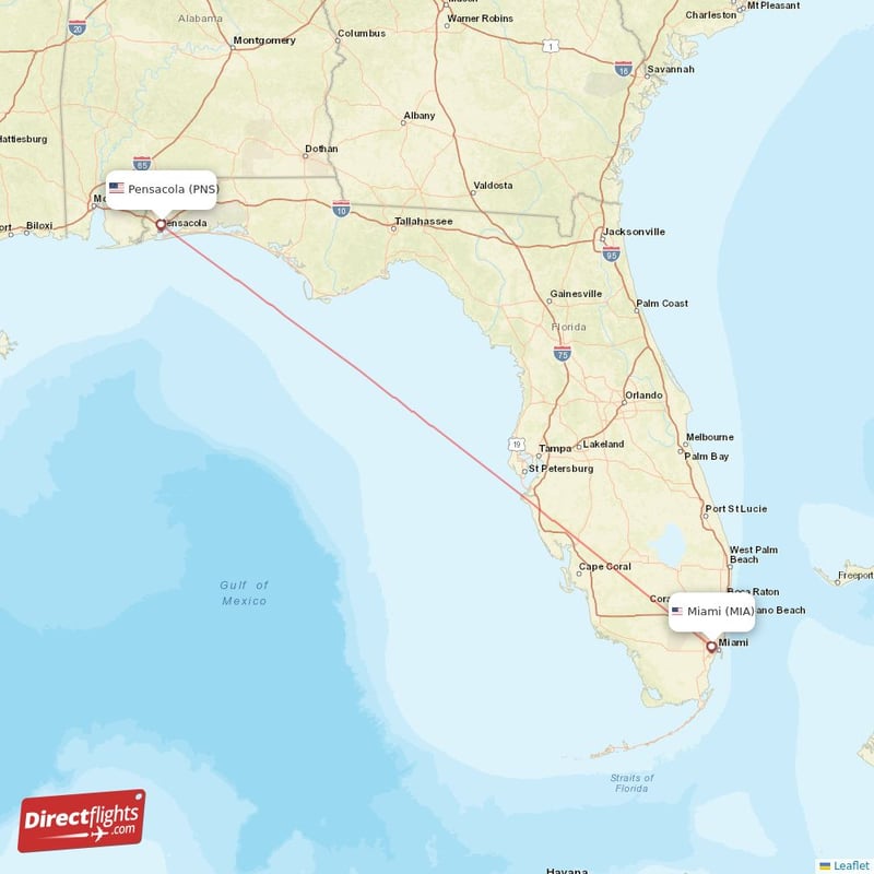
Given the significant distance, many travelers choose to fly between Pensacola and Miami to avoid the wear and tear of a 700-mile road trip.
Flight Logistics
The flight distance between Pensacola International Airport and Miami International Airport is significantly shorter than the driving distance, as the crow flies. A direct flight takes approximately 1.5 to 2 hours of air time. When you factor in security screening, boarding, and baggage claim, air travel remains the fastest method for point-to-point transit.
Pros and Cons of Flying vs. Driving
While flying is undeniably faster, it removes the ability to explore the diverse landscapes between these two cities. Conversely, driving provides unparalleled freedom and the ability to carry more luggage, but it requires substantial time and focus.
Travelers should weigh the cost of airline tickets and rental cars against the cost of fuel and overnight accommodations. If your itinerary is strictly business-oriented, flying is almost always the preferred choice. If your goal is a leisurely vacation to see the breadth of Florida, the drive—while long—is an adventure in its own right.
Tips for a Successful Florida Long-Haul
Regardless of how you choose to travel, preparation is key when traversing such a vast distance.
Preparing for Traffic
Florida is known for its heavy traffic, especially during peak tourist seasons and holidays. Major junctions near Jacksonville and Miami can become bottlenecks. Utilizing navigation apps that provide real-time updates on accidents and construction is vital to avoiding hours of delay.
The Importance of Strategic Rest Stops
Safety should always be the priority when driving long distances. Fatigue is a significant factor in road safety. Planning stops every 3 to 4 hours is recommended to stretch your legs and refresh your focus. The state offers numerous “Rest Areas” along the major interstates, providing clean facilities and information on local attractions.
Weather Considerations
Florida weather can change rapidly, particularly during the summer hurricane and thunderstorm season. Heavy downpours can reduce visibility on the highways to near zero. Travelers should always check the weather forecast for their entire route, not just their departure and arrival cities, before hitting the road.
Conclusion: Balancing the Journey
The distance between Pensacola and Miami is a testament to the sheer size of the state. Whether you are navigating the sprawling interstates to experience the cultural shift from the deep, traditional South of the Panhandle to the international, high-energy atmosphere of South Florida, or opting for a quick flight to maximize your time at your destination, understanding the distance is the first step in successful planning.
By recognizing that this isn’t a short trip, you can approach your travel logistics with the proper expectations. Whether you choose to power through the 700-mile drive or break it into smaller segments, Florida provides an array of experiences that reward those who take the time to explore its vast and varied landscape. Keep your map handy, your fuel tank full, and your itinerary flexible to ensure that the journey is just as memorable as the time spent at either end of the state.
LifeOutOfTheBox is a participant in the Amazon Services LLC Associates Program, an affiliate advertising program designed to provide a means for sites to earn advertising fees by advertising and linking to Amazon.com. Amazon, the Amazon logo, AmazonSupply, and the AmazonSupply logo are trademarks of Amazon.com, Inc. or its affiliates. As an Amazon Associate we earn affiliate commissions from qualifying purchases.