
The question of how far Petaluma is from San Francisco is a common one for those looking to explore the diverse landscapes and attractions of Northern California. While both cities are nestled within the greater Bay Area, they offer distinctly different experiences. Understanding the distance and the various transportation options available is key to planning a seamless and enjoyable trip, whether you’re considering a day excursion, a weekend getaway, or even a relocation.
The Mileage and Travel Time
The precise distance between Petaluma and San Francisco can vary slightly depending on the exact starting and ending points and the chosen route. However, generally speaking, the two cities are separated by approximately 40 to 45 miles (about 64 to 72 kilometers) when traveling by car.

This mileage translates into a travel time that is heavily influenced by traffic conditions. During non-peak hours, the drive can take as little as 45 minutes to 1 hour. However, during the morning and evening commutes, particularly on weekdays, this travel time can easily double, stretching to 1.5 to 2 hours or even more. The primary route connecting the two cities is U.S. Route 101, a major artery that experiences significant congestion.
Factors Affecting Travel Time
- Time of Day: As mentioned, rush hour is the most significant factor. Traveling outside of the 6-9 AM and 3-7 PM windows can drastically reduce your journey time.
- Day of the Week: Weekends tend to have less predictable traffic, with increased volume often associated with leisure travel and events.
- Incidents and Roadwork: Unforeseen accidents, construction projects, or special events can cause significant delays on U.S. Route 101 and other connecting roads.
- Weather Conditions: While not as impactful as in some other regions, heavy rain can slow down traffic in the Bay Area.
Transportation Options: Navigating the Route
Choosing the right mode of transportation between Petaluma and San Francisco can greatly impact your travel experience. Each option offers its own set of advantages and disadvantages, catering to different preferences and priorities.
Driving
Driving is arguably the most flexible option, allowing you to depart and arrive on your own schedule and to explore destinations along the way.
- Pros: Flexibility, ability to carry more luggage, convenience for exploring multiple stops.
- Cons: Traffic congestion, parking challenges and costs in San Francisco, fuel costs.
- Parking in San Francisco: Finding affordable and convenient parking in San Francisco can be a significant challenge. Numerous parking garages and street parking options exist, but rates can be high, and availability is often limited in popular areas like Fisherman’s Wharf or the Financial District. Utilizing parking apps and researching garage locations in advance is highly recommended.
Public Transportation
For those looking to avoid the stress of driving and parking, public transportation offers a viable and often more relaxed alternative.
SMART Train
The Sonoma-Marin Area Rail Transit (SMART) train is a relatively new and increasingly popular option. The train line runs from Cloverdale in Sonoma County down to Larkspur in Marin County.
- Route: The SMART Train line extends from Cloverdale south to Larkspur. Petaluma has a SMART Train station conveniently located downtown.
- Connecting to San Francisco: From the Larkspur station, passengers can board a Golden Gate Ferry to the San Francisco Ferry Building or Fisherman’s Wharf. This ferry ride offers scenic views of the Bay, including the Golden Gate Bridge on a clear day.
- Travel Time: The train journey from Petaluma to Larkspur typically takes around 30-40 minutes. The ferry ride to San Francisco adds another approximately 40 minutes. Total travel time, including transfers, can range from 1.5 to 2 hours, depending on connection times.
- Pros: Relaxing journey, scenic views, avoids traffic and parking, environmentally friendly.
- Cons: Requires transfers, less flexible than driving, service is not 24/7.
Golden Gate Transit Buses
Golden Gate Transit operates several bus routes that connect Sonoma County with San Francisco.
- Route: Bus routes such as the 101 and others serve Petaluma and travel south along U.S. Route 101. These buses typically terminate at various points in San Francisco, including the Transbay Terminal (now the Salesforce Transit Center).
- Travel Time: Bus travel times can be longer than driving due to frequent stops and potential traffic. Expect travel times to be in the range of 1.5 to 2.5 hours, heavily dependent on traffic conditions.
- Pros: Direct service to San Francisco without transfers, generally more affordable than driving when factoring in parking.
- Cons: Subject to traffic delays, can be less comfortable than the train/ferry combination.
Ride-Sharing Services
Services like Uber and Lyft are readily available for travel between Petaluma and San Francisco.
- Pros: Door-to-door service, convenient, can be cost-effective for groups.
- Cons: Prices can fluctuate significantly with demand and traffic, may still be subject to traffic delays.
Exploring Petaluma: A Complementary Experience
While San Francisco is a world-renowned city of iconic landmarks and bustling urban life, Petaluma offers a distinct charm and a more relaxed pace. Located in the heart of Sonoma County, it’s known for its agricultural heritage, vibrant downtown, and proximity to wine country.
- Downtown Petaluma: The historic downtown area boasts beautifully preserved Victorian architecture, unique boutiques, art galleries, and a thriving culinary scene. It’s a pleasant place to stroll, dine, and soak in the local atmosphere.
- Sonoma County Wine Country: Petaluma serves as an excellent gateway to the renowned wineries of Sonoma County. A short drive can take you to numerous vineyards offering tastings and tours.
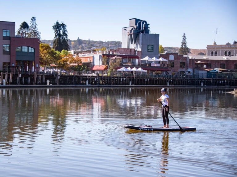
- Outdoor Activities: The surrounding natural beauty provides ample opportunities for outdoor enthusiasts, from hiking and biking trails to kayaking on the Petaluma River.

Planning Your Trip
When planning your journey from Petaluma to San Francisco, consider these planning tips:
- Check Traffic Conditions: Always check real-time traffic apps like Google Maps or Waze before you depart, especially if driving.
- Consider Your Priorities: If flexibility is paramount, driving is likely your best bet. If you prefer a more relaxed journey and want to avoid parking hassles, the SMART Train and ferry combination is an excellent choice.
- Book in Advance: For accommodations in San Francisco, especially during peak tourist seasons or major events, booking well in advance is crucial.
- Factor in Travel Time: Be realistic about travel times, particularly if you have scheduled activities or appointments in either city. Allow for buffer time to account for potential delays.
- Explore Local Transit in San Francisco: Once you arrive in San Francisco, familiarize yourself with its extensive public transportation network, including Muni buses, streetcars, and BART, to navigate the city efficiently.
In conclusion, the distance between Petaluma and San Francisco is manageable, and a variety of transportation options exist to bridge the gap. Whether you’re drawn by the urban allure of San Francisco or the charming ambiance of Petaluma, understanding the logistics will ensure a smooth and enjoyable travel experience in this beautiful region of California.
LifeOutOfTheBox is a participant in the Amazon Services LLC Associates Program, an affiliate advertising program designed to provide a means for sites to earn advertising fees by advertising and linking to Amazon.com. Amazon, the Amazon logo, AmazonSupply, and the AmazonSupply logo are trademarks of Amazon.com, Inc. or its affiliates. As an Amazon Associate we earn affiliate commissions from qualifying purchases.