
Traversing the length of California from its state capital in the north to its southernmost major city on the Pacific coast is a significant journey, one that travelers frequently undertake for business, leisure, or relocation. Understanding the exact distance and various travel options between Sacramento and San Diego is crucial for efficient trip planning. This extensive trek covers a diverse landscape, from the agricultural heartland to bustling metropolitan areas and picturesque coastal stretches.
The Geographic Overview: Unpacking the Distance
The direct distance separating Sacramento in Northern California and San Diego in Southern California is approximately 490 to 500 miles (about 789 to 805 kilometers) by road. This measurement accounts for the most common and direct driving routes available. The precise mileage can fluctuate slightly depending on the specific starting point within Sacramento and the final destination in San Diego, as well as minor deviations in chosen routes.
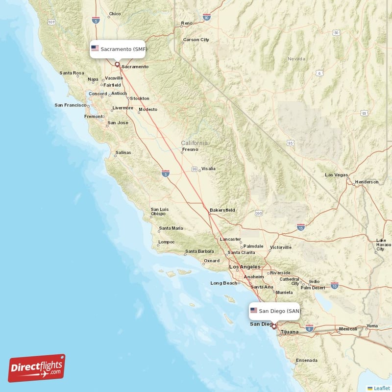
To put this into perspective, driving this distance typically requires a substantial commitment of time, ranging from 7.5 to 9 hours under ideal conditions, without factoring in significant stops for rest, meals, or unforeseen traffic delays. The journey spans the majority of California’s north-south axis, passing through various geographic and demographic regions that shape the travel experience. Sacramento, nestled at the confluence of the Sacramento and American rivers, marks the northern gateway to the vast Central Valley. San Diego, in contrast, boasts a stunning natural harbor and a vibrant coastline, representing the state’s southern maritime frontier with Mexico just beyond. This considerable expanse necessitates careful planning to ensure a smooth and enjoyable passage.
Navigating the Golden State: Driving Routes and Times
Driving is by far the most popular method for traveling between Sacramento and San Diego, offering flexibility and the opportunity to experience California’s diverse landscapes. There are primarily two major routes to consider, each offering a distinct experience in terms of speed, scenery, and potential challenges.
The Primary Artery: Interstate 5
For travelers prioritizing speed and efficiency, Interstate 5 (I-5) is the unequivocal choice. This major freeway stretches from the Canadian border to the Mexican border, serving as California’s backbone. From Sacramento, I-5 heads directly south, cutting through the sprawling Central Valley. This segment is characterized by relatively flat terrain, vast agricultural fields, and a generally straight path, allowing for consistent speeds.
- Distance: Approximately 490 miles.
- Estimated Drive Time: 7.5 to 9 hours. This estimate is highly dependent on traffic conditions, especially as one approaches and passes through the greater Los Angeles metropolitan area.
- Key Considerations:
- Traffic: The segment of I-5 that passes through Los Angeles and Orange County is notorious for congestion, particularly during weekday rush hours (6 AM – 10 AM and 3 PM – 7 PM) and on weekends. Timing your passage through this region is critical. Many travelers aim to drive through Los Angeles in the late morning, early afternoon, or very late at night.
- The Grapevine: North of Los Angeles, I-5 climbs over the Tehachapi Mountains via the Grapevine, a steep and winding pass. While generally manageable, it can experience challenging weather conditions, including heavy fog and snow during winter months, which can cause significant delays or even closures.
- Services: The I-5 corridor through the Central Valley offers numerous exits with gas stations, fast-food restaurants, and rest stops, making it convenient for quick breaks.
The Scenic Alternative: Coastal Routes
For those who view the journey as part of the adventure and have more time to spare, a coastal route offers breathtaking scenery, albeit at the cost of a much longer travel time. This option typically involves heading west from Sacramento towards the Bay Area, then following coastal highways south.
- Distance: Approximately 550-600+ miles, depending on specific turns.
- Estimated Drive Time: 10 to 12+ hours of pure driving, easily extending to two days with stops.
- Route Description: This path might involve taking I-80 or I-580 to reach the San Francisco Bay Area, then connecting to US-101 or even portions of California State Route 1 (PCH) as you head south. This route passes through picturesque coastal towns, offers stunning ocean views, and allows for exploration of charming communities along the way.
- Key Considerations:
- Time Commitment: This is not a route for hurried travelers. It demands a relaxed pace and ideally an overnight stop to fully appreciate the experience.
- Traffic: While the coastal segments are less prone to the gridlock of I-5 through Los Angeles, traffic in the Bay Area and the coastal cities of Santa Barbara and Ventura can still add significant delays.
- Road Conditions: Portions of Highway 1 can be narrow, winding, and susceptible to landslides, particularly during the rainy season. Always check current road conditions before embarking on this route.
Beyond the Wheel: Alternative Transportation Options
While driving offers the most direct control over your journey, several other transportation methods connect Sacramento and San Diego, each with its own advantages and considerations.
By Air: A Swift Connection
Flying is the fastest way to cover the distance between these two cities, ideal for business travelers or those with limited time.
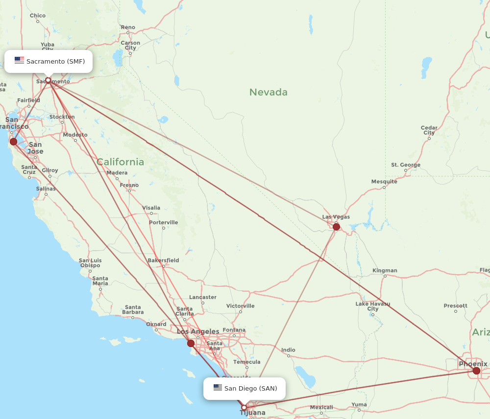
- Airports: Flights typically depart from Sacramento International Airport (SMF) and arrive at San Diego International Airport (SAN).
- Flight Time: Direct flights generally take about 1 hour and 30 minutes.
- Total Travel Time: While the flight itself is short, remember to factor in time for commuting to and from airports, security checks, boarding, and baggage claim. This can easily add 3-4 hours to the actual travel time.
- Cost: Airfare can vary widely depending on the airline, booking in advance, and seasonality. It can sometimes be comparable to or even cheaper than driving when considering fuel, wear and tear, and potential overnight stays for a long drive.
- Best For: Speed, convenience, and avoiding the stresses of long-distance driving.
By Rail: The Amtrak Experience
Amtrak offers a scenic and relaxing way to travel, though it typically involves transfers and longer travel times compared to driving or flying.
- Route: There is no direct train service. Travelers from Sacramento would typically take the Amtrak San Joaquin line south to a transfer point, often Bakersfield. From Bakersfield, a bus bridge connects passengers to the Amtrak Pacific Surfliner route, which then proceeds along the coast to San Diego.
- Travel Time: The entire journey, including transfers, can take anywhere from 10 to 14 hours or more, making it comparable to or longer than driving.
- Advantages: Passengers can relax, enjoy the scenery, avoid traffic, and often have access to Wi-Fi and dining services. The coastal segment of the Pacific Surfliner offers spectacular ocean views.
- Disadvantages: Slower than driving, less flexible in scheduling, and can be more expensive than bus travel.
By Bus: Budget-Friendly and Convenient
Bus services provide an economical option for traveling between Sacramento and San Diego.
- Providers: Companies like Greyhound operate routes connecting the two cities.
- Travel Time: Bus journeys typically range from 9 to 12 hours, depending on the number of stops and the specific route taken. Some routes may involve transfers.
- Cost: Generally the most budget-friendly option, especially when booked in advance.
- Advantages: Allows passengers to relax, sleep, or work during the journey without the stress of driving. Often includes amenities like Wi-Fi and power outlets.
- Disadvantages: Less comfortable than train or air travel for some, potential for delays, and a longer travel time compared to flying or a direct drive.
Planning Your Journey: Key Considerations for the Trip
Regardless of your chosen mode of transport, a few key considerations can significantly enhance your travel experience between Sacramento and San Diego.
Best Time to Travel
- Avoiding Peak Seasons: Summer (June-August) and major holidays (Thanksgiving, Christmas, New Year’s) see increased travel volume, leading to higher prices for flights and accommodations, and heavier traffic on roads.
- Weekday vs. Weekend: For driving, weekdays typically have less recreational traffic, but city commutes can be brutal. Weekends can have more leisure traffic but less commuter rush in metropolitan areas. Aiming for mid-morning or late evening departures on weekdays can help avoid the worst traffic in Los Angeles.
- Weather: California’s climate is generally mild, but extreme heat in the Central Valley during summer can be grueling for drivers, while winter can bring rain, fog, and occasional snow to the Grapevine pass.
Stopover Options (for driving)
For those undertaking the long drive, strategic stops are essential. Along I-5, towns like Harris Ranch or Santa Clarita offer convenient places for food, gas, and a quick stretch. If taking a more scenic coastal route, charming cities like San Luis Obispo or Santa Barbara make for excellent overnight stays, allowing you to break up the drive and enjoy the local ambiance.
What to Pack
For a road trip, ensure your vehicle is in good condition, and pack essentials like water, snacks, first-aid kit, phone chargers, and entertainment. For any mode of transport, dress in layers, as California weather can vary significantly from the Central Valley’s heat to San Diego’s cooler coastal breezes.

Flexibility and Real-Time Information
Utilize GPS navigation apps with real-time traffic updates, especially when driving through metropolitan areas. Check airline or train schedules for any delays before departing. Building in buffer time for unexpected events will reduce stress and contribute to a more enjoyable journey.
The journey between Sacramento and San Diego is a testament to the vastness and diversity of California. Whether you opt for the speed of air travel, the convenience of the road, or the relaxed pace of rail, understanding the distance and implications for your trip is the first step toward a successful adventure.
LifeOutOfTheBox is a participant in the Amazon Services LLC Associates Program, an affiliate advertising program designed to provide a means for sites to earn advertising fees by advertising and linking to Amazon.com. Amazon, the Amazon logo, AmazonSupply, and the AmazonSupply logo are trademarks of Amazon.com, Inc. or its affiliates. As an Amazon Associate we earn affiliate commissions from qualifying purchases.