
Understanding the distance to a destination is the fundamental first step in any travel plan. For Fresno, California‘s fifth-largest city, calculating the journey involves more than just miles; it encompasses the strategic routes, estimated travel times, and various transportation options available to reach this significant hub in the San Joaquin Valley. Whether you’re embarking on a road trip, catching a flight, or exploring rail and bus services, a comprehensive understanding of the “how far” will shape your travel experience, ensuring a smooth and efficient arrival. Fresno serves as a vital agricultural center, a gateway to several national parks, and a thriving urban community, drawing visitors and business travelers from across the state and beyond. This guide delves into the logistics of reaching Fresno, providing insights into distances, routes, and travel considerations to aid your planning.
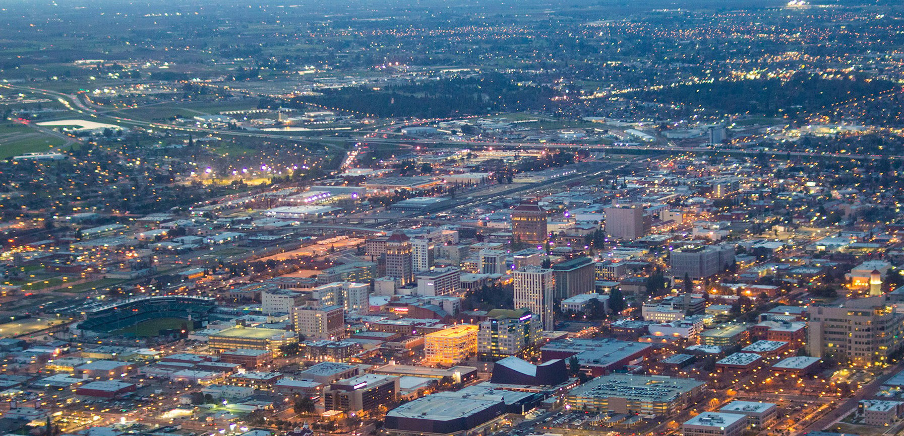
Fresno’s Strategic Location: The Heart of the Valley
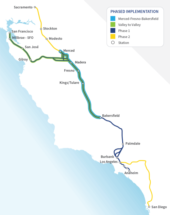
Situated almost precisely in the geographic center of California, Fresno’s location makes it a pivotal point for travel across the state. It lies approximately midway between the two largest metropolitan areas, Los Angeles to the south and San Francisco to the north, creating a natural midpoint for journeys up and down the state. The city is the largest in the fertile San Joaquin Valley, a region renowned globally for its agricultural output. This central placement not only contributes to its economic importance but also positions it as a convenient stopping point or primary destination for travelers exploring California’s diverse landscapes. Moreover, Fresno is often considered the primary gateway city for travelers heading to the majestic Yosemite National Park, Kings Canyon National Park, and Sequoia National Park, making the journey to Fresno an integral part of many adventurers’ itineraries. Understanding its geographic prominence is key to appreciating the various travel routes and times involved.
Geographic Context and Major Hubs
Fresno’s central valley location places it within a few hours’ drive of numerous major California cities. To the north, Sacramento, the state capital, and the San Francisco Bay Area cities like San Francisco, Oakland, and San Jose are all accessible via major highways. To the south, Bakersfield serves as the closest major city, with Los Angeles and San Diego further down. This positioning ensures that Fresno is well-connected by a network of state routes and interstate highways, primarily California State Route 99 and Interstate 5, which run parallel through the length of the San Joaquin Valley. The presence of these major transportation arteries significantly impacts travel times and route choices for those making the journey to Fresno. Beyond these main thoroughfares, a series of state routes branch off, connecting Fresno to coastal cities like San Luis Obispo and Monterey, and to the Sierra Nevada foothills.
Driving to Fresno: Routes, Distances, and Times
Driving is by far the most common mode of transportation to Fresno, offering flexibility and the opportunity to explore California’s diverse landscapes. The main arteries, Highway 99 and Interstate 5, define most long-distance journeys. While both run north-south through the valley, Highway 99 generally passes directly through more major cities and towns within the San Joaquin Valley, often leading to more potential for traffic but also more readily available services. Interstate 5, on the other hand, typically offers a faster, more direct route with fewer exits and services, often running through more rural areas to the west of the valley’s major population centers. Choosing between these two depends on your starting point, desired travel speed, and whether you prefer more amenities along the way.
From Northern California
Travelers from Northern California have several straightforward routes to Fresno.
- From San Francisco: The distance is approximately 185 miles (298 km). The most common route involves taking I-580 E to I-5 S, or I-580 E to I-205 E to Highway 120 E to Highway 99 S. The drive typically takes about 3 to 3.5 hours, depending heavily on traffic conditions, especially around the Bay Area bridges and the initial stretch of I-580.
- From Oakland: Similar to San Francisco, the distance is about 170 miles (274 km), with a travel time of 2.5 to 3 hours. Routes mirror those from San Francisco.
- From Sacramento: At about 170 miles (274 km), the drive from the state capital usually takes 2.5 to 3 hours, primarily via Highway 99 S. This route is generally more direct and less prone to major urban bottlenecks once past the immediate Sacramento area.
- From San Jose: Approximately 150 miles (241 km), the journey usually takes 2.5 to 3 hours. Drivers typically take Highway 101 S to Highway 152 E, connecting to Highway 99 S or Interstate 5 S. Highway 152 involves crossing the Pacheco Pass, a scenic but winding road.
From Southern California
Journeys from Southern California to Fresno are also well-defined by the major north-south highways.
- From Los Angeles: The distance is roughly 220 miles (354 km). The most common routes are Interstate 5 N to Highway 99 N (connecting near Bakersfield) or entirely via Highway 99 N from Los Angeles’s northern suburbs. Travel time ranges from 3.5 to 4.5 hours, heavily influenced by Los Angeles traffic and the condition of Highway 99 through various valley towns.
- From San Diego: At approximately 330 miles (531 km), the drive is longer, typically taking 5 to 6 hours. The route involves taking Interstate 15 N to Interstate 210 W, then Interstate 5 N to Highway 99 N.
- From Bakersfield: As the closest major city to the south, Bakersfield is only about 110 miles (177 km) from Fresno via Highway 99 N, with an estimated drive time of 1.5 to 2 hours.
- From Santa Barbara: Travelers from the central coast will typically travel inland. The distance is about 190 miles (306 km), with a travel time of 3 to 3.5 hours, usually involving Highway 101 N to Highway 166 E and then connecting to Highway 99 N.
Essential Driving Tips
To ensure a smooth journey to Fresno, consider these tips. Traffic can be a significant factor, especially during peak commute hours (6-9 AM and 3-6 PM) around major metropolitan areas like the Bay Area and Los Angeles. Weekend travel can also see increased volume. Using navigation apps like Google Maps or Waze for real-time traffic updates is highly recommended. The San Joaquin Valley can experience extreme heat in summer and dense fog (“Tule Fog”) in winter, which can drastically impact visibility and travel times; always check weather conditions before departing. Ensure your vehicle is in good condition, especially tires and fluid levels, as long stretches of highway may have limited services. Plan for fuel stops and rest breaks, particularly on Interstate 5 where services are less frequent than on Highway 99.
Flying to Fresno: Air Travel Insights
For those looking to cover significant distances quickly or who prefer not to drive, air travel offers a convenient option to reach Fresno. The city is served by a modern and accessible airport, connecting it to various national and international hubs.
Fresno Yosemite International Airport (FAT)
Fresno Yosemite International Airport (FAT) is the primary gateway for air travelers to the Central Valley and the nearby national parks. While not a massive international hub, FAT offers direct flights to several major U.S. cities, making it a convenient option. Key airlines operating out of FAT include United Airlines, American Airlines, Delta Air Lines, Southwest Airlines, Allegiant Air, and Alaska Airlines. These carriers provide direct connections to major hubs such as Denver, Phoenix, Salt Lake City, Las Vegas, Dallas, Chicago, Seattle, Portland, and San Francisco and Los Angeles (though flying within California often makes more sense for speed than cost). For international travelers or those coming from cities without direct FAT service, connecting flights through these major hubs are readily available. The airport is located just six miles northeast of downtown Fresno, offering easy access to rental cars, taxis, and ride-sharing services for onward travel.
Rail and Bus Services: Connecting the Golden State
Beyond driving and flying, Fresno is also well-connected by public transportation options, offering an alternative for those who prefer to leave the driving to someone else. These services often provide a more relaxed journey, allowing travelers to enjoy the scenery without the stress of navigating traffic.
Amtrak Connectivity
Amtrak serves Fresno through its San Joaquin route, which runs multiple times daily between Bakersfield and Oakland or Sacramento. This route is a popular choice for inter-city travel within California, offering comfortable seating, dining cars, and scenic views of the San Joaquin Valley. From the Bay Area, the journey can take approximately 3-4 hours, while from Sacramento it’s around 2.5-3 hours. Amtrak also offers bus connections from its Fresno station to destinations not directly on the rail line, including Yosemite National Park and other cities like Visalia, Paso Robles, and even Southern California cities where the San Joaquin line doesn’t extend. The Fresno Amtrak station is centrally located downtown, making it convenient for accessing local attractions and hotels.

Bus Networks
Intercity bus services, primarily operated by Greyhound and various regional carriers, also connect Fresno to a wide network of cities throughout California and beyond. These services offer a budget-friendly alternative to driving or flying, often with frequent schedules. A bus journey from San Francisco or Los Angeles typically takes longer than driving (e.g., 4-6 hours from San Francisco, 5-7 hours from Los Angeles) due to multiple stops along the route. Fresno’s main bus terminal is generally co-located with or near the Amtrak station, providing a convenient transfer point for travelers. For intra-valley travel, services like FlixBus and other private operators also offer routes to nearby cities such as Modesto, Stockton, and Merced. While bus travel may be slower, it provides an economical option with the benefit of not having to navigate or park, making it appealing for certain types of travelers.
In conclusion, “How far to Fresno, California?” is a question with multiple answers, reflecting the diverse travel options available to reach this pivotal Central Valley city. Whether you prefer the open road, the speed of air travel, or the relaxed pace of rail or bus, Fresno is remarkably accessible from all corners of the state and beyond. By carefully considering your starting point, preferred mode of transport, and any specific travel needs, you can easily plan a journey that brings you to the heart of California’s agricultural bounty and gateway to some of America’s most stunning national parks.
LifeOutOfTheBox is a participant in the Amazon Services LLC Associates Program, an affiliate advertising program designed to provide a means for sites to earn advertising fees by advertising and linking to Amazon.com. Amazon, the Amazon logo, AmazonSupply, and the AmazonSupply logo are trademarks of Amazon.com, Inc. or its affiliates. As an Amazon Associate we earn affiliate commissions from qualifying purchases.