
Driving across California is an experience that varies wildly, not just in mileage but in the rich tapestry of landscapes, cultures, and activities it offers. The Golden State, renowned for its diverse geography ranging from sun-drenched beaches and towering mountains to expansive deserts and fertile valleys, presents a myriad of options for travelers looking to traverse its vast expanse. The time it takes is rarely a simple number; it’s a dynamic calculation influenced by a multitude of factors, each contributing to a unique road trip narrative.
The Varied Landscape of California: More Than Just a Drive
California is a state of superlatives, boasting the highest peak in the contiguous United States, Mount Whitney, and the lowest point in North America, Badwater Basin in Death Valley National Park. Its borders stretch over 800 miles from north to south and approximately 250 miles east to west at its widest point. This geographical diversity means that “driving across California” can imply several distinct journeys, each with its own challenges and rewards.

North to South: The Classic Pacific Coast Highway
The most iconic north-south traverse often conjures images of the Pacific Coast Highway (Highway 1). This route hugs the coastline, offering breathtaking ocean vistas, charming seaside towns, and dramatic cliffs. While geographically direct, its winding nature and numerous photo opportunities significantly extend drive times compared to more inland, high-speed alternatives. From the Redwood Forests in the north near the Oregon border down to the bustling cities of Southern California and the Mexico border, this journey is an adventure in itself.
East to West: Deserts to Coasts
An east-west crossing of California typically involves traversing vast desert landscapes in the east, such as the Mojave Desert or parts of Death Valley, before ascending into mountain ranges and eventually descending to the vibrant coastal regions. Depending on the starting point, this could be from the Nevada border near Las Vegas to Los Angeles, or from the Sierra Nevada mountains to the San Francisco Bay Area. These routes, while often faster in terms of road conditions, can be impacted by mountain passes, especially during winter months, and the sheer scale of the desert environment.
Key Factors Influencing Your Drive Time
Calculating the duration of your Californian road trip requires an understanding of several critical variables. Ignoring these can lead to unrealistic expectations and potential frustrations.
Route Selection: Scenic vs. Swift
The primary determinant of your drive time is the route you choose. Interstate 5 (I-5) is the fastest north-south artery, designed for efficiency, cutting straight through the agricultural heart of the state. In contrast, the Pacific Coast Highway (often called PCH) is celebrated for its beauty but is significantly slower due to its serpentine curves, lower speed limits, and frequent opportunities for scenic stops. Similarly, east-west routes vary between high-speed interstates like I-10 and more winding state highways through national parks or mountain ranges.
Traffic Considerations: Urban Sprawl and Rush Hour
California’s major metropolitan areas, including Los Angeles, San Francisco, and San Diego, are infamous for their traffic congestion. Driving through or near these cities during peak rush hour times (typically 6-9 AM and 3-6 PM on weekdays) can add hours to your journey. Weekends can also see significant delays, especially on routes leading to popular attractions or recreational areas like Lake Tahoe or Palm Springs. Strategic planning to bypass these areas during peak times is crucial.
Stops Along the Way: Experiences, Not Just Miles
One of the greatest joys of a Californian road trip is the ability to stop and explore. Whether it’s a detour to Yosemite National Park, a visit to the wineries of Napa Valley, a stroll on the beaches of Santa Monica, or a meal in Carmel-by-the-Sea, these experiences inherently extend your travel time. Building in buffer time for unexpected discoveries or planned sightseeing is vital for an enjoyable, unhurried trip.
Vehicle Type and Fuel Efficiency
The type of vehicle you drive also plays a subtle role. While not directly impacting speed limits, a less fuel-efficient vehicle might necessitate more frequent fuel stops, adding short pauses to your journey. Conversely, an RV or a vehicle towing a trailer will generally travel at slower speeds and might be restricted on certain roads or lanes, affecting overall transit time.
North-South Journeys: A Detailed Breakdown
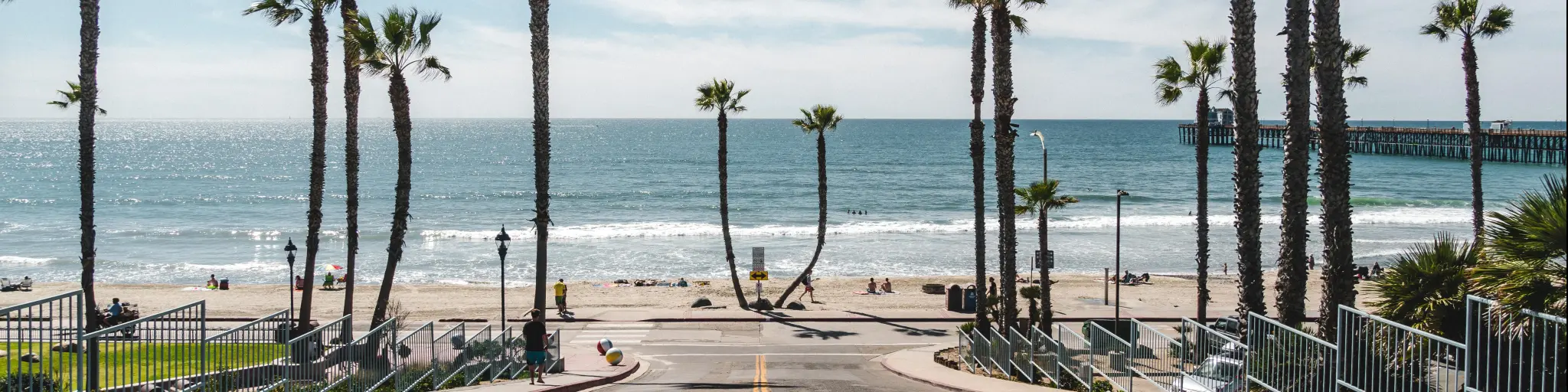
Let’s delve into specific estimates for common north-south routes, assuming reasonable driving conditions and minimal extended stops.
The I-5 Express: Speed and Efficiency
The quickest way to drive the length of California is via Interstate 5. From the Oregon border near Yreka to the Mexico border in San Ysidro, this route spans approximately 790 miles.
- Driving Time: With an average speed of 65-70 mph, and accounting for fuel and short restroom breaks (but no significant sightseeing), this journey can theoretically be completed in 11-13 hours of pure driving.
- Practical Recommendation: For safety and enjoyment, it is highly recommended to break this drive into at least two days, with an overnight stop in a city like Bakersfield or near Sacramento, depending on your direction. This allows for rest and reduces fatigue.
The Scenic Route 1 (PCH): Beauty and Time
Driving the Pacific Coast Highway from northern California (e.g., Leggett, where Highway 1 officially begins its coastal run) down to Orange County is a dramatically different proposition. While not a continuous stretch (segments require detouring onto US-101 or inland roads), the prime coastal sections like Big Sur are known for their slow, winding roads.
- Driving Time (Coastal Sections): A drive from the Mendocino Coast to San Luis Obispo via Highway 1 could easily take 2-3 days with reasonable stops, covering just the most scenic parts.
- Total Driving Time (North to South via PCH-influenced route): To truly “drive across California” predominantly via coastal routes, factoring in all the detours and slower speeds, you are looking at a minimum of 3-5 days, and more realistically 5-7 days or even longer, if you wish to fully appreciate the experience without feeling rushed. This estimate includes overnight stays in places like San Francisco, Monterey, Santa Barbara, and Los Angeles.
Alternative Inland Routes
Routes like US-101 offer a compromise between speed and scenery, connecting many coastal cities and passing through wine regions.
- Driving Time: A full north-south traverse on US-101 could take 14-16 hours of pure driving, making it a comfortable two-day trip with time for some exploration.
East-West Crossings: From Desert to Ocean
East-west journeys across California often depend heavily on your specific starting and ending points, as well as the mountain ranges you might encounter.
Southern Deserts to Coastal Metropolises
A popular east-west route is from the Nevada border near Needles (or even Arizona via I-40 to I-15) across the Mojave Desert to Los Angeles.
- Driving Time: This approximately 250-mile stretch on I-15 and then I-10 can take about 4-5 hours of driving, not including potential Los Angeles traffic. If starting further east in Arizona on I-40, the full traverse across the state could extend to 6-8 hours.
Central Valley to the Pacific
From the central part of the state, such as the San Joaquin Valley, to the coast, routes vary. For example, from Bakersfield to Pismo Beach via Highway 58 and US-101 is about 100 miles and takes approximately 2 hours. From Fresno to Monterey via Highway 152 and US-101 is roughly 150 miles and takes about 3 hours. These routes are generally quicker due to shorter distances, but can still be impacted by mountain passes and local traffic.
Essential Tips for Your California Road Trip
Regardless of your chosen route, a well-planned trip across California is a memorable journey.
Planning Your Itinerary
Use online mapping tools to estimate driving times, but always add at least 25-50% for stops, traffic, and unexpected detours. Book accommodations in advance, especially during peak seasons or for popular destinations like Yosemite or along Highway 1. Consider a flexible itinerary that allows for spontaneous exploration.
Packing Essentials
Prepare for varied climates. You might start in desert heat and end up in cool coastal fog on the same day. Pack layers, sun protection, plenty of water, and snacks. A good road trip playlist or audiobook is a must for longer stretches.
Safety and Roadside Assistance
Ensure your vehicle is in good working condition before embarking on a long drive. Have a spare tire, jumper cables, and a basic emergency kit. Consider a roadside assistance membership for peace of mind, especially when traversing remote areas like the Mojave Desert or isolated sections of Highway 1. Always inform someone of your route and estimated arrival times, particularly if traveling alone.
Driving across California is an unforgettable adventure, offering a kaleidoscope of landscapes and experiences. While the fastest route can be done in a long day’s drive, truly experiencing the state means embracing the journey, allowing for the scenic detours and local charm that make California road trips legendary.
LifeOutOfTheBox is a participant in the Amazon Services LLC Associates Program, an affiliate advertising program designed to provide a means for sites to earn advertising fees by advertising and linking to Amazon.com. Amazon, the Amazon logo, AmazonSupply, and the AmazonSupply logo are trademarks of Amazon.com, Inc. or its affiliates. As an Amazon Associate we earn affiliate commissions from qualifying purchases.