
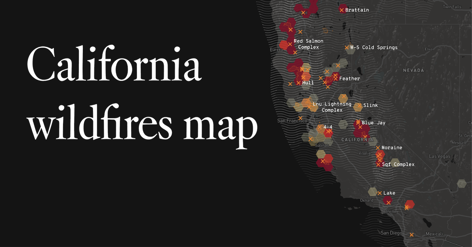
The Golden State, renowned for its sun-drenched beaches, towering redwoods, and vibrant metropolises, has also become inextricably linked in the public consciousness with another, more destructive phenomenon: wildfires. For many, the image of California is punctuated by plumes of smoke, glowing horizons, and news alerts about raging infernos. This perception, while grounded in reality, often leads to a natural question: “Where are all the fires in California?” The answer, of course, is complex and multifaceted, touching upon geography, climate, human activity, and the state’s unique ecological tapestry. Understanding this phenomenon requires a deeper dive into the factors that contribute to wildfire occurrence and the varying risk landscapes across this vast and diverse state.
The Anatomy of a Wildfire: Fuel, Ignition, and Weather
Wildfires are not spontaneous combustion events; they are the result of a precise interplay between three essential components: fuel, ignition, and weather. In California, these elements converge with alarming frequency, creating a potent recipe for disaster.
Fuel: The Dry Tinder of California’s Landscapes
California’s diverse topography hosts a wide array of vegetation, much of which is adapted to a Mediterranean climate characterized by dry, hot summers and wet winters. This adaptation often means that during the dry season, vegetation becomes highly flammable.
Chaparral and Shrublands: Nature’s Fire-Prone Zones
Vast swathes of Southern California, in particular, are dominated by chaparral and coastal sage scrub ecosystems. These dense, shrub-dominated landscapes are naturally adapted to fire, with many plant species even requiring fire for their seeds to germinate. However, the accumulation of dead plant material within these environments acts as a significant fuel source. When this dry biomass ignites, fires can spread rapidly and intensely. Areas like the Santa Monica Mountains and the hills surrounding Los Angeles and San Diego are prime examples of chaparral-laden regions prone to significant wildfire activity.
Forests: Tall Timber, Greater Risk
In Northern and mountainous regions of California, dense coniferous forests present a different but equally significant fuel challenge. Species like ponderosa pine, Douglas fir, and redwood can become incredibly dry during prolonged periods of drought. The accumulation of dead trees, fallen branches, and dry needles on the forest floor creates a continuous fuel bed that can support large, fast-moving crown fires. The Sierra Nevada mountain range, a major watershed and a popular destination for outdoor recreation, frequently experiences devastating forest fires, such as those seen in Yosemite National Park and surrounding national forests.
Agricultural Lands and Grasslands: Dry Season Hazards
Even seemingly benign landscapes like grasslands and agricultural areas can contribute to wildfire risk. During the dry summer and fall months, dry grasses and harvested crop residues can ignite easily from a stray spark. These fires can spread quickly across open terrain, threatening adjacent communities and natural areas. The Central Valley, a vast agricultural heartland, is not immune to this risk, particularly in its more rural and undeveloped fringes.
Ignition: Sparks in a Tinderbox
Once the fuel is primed, an ignition source is all that is needed to start a fire. These sources can be natural or human-caused.
Lightning: Nature’s Fiery Finger
Lightning strikes are a natural ignition source, particularly in the more remote, mountainous, and forested areas of California. During thunderstorms, especially those occurring in drier conditions where rain is minimal or absent, lightning can directly ignite vegetation. The Klamath National Forest and the Shasta-Trinity National Forest in Northern California have historically experienced significant lightning-ignited fires.
Human Activity: The Dominant Culprit
Unfortunately, human activities are the leading cause of wildfires in California. These can range from accidental ignitions to deliberate acts.
- Electrical Equipment: Faulty power lines, falling power lines, and arcing equipment from utility companies have been identified as major contributors to some of the state’s most destructive fires, notably in areas managed by Pacific Gas and Electric (PG&E).
- Campfires and Smoking: Unattended campfires, improperly extinguished cigarettes, and fireworks are frequent ignition sources, especially in recreational areas during dry periods.
- Equipment Use: Sparks from machinery, vehicles (especially catalytic converters), and agricultural equipment can easily ignite dry vegetation.
- Arson: While less common than accidental ignitions, deliberately set fires pose a serious threat and are investigated as criminal acts.
- Vehicles: Hot exhaust systems or sparks from undercarriages can ignite dry roadside vegetation.
Weather: The Accelerant of Destruction
Even with ample fuel and an ignition source, weather conditions play a critical role in determining whether a fire ignites, spreads, and becomes uncontrollable.
Wind: The Unpredictable Driver
Wind is perhaps the most critical weather factor in wildfire behavior. Strong, gusty winds can rapidly propel flames, carry burning embers (firebrands) long distances to start new fires (spotting), and dramatically increase the rate of spread. The notorious “Santa Ana winds” in Southern California, hot, dry, and powerful offshore winds that blow during the fall and winter, are infamous for their ability to fan flames into raging infernos, particularly in the chaparral-covered hillsides. Similarly, the “Diablo winds” in Northern California pose a similar threat to forested and shrubland areas.
Drought and Low Humidity: Creating a Tinderbox
California experiences cyclical droughts, and prolonged periods of below-average rainfall lead to critically low moisture content in vegetation. This dry fuel becomes exceptionally susceptible to ignition and burns more intensely. Low relative humidity, meaning the air has little capacity to hold moisture, further exacerbates this condition by drawing moisture out of plants and fuels. The state has endured several significant drought years in recent decades, creating prolonged periods of extremely high fire danger.
High Temperatures: Escalating the Risk
Extreme heat further dries out vegetation and contributes to drier air. High daytime temperatures, combined with low humidity and wind, create a dangerous environment where fires can ignite easily and spread with terrifying speed.
Hotspots: Where Fires Tend to Ignite and Spread
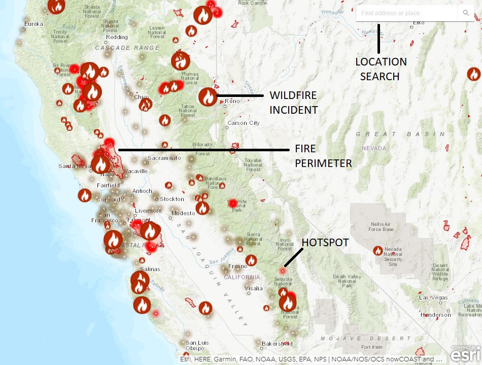
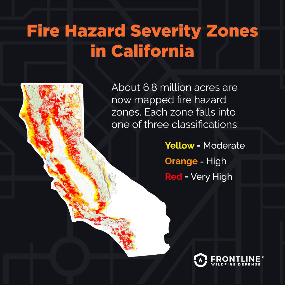
While fires can and do occur throughout California, certain regions are consistently more prone to significant wildfire activity due to the confluence of fuel, weather patterns, and human influence.
Southern California’s Chapparal-Covered Hillsides
The coastal mountain ranges of Southern California, including the Santa Monica Mountains, San Gabriel Mountains, and San Bernardino Mountains, are perennial hotspots. The dense, highly flammable chaparral vegetation, combined with the intense Santa Ana winds, creates a volatile mix. Many of the state’s most devastating interface fires, which occur where wildlands meet urban development, have originated in these areas, threatening major metropolitan areas like Los Angeles, Orange County, and San Diego County.
Northern California’s Forests and Shrublands
In the northern half of the state, the focus often shifts to large forested areas and mixed conifer and shrubland ecosystems. The Sierra Nevada range, encompassing national parks and vast national forests like the Tahoe National Forest and the Eldorado National Forest, experiences significant fire activity, often exacerbated by drought and beetle-killed trees, which add substantial dead fuel. The remote and rugged terrain can make fire suppression challenging. The northern coast ranges and areas like Mendocino County also experience frequent fires in their more wooded and chaparral-dominated landscapes.
The Wildland-Urban Interface (WUI)
A critical factor contributing to the perception of “fires everywhere” is the increasing encroachment of human development into fire-prone wildland areas. The Wildland-Urban Interface (WUI) is where houses and communities are built adjacent to or within undeveloped wildlands. This proximity dramatically increases the risk to human life and property, and makes fires more visible and impactful on urban populations. Many of the most devastating fires in recent years, such as the Camp Fire in Butte County and the Woolsey Fire in Los Angeles and Ventura Counties, have occurred within the WUI.
Managing the Risk: A Constant Battle
The question “Where are all the fires in California?” is also an inquiry into a complex and ongoing challenge of risk management. California is actively engaged in strategies to mitigate wildfire risk, understanding that complete eradication is impossible.
Forest Management and Prescribed Burns
Ecologists and fire managers are increasingly advocating for proactive forest management techniques, including thinning overgrown forests and conducting prescribed burns (controlled fires set under specific conditions) to reduce the amount of fuel available. These methods aim to mimic natural fire cycles and create healthier, more resilient ecosystems. Regions like the Sequoia National Forest are implementing such strategies.
Utility Infrastructure Hardening
In response to the significant role of electrical equipment in igniting fires, utility companies are investing heavily in infrastructure upgrades. This includes burying power lines in high-risk areas, upgrading equipment, and implementing Public Safety Power Shutoffs (PSPS) during periods of extreme fire danger.
Community Preparedness and Defensible Space
Homeowners and communities in fire-prone areas are encouraged to create “defensible space” around their properties by clearing flammable vegetation and using fire-resistant building materials. Evacuation preparedness plans are also crucial for residents living in the WUI.
Climate Change: The Overarching Challenge
Underpinning all these factors is the undeniable influence of climate change. Rising global temperatures contribute to longer and more intense drought periods, hotter heatwaves, and shifts in weather patterns that can exacerbate fire conditions. This makes California’s wildfire problem not just a local or regional issue, but a symptom of a global environmental challenge.
In conclusion, while fires in California may seem widespread and pervasive, they are concentrated in areas with specific ecological characteristics, ignition patterns, and weather influences. The question of “where” is less about a single location and more about understanding the dynamic interplay of natural factors and human impacts that define California’s ongoing relationship with fire.
LifeOutOfTheBox is a participant in the Amazon Services LLC Associates Program, an affiliate advertising program designed to provide a means for sites to earn advertising fees by advertising and linking to Amazon.com. Amazon, the Amazon logo, AmazonSupply, and the AmazonSupply logo are trademarks of Amazon.com, Inc. or its affiliates. As an Amazon Associate we earn affiliate commissions from qualifying purchases.