
The Las Vegas Strip is perhaps the most recognizable stretch of pavement in the world. For many, it is the beating heart of Las Vegas, Nevada, synonymous with neon lights, towering architecture, and a constant hum of energy. However, for those planning to navigate it on foot or trying to understand the geography of this desert oasis, a fundamental question arises: How long is the Las Vegas Strip actually? While it appears as a concentrated burst of light from an airplane, the physical reality of its dimensions is a subject of both geographical precision and historical evolution.

To understand the length of the Las Vegas Strip, one must first define its boundaries. Officially, the Las Vegas Strip is a 4.2-mile (6.8 km) section of Las Vegas Boulevard South. It is a unique landmark not just for its scale, but for its location; interestingly, most of the Las Vegas Strip is not actually within the city limits of Las Vegas but rather in the unincorporated townships of Paradise and Winchester in Clark County.
Defining the Physical Boundaries of a Global Landmark
The exact measurement of the Las Vegas Strip typically begins at the southern end and terminates at the northern tip. Understanding these bookends is essential for anyone wishing to grasp the sheer scale of the architecture and the distance required to traverse the entire length.
The Southern Gateway: From the Sign to Mandalay Bay
The journey of the Las Vegas Strip conceptually begins at the Welcome to Fabulous Las Vegas Sign. This 25-foot-tall classic neon landmark, designed by Betty Willis in 1959, serves as the unofficial entry point. However, the commercial “Strip” effectively begins at the Mandalay Bay Resort and Casino.
As you move north from Mandalay Bay, the density of the built environment increases. This southern sector is characterized by massive footprints, including the Luxor Hotel and Casino with its iconic pyramid shape and the medieval-themed Excalibur Hotel and Casino. The distance between these properties alone can be deceiving; what looks like a short walk is often a half-mile trek due to the sheer size of these architectural giants.
The Northern Frontier: Reaching The STRAT
For many years, the northern boundary of the Las Vegas Strip was considered to be Sahara Avenue, where the Sahara Las Vegas stands. However, as the skyline expanded, the definition of the landmark grew with it. Today, the northern terminus is widely recognized as The STRAT Hotel, Casino & Tower.
Standing at 1,149 feet, The STRAT is the tallest freestanding observation tower in the United States. It marks the transition from the high-density resort corridor into the Arts District and eventually Downtown Las Vegas. Measuring from Mandalay Bay to The STRAT gives us the definitive 4.2-mile measurement that characterizes this world-famous landmark.
The Architectural Evolution of the 4.2-Mile Stretch
The length of the Las Vegas Strip is not just a measurement of distance, but a timeline of 20th and 21st-century architecture. Over the decades, the landscape has shifted from low-slung motor inns to some of the most complex structural achievements in the world.
From Highway 91 to a National Scenic Byway
Long before it was a global landmark, this stretch of road was known simply as Highway 91. The transformation began in the 1940s with the opening of El Rancho Vegas and The Last Frontier. At that time, the “Strip” was much shorter and far less dense.
The mid-century era brought the “Rat Pack” glamour, with landmarks like the Sands Hotel and the Flamingo Las Vegas defining the aesthetic. These buildings were focused on the street, designed to lure drivers in with flashing neon. Today, the Las Vegas Strip is the only “nighttime” National Scenic Byway, a testament to how the lighting and architecture have become a protected cultural and historical asset.
The Rise of the Mega-Resort
The 1990s marked a radical shift in the physical makeup of the Las Vegas Strip. This era saw the birth of the mega-resort, starting with The Mirage and followed by Treasure Island and Bellagio. These structures didn’t just occupy space; they created environments.
The Fountains of Bellagio and the artificial canals at The Venetian Resort Las Vegas added layers of depth to the 4.2-mile stretch. Architecture became a form of transportive storytelling. Visitors could walk past the Eiffel Tower at Paris Las Vegas and find themselves at the Statue of Liberty at New York-New York Hotel and Casino within twenty minutes. This density of landmarks within a four-mile radius is unmatched anywhere else on the globe.
Navigating the Length: Infrastructure and Pedestrian Flow
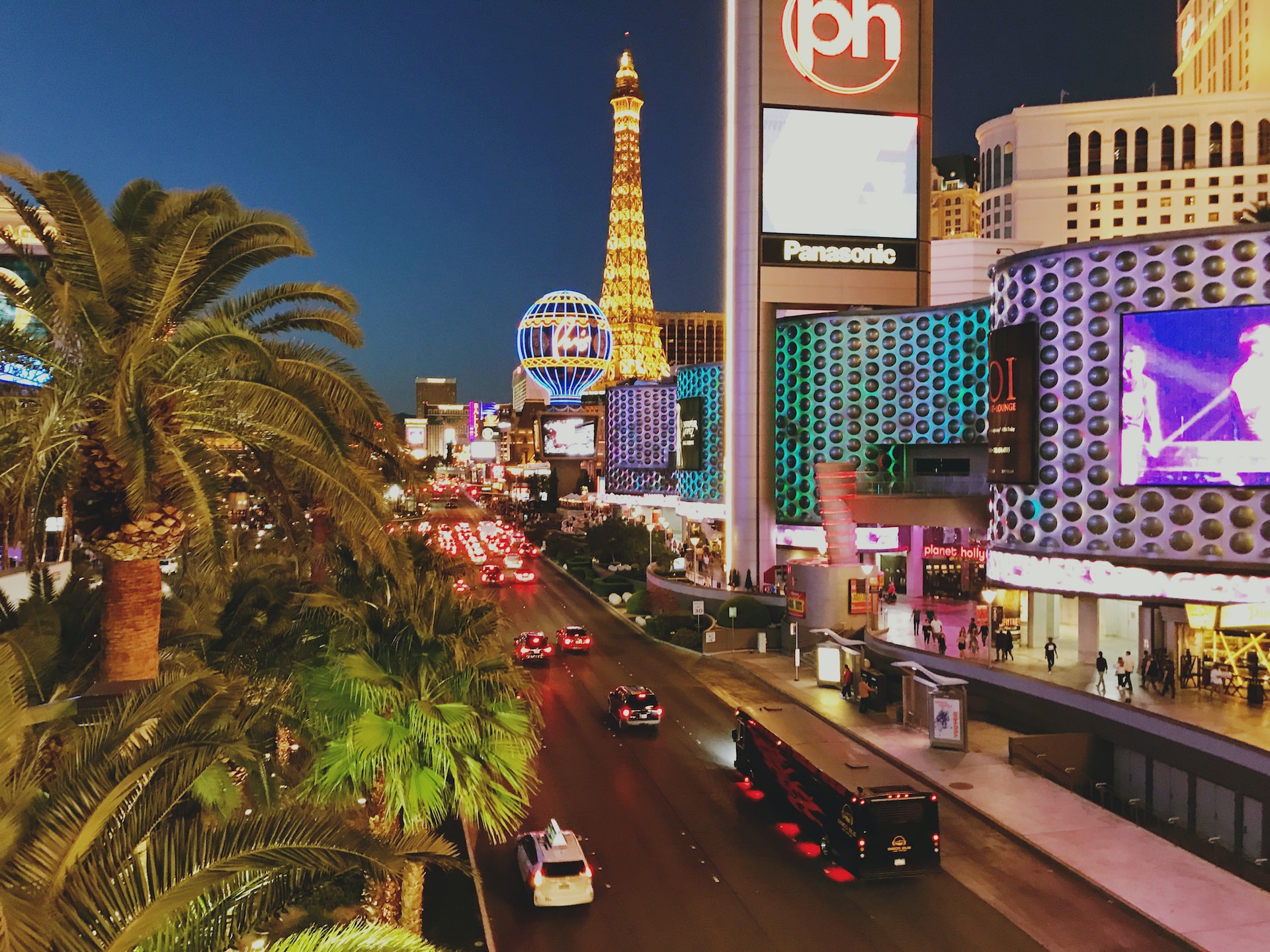
While 4.2 miles might seem like a manageable distance for a seasoned walker, the Las Vegas Strip presents unique challenges. The “Strip Mile” is a common term used by locals to describe the phenomenon where a destination looks close but takes significantly longer to reach due to the massive scale of the buildings and the intricate pedestrian infrastructure.
Pedestrian Bridges and the Elevated Experience
To maintain the flow of traffic on Las Vegas Boulevard, the city and county have implemented an extensive system of pedestrian bridges. These bridges are landmarks in their own right, offering some of the best vantage points for photography.
Major intersections, such as the crossing of Tropicana Avenue and Las Vegas Boulevard, require pedestrians to use these bridges to move between MGM Grand, New York-New York, Excalibur, and Tropicana Las Vegas. While these structures ensure safety, they also add time and distance to the trek, turning a simple four-mile walk into a multi-hour excursion.
Transit Solutions: The Monorail and The Loop
For those who find the 4.2-mile walk too daunting, the Las Vegas Strip offers specialized transit systems that have become part of the area’s technological identity. The Las Vegas Monorail runs behind the eastern side of the resorts, connecting Sahara Las Vegas to MGM Grand.
In addition to the monorail, the Las Vegas Convention Center introduced the Vegas Loop, an innovative underground transportation system developed by The Boring Company. This system utilizes Tesla vehicles to ferry passengers through tunnels, providing a futuristic solution to the “long walk” across the Las Vegas Strip. Furthermore, localized trams like the one connecting Aria Resort and Casino, Bellagio, and Park MGM help bridge the gaps between major landmarks.
The Modern Skyline: New Landmarks and Future Growth
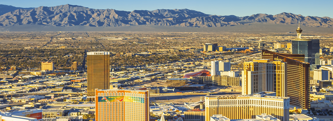
The Las Vegas Strip is never truly finished. Its length and skyline are constantly being redefined by new projects that push the boundaries of engineering and design.
Resorts World and the North End Renaissance
For many years, the northern end of the Las Vegas Strip was less developed than the center. However, the opening of Resorts World Las Vegas in 2021 changed the visual dynamic of the northern 4.2-mile stretch. This massive $4.3 billion complex brought a modern, high-tech aesthetic to the area near Fashion Show Mall.
Nearby, Fontainebleau Las Vegas finally opened its doors, adding a 67-story blue glass skyscraper to the horizon. These developments have successfully anchored the northern end of the landmark, making the entire 4.2 miles a continuous, high-energy corridor of commerce and entertainment.
The Sphere and the Digital Horizon
Perhaps the most significant recent addition to the landmarks surrounding the Las Vegas Strip is Sphere. While it is located slightly off the main boulevard behind The Venetian, it has fundamentally altered the experience of the Las Vegas Strip. Standing at 366 feet tall and 516 feet wide, it is the largest spherical structure in the world.
Its exterior, the Exosphere, is covered in 1.2 million LED pucks, allowing it to project high-resolution imagery that can be seen from miles away. This digital landmark adds a new dimension to the Las Vegas Strip, proving that the “length” of the area is not just about the ground covered, but the visual space it occupies in the mind of the observer.
The Cultural Significance of the 4.2 Miles
Beyond the physical dimensions, the Las Vegas Strip serves as a cultural landmark that mirrors American ambition and architectural trends. It is a place where history is frequently demolished to make way for the future.
The demolition of the Stardust Resort and Casino and the Riviera Hotel and Casino allowed for the expansion of the Las Vegas Convention Center and the birth of new resorts. This constant state of flux means that while the length of the Las Vegas Strip remains a constant 4.2 miles, the landmarks within it are perpetually evolving.
From the High Roller observation wheel at the LINQ Promenade to the luxury retail at The Shops at Crystals, every inch of this 4.2-mile stretch is meticulously designed. Whether you are viewing it from the top of the Eiffel Tower Restaurant or walking the sidewalk past Caesars Palace, the Las Vegas Strip remains a testament to the power of architecture to create a world within a world.
In conclusion, the 4.2-mile length of the Las Vegas Strip is much more than a simple measurement of Las Vegas Boulevard. It is a journey through time, a gallery of engineering marvels, and a landmark that continues to grow in stature even as its geographic borders remain defined. Understanding this distance is the first step in truly appreciating the scale of the Silver State’s most famous contribution to the global landscape.
LifeOutOfTheBox is a participant in the Amazon Services LLC Associates Program, an affiliate advertising program designed to provide a means for sites to earn advertising fees by advertising and linking to Amazon.com. Amazon, the Amazon logo, AmazonSupply, and the AmazonSupply logo are trademarks of Amazon.com, Inc. or its affiliates. As an Amazon Associate we earn affiliate commissions from qualifying purchases.