
The Sunshine State, with its distinctive peninsula shape and vibrant spirit, offers a unique visual identity. Drawing it is more than just sketching a map; it’s about capturing the essence of its diverse landscapes and iconic features. Whether you’re a budding cartographer, an artist seeking inspiration, or simply curious about the geography of this popular destination, understanding how to represent Florida can be a rewarding exercise.
Understanding the Basic Shape
The foundation of drawing Florida lies in its recognizable outline. The state is essentially a long, narrow peninsula extending south from the southeastern United States, bordered by the Atlantic Ocean to the east and the Gulf of Mexico to the west.

The Panhandle
A crucial element of Florida’s shape is its northwestern protrusion, commonly known as the Panhandle. This section stretches westward, creating a distinct bulge before the main peninsula begins. When sketching, pay attention to the curve where the Panhandle meets the rest of the state. A common mistake is to make this connection too sharp; it’s a gentler, more organic transition.
The East Coast
The eastern coastline of Florida is relatively smooth and consistent, characterized by a gentle curve southward. Cities like Jacksonville, Miami, and Fort Lauderdale are situated along this coast. When drawing, aim for a fluid line that conveys the expansive beaches and ocean views.
The West Coast
In contrast, the western coastline of Florida is more varied. It features numerous bays, inlets, and the distinct shape of the Tampa Bay area. Cities such as Tampa, St. Petersburg, and Sarasota are located here. This coast often appears more “indented” than the eastern side. Incorporating these subtle variations will add realism to your drawing.
Southern Tip
The southernmost point of Florida tapers down, forming the gateway to the Florida Keys. This area is characterized by a cluster of islands. When drawing this region, focus on the transition from mainland to archipelago. The shape is not a sharp point but a broader area that then fragments into smaller landmasses.
Incorporating Key Geographical Features
Beyond the outline, adding key geographical features will bring your drawing to life and provide context. These elements are what make Florida unique and recognizable.
The Everglades
No drawing of Florida is complete without acknowledging the vast expanse of the Everglades. Located in the southern part of the state, this unique ecosystem is often depicted as a large, relatively flat wetland area. While it might be a simplified representation on a map, understanding its geographical placement is crucial. You can indicate it with subtle shading or a textured pattern to suggest its swampy nature.
Lakes and Rivers
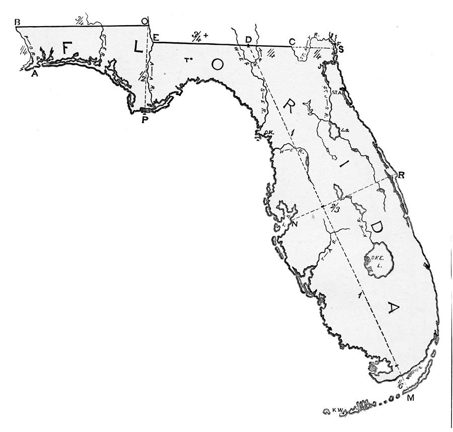
Florida is dotted with numerous lakes and rivers. The most prominent is Lake Okeechobee, one of the largest freshwater lakes in the United States, situated in the southern part of the peninsula. Including this significant body of water will add depth and detail. Smaller lakes can be represented as simple ovals or irregular shapes, strategically placed to reflect known geography. Rivers, like the St. Johns River, often meander across the landscape, and their paths can be sketched to follow the general topography.
Islands and Keys
As mentioned, the Florida Keys are a vital part of Florida’s geography. These islands stretch southwestward from the mainland. When drawing them, think of a string of pearls or irregularly shaped beads. The largest and most prominent island is Key West. Sketching the chain of islands, connected by the iconic Overseas Highway, adds a distinctive visual element to your map.
Adding Detail and Context
To elevate your drawing from a simple outline to a more engaging representation, consider adding details that highlight the state’s character and points of interest.
Major Cities
Placing the major cities of Florida will provide geographical anchors and help viewers orient themselves. These include:
- North: Jacksonville
- Central: Orlando (known for its theme parks), Tampa
- South: Miami, Fort Lauderdale
- Capital: Tallahassee (located in the Panhandle)
You can represent cities with simple dots or small circles. For larger, more prominent cities, you might use slightly larger markers or add their names.
Iconic Landmarks and Attractions
Florida is synonymous with a variety of famous landmarks and attractions that can be visually represented. These add significant character to any drawing.
- Theme Parks: The area around Orlando is world-renowned for its theme parks, including Walt Disney World Resort and Universal Orlando Resort. While you wouldn’t draw individual park structures, you could mark the general area with a cluster of small, stylized icons or a note indicating the “Theme Park Capital.”
- Kennedy Space Center: Located on the Atlantic Ocean coast, the Kennedy Space Center is a significant landmark. A small icon of a rocket ship can effectively represent this important site.
- Beaches: Florida is celebrated for its beaches. You can denote major beach areas along both coastlines with a light sandy color or by drawing small, stylized waves.
- National Parks: Besides the Everglades, Florida has other notable natural areas like Biscayne National Park and Dry Tortugas National Park. These can be indicated with green shading or small park symbols.
Suggested Artistic Styles
The way you choose to draw Florida can greatly influence its presentation.
Stylized Map
A stylized map focuses on key shapes and features without aiming for strict cartographic accuracy. This approach is excellent for travel brochures, infographics, or artistic interpretations. You might use bold outlines, bright colors, and simplified icons for landmarks. The goal is to be visually appealing and informative at a glance.
Realistic Outline
For a more grounded approach, aim for a realistic outline based on geographical maps. This is suitable for educational purposes or when precise representation is desired. Focus on capturing the subtle curves and inlets of the coastline, the precise placement of lakes, and the overall proportions of the state.

Artistic Impression
An artistic impression can take many forms, from watercolor washes that emphasize the watery nature of the state to line drawings that highlight its architectural icons or natural beauty. This style allows for more creative freedom, using color, texture, and composition to convey the feeling of Florida. You might focus on drawing a specific region or a symbolic representation of its culture.
By following these steps, from understanding the basic outline to incorporating detailed features and considering artistic style, you can effectively “draw” Florida in a way that is both informative and visually engaging.
LifeOutOfTheBox is a participant in the Amazon Services LLC Associates Program, an affiliate advertising program designed to provide a means for sites to earn advertising fees by advertising and linking to Amazon.com. Amazon, the Amazon logo, AmazonSupply, and the AmazonSupply logo are trademarks of Amazon.com, Inc. or its affiliates. As an Amazon Associate we earn affiliate commissions from qualifying purchases.