
Drawing the iconic shape of Florida can be a rewarding artistic endeavor, allowing you to capture the essence of the Sunshine State on paper. Whether you’re an aspiring artist or simply want to create a visual representation of this unique peninsula, understanding its geographical features is key. This guide will break down the process into manageable steps, focusing on the distinctive characteristics that make Florida instantly recognizable. We’ll explore the main geographical outlines, key peninsular formations, and the subtle curves that define its coastline.
Understanding Florida’s Unique Geography
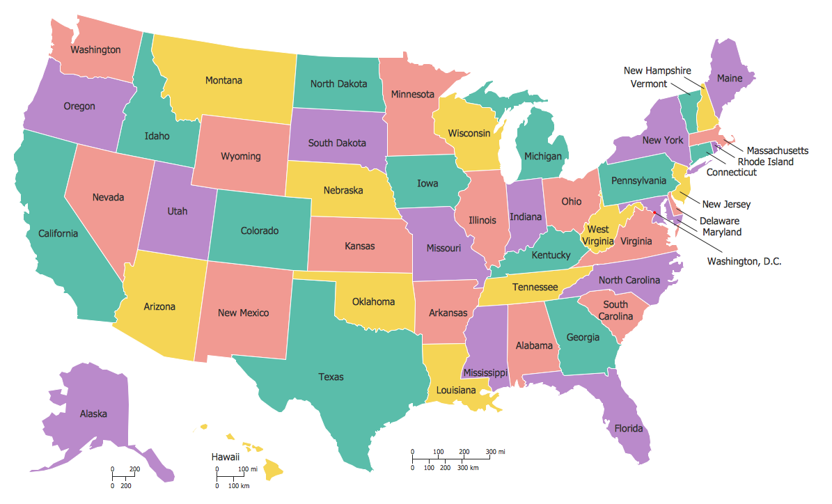
Before putting pencil to paper, it’s helpful to grasp the fundamental shape of Florida. It’s a large peninsula situated in the southeastern United States, bordered by the Atlantic Ocean to the east and the Gulf of Mexico to the west. Its distinctive form is elongated from north to south, with a broad northern section that tapers dramatically into a long, slender southern peninsula. The Florida Keys, a chain of islands extending southwest from the mainland, add another unique element to its silhouette.

The Northern Border and Panhandle
The northern boundary of Florida is irregular, defined in part by its border with Georgia and Alabama. The westernmost part of this border forms the “Panhandle,” a distinct geographical feature that juts westward along the Gulf of Mexico. This panhandle has a somewhat straighter northern edge compared to the curving southern coastline. When drawing this section, think of a roughly horizontal line with a slight downward curve as it approaches the coast. The coastline itself here is less jagged than in other areas, offering a smoother transition into the gulf.
The East Coast: A Gentle Curve
As we move south along the Atlantic side, the coastline of Florida begins to form a long, sweeping curve. This eastern seaboard is characterized by its relatively consistent, gentle arc. It’s a much straighter line than what you’ll find on the western coast, though it’s not perfectly straight. Imagine drawing a long, graceful “C” shape that extends downwards. Cities like Jacksonville, Miami, and Fort Lauderdale are situated along this eastern edge, and their presence can sometimes inform the subtle undulations of the coastline in detailed drawings.
The West Coast: Bays and Inlets
The western coastline, facing the Gulf of Mexico, presents a stark contrast to the east. It is far more irregular, marked by numerous bays, inlets, and estuaries. This creates a more complex and textured outline. Think of it as a series of curves and indentations. Key features include Tampa Bay, which creates a significant indentation in the coastline, and the many smaller bays and islands that dot the shoreline. When drawing this side, allow for more variation and natural undulations. This is where you’ll find cities like Tampa, St. Petersburg, and Fort Myers.
The Southern Tip and the Keys
The southernmost point of mainland Florida is broad and then tapers into a distinct point. From this point, the famous Florida Keys extend southwestward, forming a string of islands. These islands are often depicted as a series of small, connected shapes trailing off the mainland. The Overseas Highway, a famous roadway connecting the Keys, can sometimes be suggested visually as a line running through them. This distinctive chain of islands is a crucial element in recognizing the shape of Florida.
Step-by-Step Drawing Guide
Let’s translate this geographical understanding into practical drawing steps. We will begin with a basic outline and progressively add detail.
Step 1: The Basic Outline
Start by lightly sketching a large, somewhat horizontal oval or elongated shape. This will represent the general mass of the state. Don’t worry about perfection at this stage; it’s just a guide.
Step 2: Defining the Northern Border and Panhandle
From the left side of your oval, draw a somewhat straight line extending outwards to the left. This is the northern edge of the Panhandle. Then, curve this line downwards to meet the coast of the Gulf of Mexico. The westernmost tip of the Panhandle can be a bit squared off or gently rounded. Now, connect this western coastline to the northernmost point of your original oval. This northern border with Georgia and Alabama is somewhat jagged, so don’t be afraid to introduce a few slight curves and angles.
Step 3: Drawing the East Coast

From the northernmost point of Florida, begin to draw the eastern coastline. This is the long, sweeping curve towards the south. Aim for a smooth, continuous arc. You can introduce very subtle bulges and indentations, but the overall impression should be one of a gentle, consistent curve. Remember that this side faces the vast Atlantic Ocean.
Step 4: Capturing the Irregular West Coast
As you move south on the western side, transition to a more complex outline. Begin by drawing the large indentation of Tampa Bay. This will create a significant inward curve. From there, continue south, introducing smaller bays, inlets, and perhaps the outlines of barrier islands. This side requires more attention to detail and variation in the line. Imagine drawing a series of connected “U” shapes and curves.
Step 5: The Southernmost Point and the Keys
As you reach the southern end of the peninsula, bring the lines of the east and west coasts together. The southernmost tip can be drawn as a relatively broad point. Then, extending from this point, begin to sketch the Florida Keys. Draw a series of small, elongated shapes connected by thin lines (representing bridges or the Overseas Highway) that trail off towards the southwest.
Step 6: Refinement and Detail
Once you have the basic outline, begin to refine your drawing. Erase any construction lines and darken the main outline. You can add small details like the general shape of Lake Okeechobee or hints of major cities along the coastlines. For a more artistic rendition, you might consider the shapes of popular tourist destinations. For instance, the distinct coastline near Everglades National Park or the submerged reefs off the coast of the Keys could be subtly suggested.
Artistic Considerations and Variations
Drawing the state of Florida offers ample opportunity for artistic interpretation. The level of detail can vary greatly depending on your desired outcome.
Minimalist Outline
For a simple, recognizable symbol, focus on the absolute essential curves and points. A clean, bold outline is often sufficient for logos, maps, or basic illustrations. This approach emphasizes the overall silhouette without getting bogged down in intricate coastal details.
Detailed Representation
For a more accurate or informative drawing, consider incorporating major geographical features. This might include the distinct shapes of large bays like Tampa Bay, the general outline of Lake Okeechobee, and the chain of the Florida Keys. Adding the borders with neighboring states with greater precision also enhances accuracy.
Stylized Artistic Renditions
Beyond strict geographical accuracy, artists can imbue their drawings with a sense of place. This could involve using specific color palettes associated with Florida – vibrant blues for the ocean, sandy yellows for the beaches, and lush greens for the interior. You might also choose to incorporate iconic imagery within the shape, such as palm trees along the coast or representations of wildlife, creating a richer narrative within the drawing. For example, the silhouette of a flamingo, the state bird, could be subtly integrated into the design.
Incorporating Landmarks
For drawings focused on specific regions or attractions, you can adapt the state outline to highlight key landmarks. For instance, if drawing a map of Central Florida, the outline could be slightly distorted or annotated to emphasize the location of Walt Disney World Resort or Universal Orlando Resort. Similarly, a drawing focused on South Florida might highlight the distinctive shape of the Everglades or the urban sprawl of Miami.
Conclusion
Drawing the state of Florida is a journey through its unique geography, from the western Panhandle to the southern Keys. By understanding the distinct contours of its eastern and western coastlines, and the specific formations that define its peninsular shape, you can create an accurate and aesthetically pleasing representation. Whether you aim for a simple, symbolic outline or a detailed, artistic interpretation, the process of drawing Florida offers a creative way to connect with the essence of this diverse and captivating state. The resulting artwork can serve as a beautiful reminder of a vacation, a point of pride for residents, or simply a testament to the joy of capturing geography through art.
LifeOutOfTheBox is a participant in the Amazon Services LLC Associates Program, an affiliate advertising program designed to provide a means for sites to earn advertising fees by advertising and linking to Amazon.com. Amazon, the Amazon logo, AmazonSupply, and the AmazonSupply logo are trademarks of Amazon.com, Inc. or its affiliates. As an Amazon Associate we earn affiliate commissions from qualifying purchases.