
When travelers plan a trip to New York City, they often view the metropolis as an island-centric phenomenon. However, understanding the geographic footprint of the “Five Boroughs” is essential for navigating the complex web of regional travel. While New York City is synonymous with Manhattan, Brooklyn, Queens, the Bronx, and Staten Island, its immediate borders extend beyond the municipal limits into the broader landscapes of the United States. Defining exactly which states “border” New York City requires a look at both land boundaries and the unique aquatic borders that define the region.
The Geographic Reality of State Borders
Strictly speaking, New York City shares a land border with only one state: New York. Because the city is a constituent part of the New York State, the northern boundary of the Bronx connects seamlessly to Westchester County.
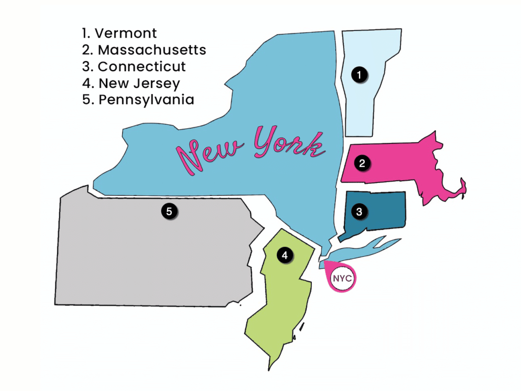
The New York State Connection
The Bronx is the only borough physically connected to the mainland of the United States. Travelers moving north from the city limits quickly find themselves in Yonkers or Mount Vernon. This transition marks the exit from the urban density of the city into the suburban character of the Hudson Valley. For tourists, this connection is vital, as it serves as the gateway to the Metro-North Railroad, facilitating day trips to historic sites and nature preserves outside the city.
The Aquatic Border with New Jersey
While New York City is contained within New York State, its western boundary is defined by the Hudson River, which separates the city from New Jersey. Though they do not share a land border in the traditional sense, the state line runs through the water, meaning that places like Jersey City and Hoboken sit directly across the river from Manhattan. This creates a unique trans-state dynamic where thousands of commuters traverse the Holland Tunnel or the Lincoln Tunnel daily, effectively blurring the lines between the two states in the context of the metropolitan labor market and tourism industry.
Island Connections and the Eastern Horizon
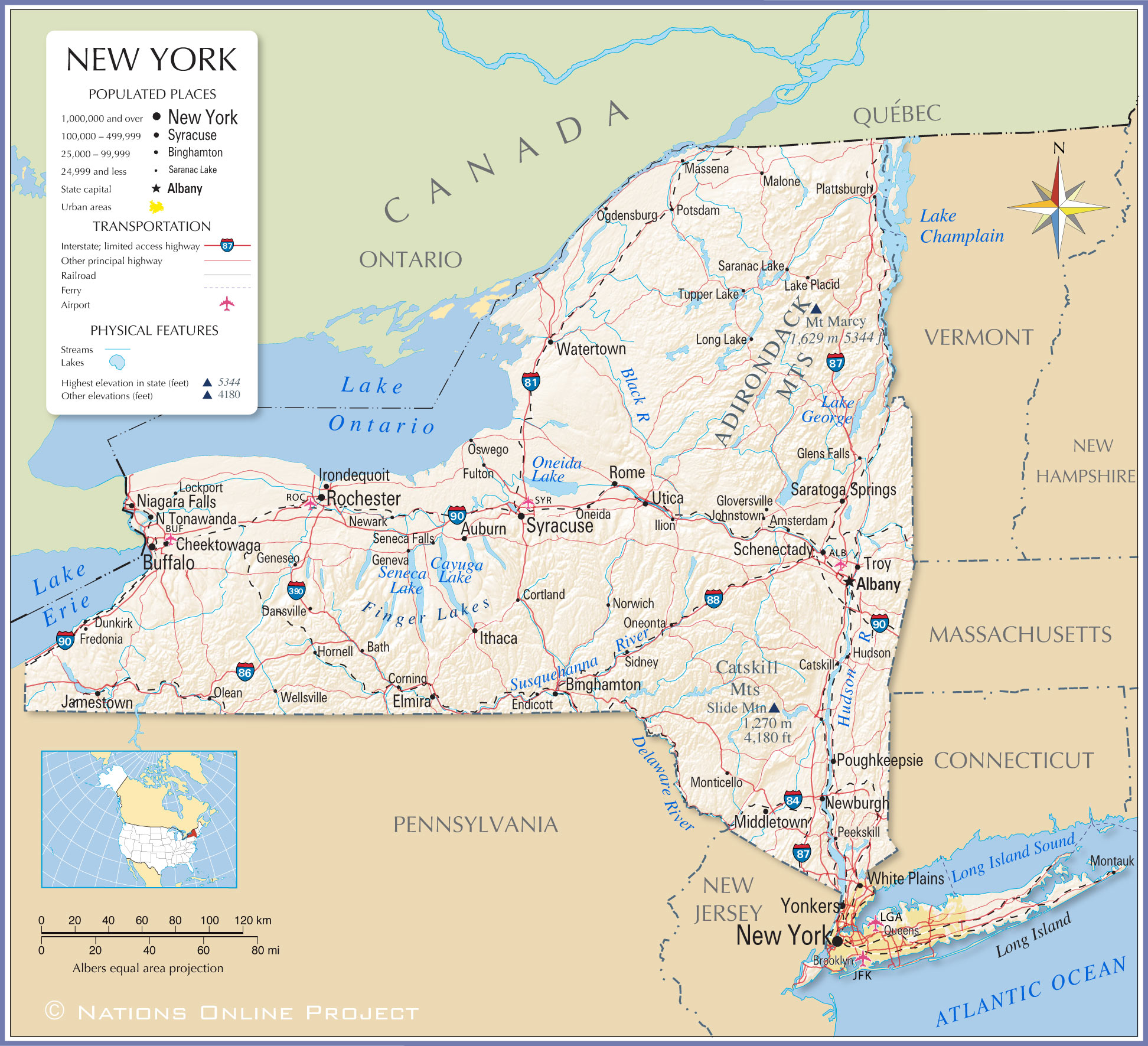
The eastern side of the city presents a different geographical narrative. The boroughs of Queens and Brooklyn are located on the western tip of Long Island. Unlike the western border with New Jersey, the eastern boundary of New York City is entirely contained within the state of New York.
Navigating Long Island
As visitors travel east from the city, they enter Nassau County and eventually Suffolk County. While these areas are technically part of the same state, they are distinct from the city’s jurisdiction. This distinction is important for travelers looking to visit attractions such as Jones Beach State Park or the upscale Hamptons. While not a separate state, the transit shift from the Long Island Rail Road highlights the transition from the city grid to the sprawling suburbs of the island.
The Gateway to Connecticut
Though New York City does not share a direct border with Connecticut, it is geographically proximal enough that the two are deeply integrated. Travelers heading northeast from the city through Westchester County can reach the Connecticut state line within an hour. This proximity makes cities like Stamford and Greenwich accessible hubs for those visiting the region, often served by the same commuter networks that define life in the city.
Strategic Travel Planning Across State Lines
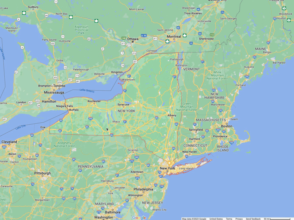
Understanding that New York City is the anchor of a massive tri-state region—comprising New York, New Jersey, and Connecticut—enhances the visitor experience. By recognizing the role of New Jersey as a waterfront partner and New York State as the city’s immediate northern and eastern extension, travelers can better utilize the regional transit infrastructure.
Transit and Accessibility
The Port Authority Bus Terminal serves as a critical junction for those traveling between New York City and neighboring states. Furthermore, the George Washington Bridge provides a monumental link between the Bronx and Fort Lee, New Jersey. Understanding these connections allows for smarter itinerary planning, such as opting for a hotel in Weehawken for lower rates while maintaining direct access to Midtown Manhattan via the NY Waterway ferry.
The Cultural Reach of the Metropolitan Area
The influence of New York City does not stop at the state line. From the culinary influences in New Jersey to the quiet coastal charm of Connecticut, the “Tri-State Area” acts as an expanded ecosystem. Visitors who take the time to explore beyond the Five Boroughs find that the reach of the city’s culture permeates the nearby landscapes. Whether one is visiting the Statue of Liberty in the harbor—which sits in shared waters—or heading to the Hudson Valley for autumn foliage, the geography of the borders is what makes the region so dynamic.
In summary, while New York City remains the focal point, the reality of its borders is defined by a reliance on New York State for land expansion and New Jersey for its maritime connectivity. Navigating these boundaries is not just a lesson in geography; it is a fundamental aspect of experiencing the true scale and energy of the New York metropolitan experience. By viewing the city as the center of a connected web, travelers can leverage the best of what the entire region has to offer, from the urban heights of Empire State Building to the accessible regional getaways found just across the river.
LifeOutOfTheBox is a participant in the Amazon Services LLC Associates Program, an affiliate advertising program designed to provide a means for sites to earn advertising fees by advertising and linking to Amazon.com. Amazon, the Amazon logo, AmazonSupply, and the AmazonSupply logo are trademarks of Amazon.com, Inc. or its affiliates. As an Amazon Associate we earn affiliate commissions from qualifying purchases.