
Understanding California’s Wildfire Landscape
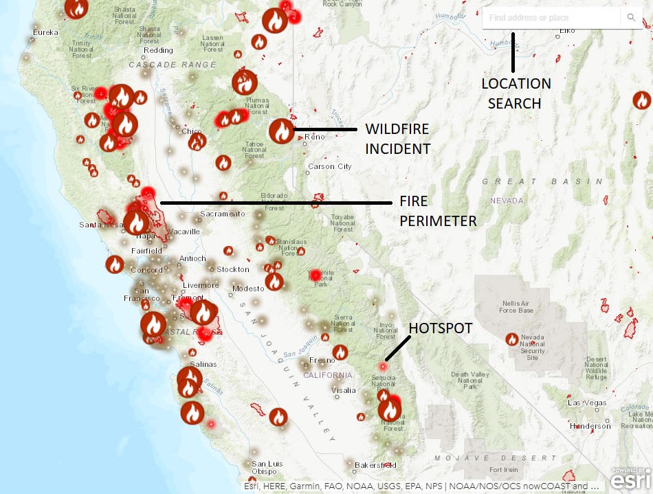
California, a state renowned for its diverse geography and iconic landmarks, is also unfortunately familiar with the destructive power of wildfires. These natural phenomena, exacerbated by climate change and human activity, significantly impact the state’s environment, economy, and the lives of its residents and visitors. For those planning trips to the Golden State, understanding the current wildfire situation is paramount for ensuring safety and making informed travel decisions. While the immediate threat of active fires is a primary concern, the broader context of fire-prone regions, seasonal patterns, and preventative measures offers a more comprehensive picture for travelers.
Historical Context and Contributing Factors
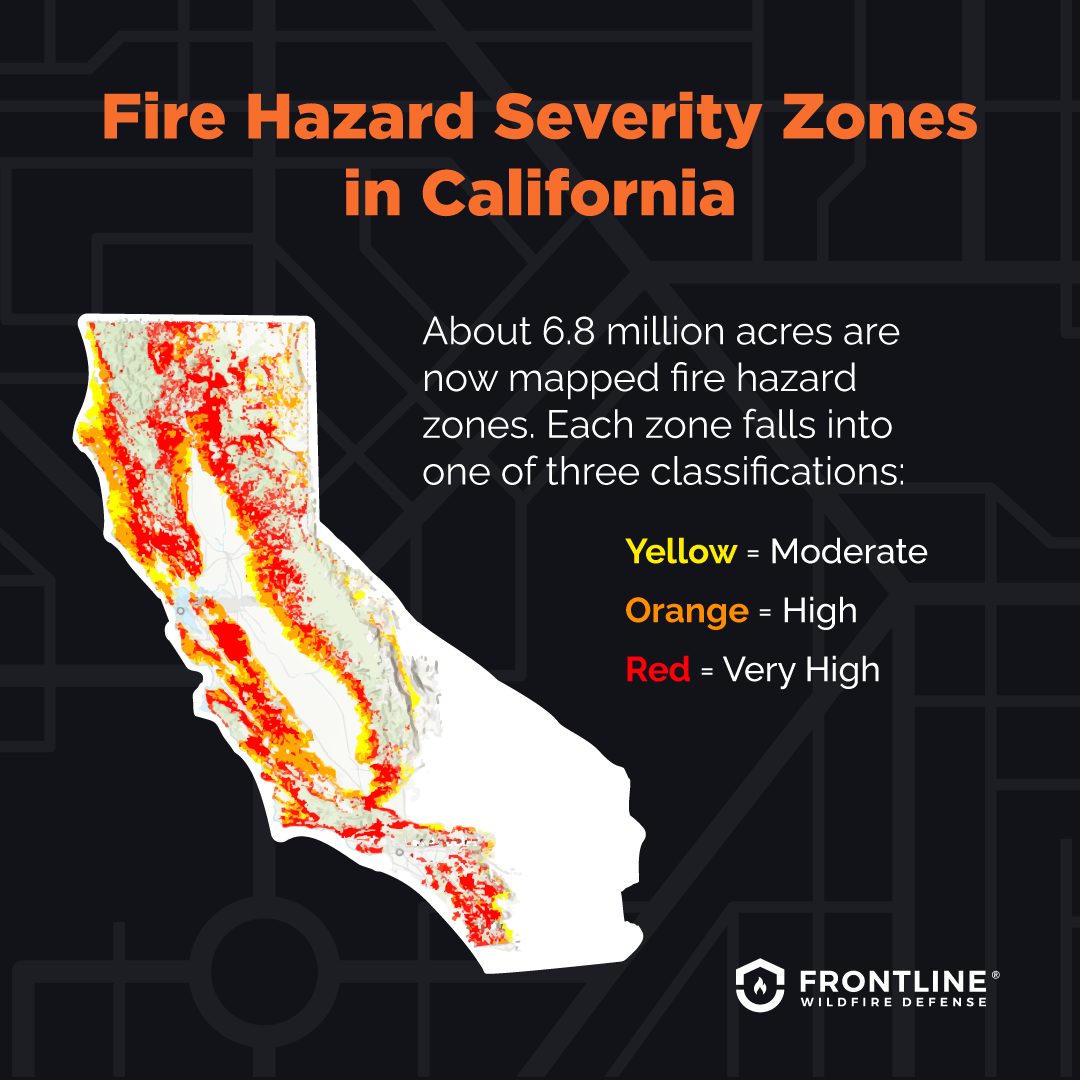
California’s landscape, characterized by vast forests, dry grasslands, and chaparral ecosystems, creates conditions ripe for wildfires. The state experiences a Mediterranean climate with hot, dry summers and mild, wet winters. This natural dryness, particularly in the southern regions, makes vegetation susceptible to ignition. Historically, natural ignitions like lightning strikes have been a part of the ecosystem, with some plant species even relying on fire for regeneration. However, a confluence of factors has amplified the frequency and intensity of wildfires in recent decades.
- Climate Change: Rising global temperatures lead to hotter and drier conditions across California. This results in drier vegetation, extending the wildfire season and making fires burn more intensely and spread more rapidly. Prolonged droughts, a recurring feature of California’s climate, further exacerbate these conditions.
- Vegetation Management: Decades of fire suppression have led to an accumulation of dense undergrowth and dead vegetation in many forests. This “fuel load” acts like kindling, allowing fires to ignite more easily and spread with greater ferocity when they do occur.
- Human Activity: While natural ignitions occur, a significant percentage of wildfires are human-caused, stemming from unattended campfires, faulty electrical equipment, arson, and other accidental ignitions. Urban sprawl into wildland areas, known as the Wildland-Urban Interface (WUI), also increases the risk to communities.
- Topography and Wind: California’s varied topography, with steep canyons and mountain ranges, can influence fire behavior, creating unpredictable wind patterns that can rapidly propel flames. The infamous Santa Ana winds in Southern California and the Diablo winds in Northern California are notorious for their ability to fan wildfires into infernos.
Real-Time Fire Information Resources
Navigating the dynamic nature of wildfires requires access to reliable, up-to-date information. For travelers, knowing where to find this data can be the difference between a safe journey and an interrupted or dangerous experience. Fortunately, several official and reputable sources provide real-time updates on active fires, air quality, and evacuation orders.
Official Government Agencies
The primary sources for wildfire information are the governmental agencies tasked with fire management and public safety. These organizations deploy resources, monitor fire activity, and disseminate critical updates to the public.
- CAL FIRE (California Department of Forestry and Fire Protection): As the leading agency, CAL FIRE maintains an interactive map and incident list detailing active wildfires across the state. Their website provides crucial information on fire size, containment, personnel assigned, and the areas affected. They also issue crucial evacuation orders and warnings.
- U.S. Forest Service (USFS): For fires occurring on federal lands, such as national forests like the Shasta-Trinity National Forest or Sequoia National Forest, the U.S. Forest Service provides incident information. Their websites and local ranger district offices are valuable resources.
- National Interagency Fire Center (NIFC): While not state-specific, the NIFC offers a national overview of significant fires, which can include major incidents in California.
Air Quality Monitoring
Beyond the direct threat of flames, wildfire smoke can travel significant distances, impacting air quality and posing health risks. Travelers should also monitor air quality reports.
- AirNow.gov: This joint effort by the U.S. Environmental Protection Agency (EPA) and other agencies provides real-time air quality data and forecasts across the United States, including California. They use the Air Quality Index (AQI) to communicate the level of air pollution.
- Local Air Districts: Many counties in California have their own air quality management districts that provide localized, detailed information on air quality within their jurisdictions.
Emergency Notification Systems
Subscribing to local emergency alert systems can provide immediate notifications about developing situations, including evacuation orders.
- County Emergency Alerts: Most California counties offer opt-in alert systems. Travelers can often sign up online or through local government websites. Examples include AlertSanDiego or Nixle.
Impact on Travel and Tourism
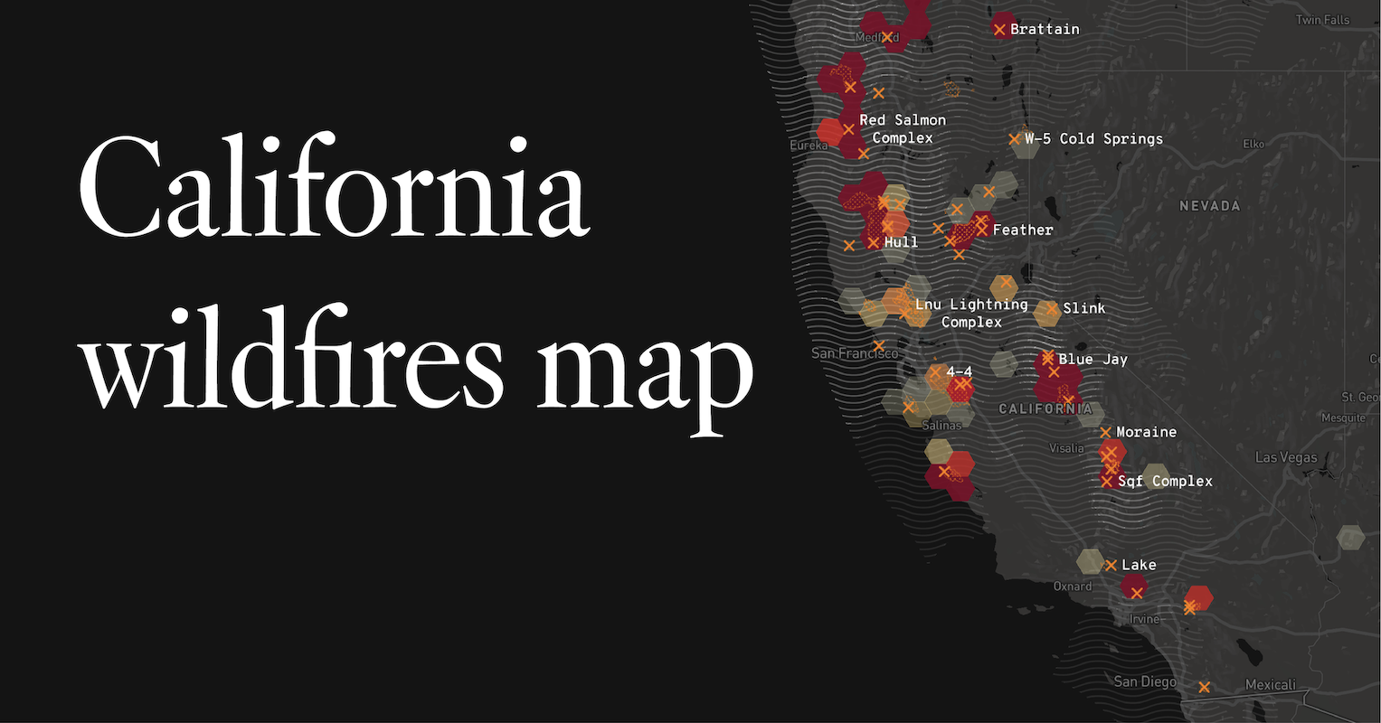
Wildfires have a profound and often disruptive effect on tourism and travel in California. The direct impact can range from road closures and flight cancellations to the complete evacuation of popular tourist destinations. Understanding these potential disruptions is crucial for planning a trip.
Road Closures and Access
Active wildfires can lead to the closure of major highways and secondary roads, significantly altering travel routes. Scenic byways, national park roads, and access routes to popular attractions may become impassable for days or even weeks.
- Caltrans QuickMap: The California Department of Transportation provides a real-time map of traffic conditions, including road closures due to fires, accidents, or construction. This is an essential tool for drivers planning their routes.
- National Park Service Alerts: For travelers planning visits to national parks like Yosemite National Park or Death Valley National Park, checking the National Park Service website for alerts and closures is vital. Many park roads and facilities can be impacted by nearby fires or smoke.
Air Travel Disruptions
Smoke plumes from large wildfires can affect visibility at airports, leading to flight delays and cancellations. This can impact travelers flying into or out of major hubs like Los Angeles International Airport or San Francisco International Airport. Travelers should monitor their airline’s status and airport advisories.
Destination Advisories and Closures
Some tourist areas may be directly threatened by wildfires, leading to mandatory evacuations and temporary closures of hotels, restaurants, and attractions. This can affect popular destinations such as the Napa Valley wine region or coastal towns like Santa Barbara. Always check the official tourism websites or local government announcements for the specific area you plan to visit.
Planning Your Trip Amidst Wildfire Season
California’s wildfire season is not a static period but rather a dynamic threat that can vary in intensity and location throughout the year. While traditionally associated with the drier, hotter months, fires can occur at any time. Proactive planning and flexibility are key to a successful and safe travel experience.
Seasonal Considerations
While peak fire activity is generally observed during the summer and fall months, particularly in Southern California and the Sierra Nevada, it’s important to recognize that fires can and do occur during other times of the year. Early spring rains can lead to abundant vegetation growth, which then dries out and becomes fuel as temperatures rise, increasing the risk of fires even in late spring or early summer. Conversely, dry winters can lead to earlier fire starts.
Pre-Trip Preparation and Safety Tips
- Stay Informed: Before and during your trip, regularly check the resources mentioned above for current fire activity and air quality.
- Flexibility is Key: Be prepared to alter your itinerary. Have backup plans in case your primary destination becomes inaccessible or unsafe due to fire activity or smoke.
- Book Accommodations Wisely: When booking hotels or vacation rentals, consider their proximity to known fire-prone areas. Many lodging establishments in popular tourist destinations, such as hotels in San Diego or Lake Tahoe, are accustomed to advising guests on local conditions.
- Pack Accordingly: If traveling to an area with potential smoke, consider packing N95 or KN95 masks to protect against particulate matter.
- Understand Evacuation Procedures: Familiarize yourself with what evacuation orders and warnings mean. Know your routes out of your accommodation and potential safe havens.
- Respect Fire Restrictions: Adhere strictly to any fire bans or restrictions in place, whether they are in national parks, forests, or local campgrounds.
The Role of Responsible Tourism
Travelers can contribute to wildfire prevention and mitigation by practicing responsible tourism. This includes:
- Properly Disposing of Smoking Materials: Never discard cigarettes carelessly, especially in dry vegetation.
- Safe Campfire Practices: Ensure campfires are completely extinguished before leaving them.
- Vehicle Maintenance: Ensure vehicles are in good working order, as catalytic converters can ignite dry grass.
- Staying on Designated Trails: This helps prevent accidental ignitions and protects fragile ecosystems.
By staying informed, planning with flexibility, and practicing responsible behavior, travelers can navigate the challenges posed by wildfires and continue to enjoy the unparalleled beauty and experiences that California offers. The proactive traveler is a safe traveler, and in the context of California’s wildfire landscape, this approach is more critical than ever.
LifeOutOfTheBox is a participant in the Amazon Services LLC Associates Program, an affiliate advertising program designed to provide a means for sites to earn advertising fees by advertising and linking to Amazon.com. Amazon, the Amazon logo, AmazonSupply, and the AmazonSupply logo are trademarks of Amazon.com, Inc. or its affiliates. As an Amazon Associate we earn affiliate commissions from qualifying purchases.