
Southern California, a region synonymous with sun-drenched beaches, Hollywood glamour, and iconic theme parks, also grapples with a recurring natural phenomenon: wildfires. Understanding the geographic patterns and contributing factors behind these fires is crucial for both residents and visitors planning their travel to this diverse and dynamic landscape. While the specter of fire can cast a shadow, informed preparation and awareness can ensure a safe and enjoyable experience exploring the many wonders of Southern California. This exploration delves into the areas most prone to fires, the environmental conditions that foster them, and how to navigate the region responsibly.

Understanding the Fire-Prone Zones
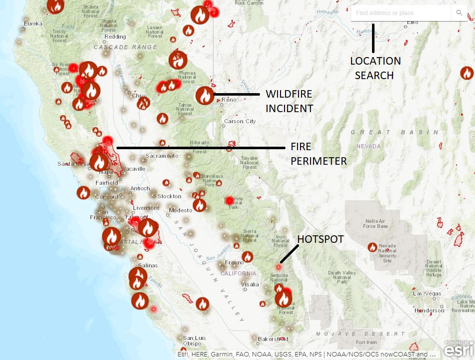
Southern California’s geography plays a significant role in determining where fires are most likely to ignite and spread. The region’s topography, characterized by coastal plains, mountain ranges, and inland valleys, creates a complex interplay of weather patterns and fuel availability.
Coastal Mountain Ranges and Foothills
The Santa Monica Mountains, the San Gabriel Mountains, and the San Bernardino Mountains are particularly vulnerable. These rugged areas are covered in chaparral, a dense, drought-tolerant shrubland that becomes highly flammable during dry periods. The steep terrain can also contribute to rapid fire spread, with flames moving uphill at an accelerated pace. Communities nestled in the foothills and canyons of these ranges often face the highest risk. Cities like Agoura Hills, Malibu, and Pasadena have experienced significant wildfires, underscoring the importance of fire preparedness in these foothill communities.
Inland Valleys and Deserts
While the mountains are a primary concern, inland valleys and desert fringes are also susceptible. Areas bordering the Mojave Desert, such as the Antelope Valley, can experience rapid fire growth when dry grasses and brush ignite. Strong winds, common in these open areas, can quickly spread flames across vast distances. The transition zones between more arid desert landscapes and chaparral-covered hillsides often present a complex fire environment.
Urban Interface Zones
A significant concern in Southern California is the Wildland-Urban Interface (WUI). This is where human development encroaches upon or is adjacent to wildland areas. Many communities in Los Angeles, Orange, Riverside, and San Bernardino counties are situated within these WUI zones. This proximity increases the risk of fires spreading from wildlands into residential areas, as well as the potential for human-caused ignitions within wildland areas. The construction of homes and infrastructure in these areas, coupled with the presence of flammable vegetation, creates a challenging environment for fire management.
Key Factors Fueling Southern California Fires
Several environmental and climatic factors converge to create the conditions ripe for wildfires in Southern California. Understanding these drivers is essential for predicting fire risk and developing effective mitigation strategies.
The Santa Ana Winds
Perhaps the most notorious fire accelerant in Southern California is the Santa Ana winds. These are dry, northeasterly or easterly winds that typically occur during the fall and winter months. They are characterized by their high speed, low humidity, and warm temperatures. The Santa Anas dry out vegetation, making it incredibly susceptible to ignition. When combined with abundant dry fuel, these winds can turn a small spark into a catastrophic inferno within hours, pushing fires with incredible speed and ferocity across the landscape. Regions directly in the path of these winds, including coastal areas and canyons, experience a significant spike in fire danger during these events.
Drought Conditions
Southern California has a Mediterranean climate, with dry summers and wet winters. However, prolonged periods of drought, often exacerbated by climate change, can significantly increase wildfire risk. Years of below-average rainfall lead to a buildup of dead and dry vegetation, which acts as abundant fuel for fires. Even seemingly small amounts of moisture from infrequent rain can promote grass growth, which then dries out and becomes highly flammable once the weather heats up. The extended drought cycles of recent years have made the region more vulnerable than ever to large and destructive fires.
Topography and Vegetation
As mentioned previously, the steep topography of the mountain ranges, combined with the dense chaparral vegetation, creates a highly flammable environment. Chaparral species are adapted to fire, with some even requiring heat to germinate their seeds. While a natural part of the ecosystem, in prolonged dry periods, this vegetation becomes a significant fire hazard. The rapid spread of fire uphill is a well-documented phenomenon, making canyons and slopes particularly dangerous. The presence of invasive grasses in some areas also contributes to a more volatile fire regime, as these grasses dry out faster than native chaparral.
Navigating and Experiencing Southern California Safely
While wildfire is a natural part of the Southern California environment, visitors and residents can take proactive steps to minimize risks and ensure a safe experience. Awareness and preparation are key.
Staying Informed and Prepared
Before and during any visit to Southern California, especially during the fire season (typically late summer through fall), it is crucial to stay informed about current fire conditions. Local news outlets, fire department websites, and emergency alert systems provide real-time updates on active fires, evacuation orders, and air quality advisories. Many state and national parks will issue fire restrictions or closures during high-risk periods. Checking these advisories before embarking on outdoor activities, such as hiking in the Los Padres National Forest or visiting areas like Griffith Observatory, is essential.
Understanding Air Quality
Wildfires can significantly impact air quality, even miles away from the actual fire. Smoke plumes can carry fine particulate matter that is harmful to respiratory health. During periods of significant wildfire activity, it is advisable to limit outdoor strenuous activity, stay indoors with windows and doors closed, and use air purifiers if available. Individuals with pre-existing respiratory conditions, such as asthma or emphysema, should be particularly vigilant and consult with their healthcare providers. Many cities in Southern California, like Los Angeles, often experience hazy skies and reduced visibility due to wildfire smoke.
Responsible Outdoor Practices
For those venturing into wildland areas for recreation, practicing fire safety is paramount. This includes strictly adhering to any fire restrictions, such as campfire bans. Properly extinguishing all campfires and ensuring they are completely cold before leaving is non-negotiable. Disposing of cigarettes in designated receptacles and never throwing them from vehicles is also critical. Using spark arrestors on off-road vehicles and ensuring trailers are equipped with proper safety chains to prevent sparks are important measures for preventing accidental ignitions. Respecting designated trails and avoiding driving or parking on dry grass can also prevent sparks.
The Resilience and Future of Southern California
Despite the challenges posed by wildfires, Southern California continues to be a vibrant and desirable region for travel and residence. The community’s resilience in the face of these natural events, coupled with ongoing efforts in fire management, prevention, and community planning, are vital.
Fire Management and Prevention Strategies
California, and Southern California in particular, is at the forefront of developing innovative fire management strategies. These include prescribed burning to reduce fuel loads in a controlled manner, strategic vegetation thinning, and the development of more fire-resilient building materials and community planning in WUI areas. The California Department of Forestry and Fire Protection (CAL FIRE) and the U.S. Forest Service are instrumental in these efforts, working collaboratively with local fire departments and communities. Advanced fire detection technologies, such as satellite monitoring and aerial reconnaissance, also play a crucial role in early detection and response.

Planning Your Visit with Fire Awareness
For travelers, understanding the potential for wildfires means incorporating flexibility into travel plans. While major tourist destinations like Disneyland Resort or the beaches of San Diego are typically unaffected by direct fire impacts, remote hiking areas or specific canyons might experience closures. Always check for local advisories before heading to more remote natural attractions. The beauty of Southern California, from the iconic landscapes of Joshua Tree National Park to the coastal beauty of Santa Barbara, is best enjoyed with an informed and respectful approach to the natural environment, including its inherent fire risks. By staying informed and prepared, visitors can continue to experience the diverse wonders Southern California has to offer.
LifeOutOfTheBox is a participant in the Amazon Services LLC Associates Program, an affiliate advertising program designed to provide a means for sites to earn advertising fees by advertising and linking to Amazon.com. Amazon, the Amazon logo, AmazonSupply, and the AmazonSupply logo are trademarks of Amazon.com, Inc. or its affiliates. As an Amazon Associate we earn affiliate commissions from qualifying purchases.