
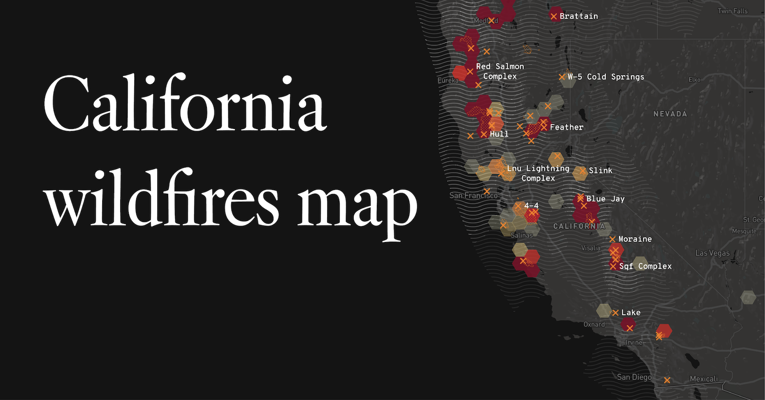
The state of California is no stranger to wildfires. Annually, the dry climate and often strong winds create conditions ripe for ignition, leading to extensive fire seasons. Understanding the current locations of these fires is crucial for residents, travelers, and emergency services alike. This information is dynamic and constantly updated by various agencies. While a real-time map is the most accurate source, this guide will explore the typical regions affected by California wildfires and the factors influencing their spread, providing context for those planning trips or seeking information about affected areas.
Understanding California’s Wildfire Landscape
California’s diverse topography and climate create a complex wildfire environment. Understanding these underlying factors can help predict where fires are more likely to occur and how they might spread.
Geographical Hotspots
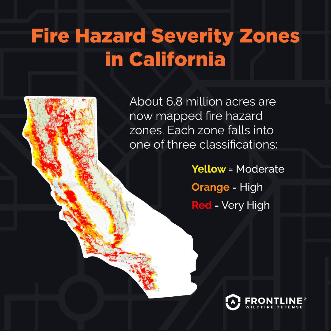
Certain regions within California are historically more prone to wildfires due to a combination of natural vegetation, dry conditions, and historical human activity.
Southern California
The chaparral-covered hills and mountains of Southern California are particularly susceptible. Areas like Los Angeles County, Ventura County, and San Diego County frequently experience large fires. The Santa Ana winds, hot and dry offshore winds that blow during the fall and winter, can rapidly escalate fire behavior, pushing flames towards populated coastal areas and canyons. Cities like Malibu and communities in the Santa Monica Mountains have faced devastating fire events.
Northern California
The vast forests of Northern California are another major fire-prone zone. The Sierra Nevada mountain range, with its extensive pine and fir forests, is a significant area of concern. Wildfires in this region can impact national parks such as Yosemite National Park and Sequoia National Park, as well as timberlands and rural communities. The North Coast region, known for its redwood forests, can also experience fires, though they tend to be slower-moving due to the high moisture content of the redwoods. Counties like Shasta County, Butte County, and Lake County have seen some of the state’s most destructive fires.
Central California
The coastal ranges and inland valleys of Central California also face fire risks. Agricultural areas bordering wildlands can be particularly vulnerable. The transition zones between coastal fog and drier inland temperatures create unique fire dynamics in areas like Monterey County and parts of the Central Valley.
Contributing Factors
Several environmental and climatic factors contribute to the prevalence and intensity of California wildfires.
Drought and Vegetation Dryness
California has experienced prolonged periods of drought in recent decades. This extreme dryness desiccates vegetation, turning grasses, shrubs, and trees into highly flammable fuel. When a fire ignites, it can spread with unprecedented speed and intensity through these tinder-dry conditions.
Wind Patterns
As mentioned, Santa Ana winds in the south and Diablo winds in the north are powerful, dry offshore winds that can fan flames and drive them rapidly. These wind events are often the catalyst for the most catastrophic fires.
Topography
Steep slopes can accelerate fire spread as flames move uphill more quickly. Canyons can channel winds and heat, further intensifying fire behavior. The rugged terrain in many parts of California makes firefighting operations more challenging.
Ignition Sources
Wildfires can be ignited by lightning strikes, particularly during dry thunderstorms, or by human causes. Human causes are far more common and include unattended campfires, sparks from equipment, downed power lines, arson, and discarded cigarettes.
Monitoring and Reporting Fire Locations
The most accurate and up-to-date information on California wildfire locations comes from official sources that continuously monitor and report on fire activity.
Official Fire Agencies
Several state and federal agencies are responsible for fire management and response in California.
CAL FIRE
The California Department of Forestry and Fire Protection (CAL FIRE) is the primary state agency responsible for preventing and fighting wildfires. Their website and social media channels provide real-time incident updates, including maps and statistics on active fires. They often have an online incident information page for major fires.
U.S. Forest Service
The U.S. Forest Service manages vast tracts of national forest land across California, such as the Angeles National Forest, San Bernardino National Forest, and Inyo National Forest. They actively monitor and report fires occurring within these boundaries.
Local Fire Departments and Sheriff’s Offices
Local fire departments and sheriff’s offices play a critical role in initial attack and public notification, especially for fires that start in or threaten populated areas. They often disseminate information through local news outlets and community alert systems.
Online Resources for Fire Information
Beyond agency websites, several online platforms aggregate fire data for public consumption.

Fire Mapping Websites
Websites like GeoMAC Wildland Fire, the National Interagency Fire Center (NIFC) incident map, and various news organizations’ interactive fire maps provide visual representations of active fire perimeters, containment lines, and affected areas. These maps are invaluable for understanding the geographic spread.
Emergency Alert Systems
Many California counties utilize emergency alert systems, such as Nixle or specific county-level systems, to send direct notifications to residents about evacuations, road closures, and significant fire events in their vicinity. Signing up for these alerts is highly recommended for anyone living in or traveling to fire-prone areas.
Social Media
Official agency social media accounts (e.g., Twitter, Facebook) often provide the most immediate updates on significant fire incidents, including evacuation orders and important safety information. Following relevant agencies like CAL FIRE, local fire departments, and emergency management offices is a good practice during fire season.
Impact on Travel and Tourism
Wildfires can have a significant impact on travel plans and tourism in California. Awareness of fire locations is vital for making informed decisions.
Road Closures and Evacuations
Active fires and the resulting firefighting efforts often lead to widespread road closures, particularly on highways and secondary roads that traverse or are adjacent to fire areas. This can cause significant travel delays and force detours. Evacuation orders, which restrict access to certain zones, are implemented to ensure public safety. Travelers should always check current road conditions before embarking on a journey.
Air Quality and Health Concerns
Smoke from wildfires can travel hundreds of miles, severely impacting air quality in areas far from the actual fire. Poor air quality can lead to respiratory problems, eye irritation, and other health issues. This can affect outdoor activities, including hiking, visiting national parks, and even enjoying city life. Travelers may wish to monitor air quality indexes (AQI) for their destinations.
Impact on Attractions and Accommodations
Popular tourist destinations, national parks, and state parks can be closed or have restricted access due to wildfires. This includes iconic locations such as Yosemite National Park or beaches near affected coastal areas. Furthermore, hotels and resorts in or near fire zones may experience cancellations, closures, or be impacted by power outages and evacuation orders. Travelers should verify the operational status of their planned accommodations and attractions.
Planning and Preparedness
Given the unpredictable nature of wildfires, it is essential for travelers to have a flexible plan.
Pre-Trip Research
Before booking or departing for a trip to California, it is prudent to research current fire activity and weather conditions. Websites like CAL FIRE and local news sources are invaluable for this.
Staying Informed During Travel
Once in California, travelers should remain vigilant and stay informed about any developing fire situations. This might involve checking local news, listening to emergency broadcasts, or monitoring official social media channels.
Travel Insurance
Consider travel insurance that covers disruptions due to natural disasters. This can provide financial protection if a trip needs to be canceled or interrupted due to wildfires.
Fire Prevention and Safety
While this article focuses on the location of fires, it’s important to remember that prevention is key to reducing their impact. Awareness of fire safety practices is crucial for both residents and visitors.
Human Causes of Fires
The majority of California wildfires are human-caused. Simple precautions can make a significant difference.
Campfire Safety
If camping, always ensure campfires are fully extinguished and cold to the touch before leaving. Use designated fire rings and follow all fire restrictions.
Equipment Use
Be mindful of equipment that can spark, such as lawnmowers, chainsaws, and off-road vehicles, especially during dry periods. Avoid using these tools during high fire-risk times, and ensure they are in good working order.
Vehicle Maintenance
Ensure vehicles are properly maintained. Dragging chains from trailers can cause sparks. Parking a hot vehicle on dry grass can ignite vegetation.
Reporting Fires
If you see smoke or flames, report it immediately. Call 911 and provide as much detail as possible about the location and size of the fire. Early detection is critical for a swift response.
By staying informed about current fire locations, understanding the factors that contribute to wildfires, and practicing fire prevention, both residents and visitors can navigate California more safely, especially during its challenging fire seasons. Always consult official sources for the most up-to-date information.
LifeOutOfTheBox is a participant in the Amazon Services LLC Associates Program, an affiliate advertising program designed to provide a means for sites to earn advertising fees by advertising and linking to Amazon.com. Amazon, the Amazon logo, AmazonSupply, and the AmazonSupply logo are trademarks of Amazon.com, Inc. or its affiliates. As an Amazon Associate we earn affiliate commissions from qualifying purchases.