
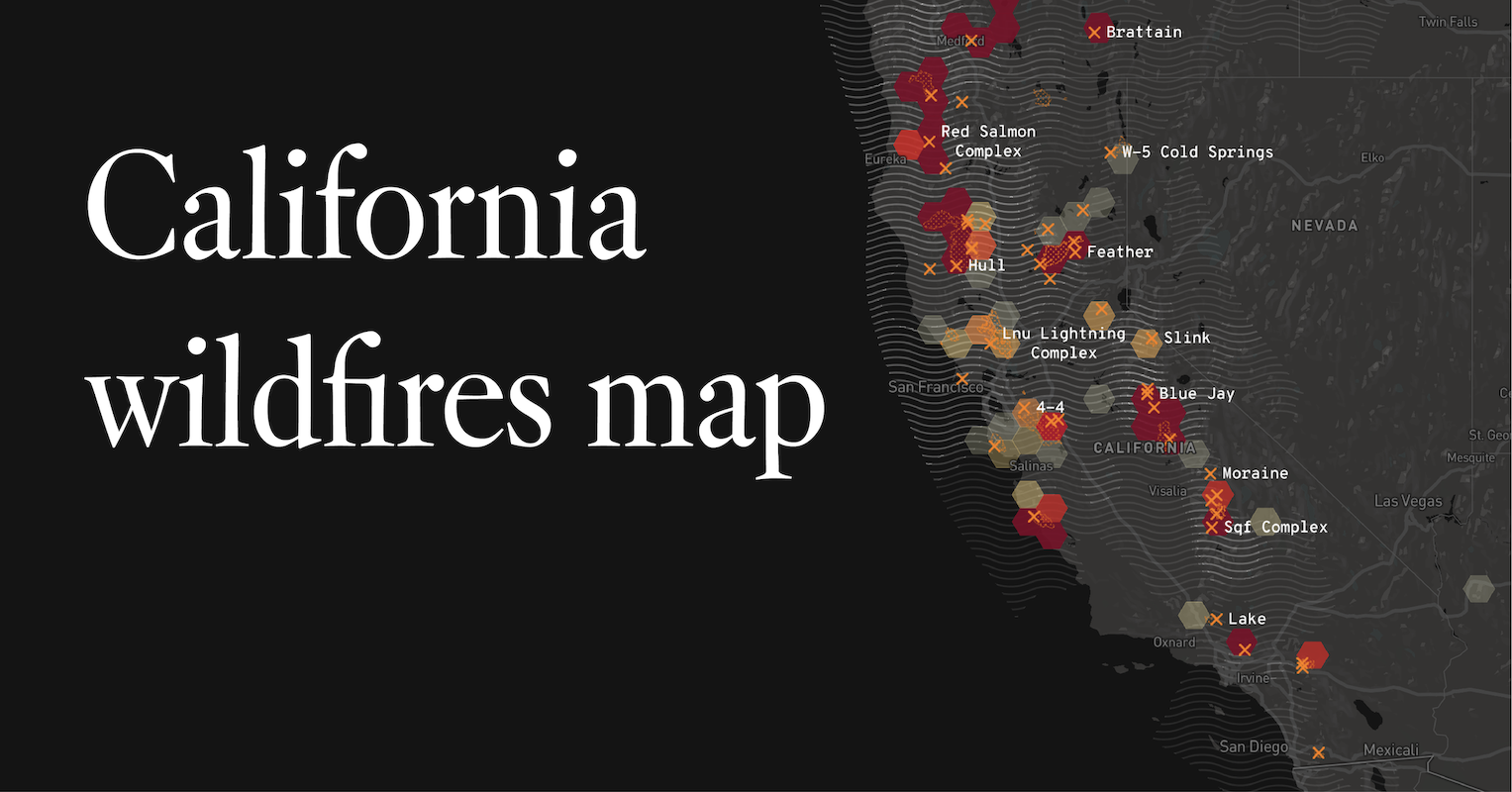
California, a state renowned for its diverse landscapes, from sun-drenched beaches to towering redwood forests and arid desert expanses, is unfortunately also susceptible to wildfires. These natural events, often exacerbated by dry conditions and high winds, can significantly impact travel plans, tourism, and the very allure of its famous landmarks. Understanding the current fire situation is paramount for anyone planning a trip to the Golden State, ensuring safety, and making informed decisions about destinations. This guide aims to provide insight into where fires are occurring in California, with a focus on how these events might affect your exploration of its many attractions.
Understanding California’s Wildfire Landscape
California’s climate and geography create a perfect storm for wildfires. The state experiences a Mediterranean climate characterized by hot, dry summers and mild, wet winters. This seasonal pattern leads to periods of extensive vegetation dryness, particularly during the summer and fall months, making it highly flammable. When combined with strong winds, such as the infamous Santa Ana winds, these dry conditions can rapidly ignite and spread fires across vast areas.
Seasonal Fire Patterns and Contributing Factors
While wildfires can occur at any time of year, the peak fire season in California typically runs from May through October, intensifying in the late summer and early fall. Several factors contribute to the severity and frequency of these fires:
- Drought Conditions: Prolonged periods of low rainfall lead to a buildup of dry fuel (vegetation). Even small ignitions can escalate quickly under these circumstances.
- High Temperatures: Increased temperatures dry out vegetation further, making it more combustible.
- Wind Events: Strong, gusty winds, like the Santa Ana winds in Southern California or the Diablo winds in Northern California, can fan flames and propel them rapidly, creating unpredictable and dangerous fire behavior.
- Human Activity: While lightning can spark wildfires, a significant percentage are caused by human activities, including unattended campfires, discarded cigarettes, equipment malfunctions, and arson.
- Climate Change: Scientific consensus points to climate change as a significant factor, contributing to hotter temperatures, more prolonged droughts, and increased fire intensity across the state.
Identifying Current Fire Information
For travelers, staying informed about active wildfires is crucial. The most reliable sources of information include:
- Cal Fire: The California Department of Forestry and Fire Protection (Cal Fire) is the primary state agency responsible for fire prevention and suppression. Their website provides real-time incident maps, evacuation information, and details on major ongoing fires.
- National Interagency Fire Center (NIFC): NIFC provides national fire information, including data on large wildfires across the United States, which can be filtered by state.
- Local News Outlets: Local television, radio stations, and newspapers are invaluable for up-to-the-minute reporting on fires affecting specific regions, including potential road closures and air quality alerts.
- Emergency Alert Systems: Mobile alert systems, such as Wireless Emergency Alerts (WEA), can provide immediate notifications for evacuation orders in your vicinity.
Impact on Travel and Tourism
Wildfires in California can have a profound and immediate impact on travel and tourism. The very attractions that draw visitors from around the globe can be directly affected, leading to closures, altered experiences, and safety concerns.
Affected Destinations and Attractions
The scale and location of wildfires determine which areas are most impacted. Major tourist destinations and natural landmarks are not immune. For example, fires in proximity to national parks like Yosemite National Park or Joshua Tree National Park can lead to temporary closures of roads, trails, and campgrounds, significantly disrupting visitor access. Coastal regions, wine country areas such as Napa Valley and Sonoma County, and densely populated urban areas can also experience disruptions.
- National and State Parks: Access to iconic natural wonders can be restricted or impossible during active fire events. This includes popular hiking trails, scenic drives, and visitor centers.
- Coastal Communities: Fires near the coast can lead to smoke-filled skies, impacting beach experiences and outdoor dining.
- Mountain Regions: Areas like the Sierra Nevada are particularly vulnerable, and fires can impact ski resorts and summer recreation areas.
- Urban Centers: While less common for large-scale destruction in densely populated areas, smoke from distant fires can drastically reduce air quality in cities like Los Angeles and San Francisco, affecting outdoor activities and visibility.
Planning Your Itinerary with Fire Season in Mind
When planning a trip to California, especially during the peak fire season, flexibility and preparedness are key.
- Monitor Fire Conditions: Before and during your trip, regularly check Cal Fire and other reliable sources for any active fires in your intended travel areas.
- Have Backup Plans: Identify alternative destinations or activities in case your primary plans are affected by fire-related closures or poor air quality.
- Consider Air Quality: Wildfires produce smoke that can travel long distances, leading to unhealthy air quality. Check air quality indexes (AQI) for your destination and consider indoor activities if air quality is poor.
- Book Flexible Accommodations: Opt for hotels or vacation rentals with flexible cancellation policies, allowing you to adjust your plans if necessary.
- Stay Informed About Road Closures: Fires can necessitate the closure of major highways and local roads, impacting travel times and accessibility.
Specific Regions and Their Fire Vulnerability

California’s vastness means that fire risk varies significantly by region. Understanding these regional differences can help travelers make more informed decisions.
Northern California’s Diverse Landscapes
Northern California, encompassing everything from the dramatic coastline to the fertile agricultural valleys and the dense forests of the Shasta-Trinity National Forest, faces unique wildfire challenges. The region is known for its towering redwoods, vast wilderness areas, and agricultural heartland.
- Forestry and Wilderness Areas: Large tracts of forest land, particularly in mountainous and remote areas, are highly susceptible. Fires here can be challenging to contain due to difficult terrain and dense vegetation.
- Wine Country: Areas like Sonoma County and Napa Valley, with their rolling hills covered in vineyards and dry grasses, can be prone to fires, especially during dry, windy conditions. These events can threaten agricultural operations and tourist infrastructure.
- Coastal Ranges: The dry chaparral and brush found in the coastal mountain ranges can ignite and spread rapidly towards communities.
Central California’s Mountainous and Agricultural Zones
Central California presents a mix of mountain ranges, fertile valleys, and a long coastline. The region includes iconic natural landmarks and agricultural powerhouses.
- Sierra Nevada Foothills: The western slopes of the Sierra Nevada, transitioning from mountain forests to chaparral and oak woodlands, are a significant fire-prone zone. This includes areas surrounding popular destinations.
- Central Valley Fringe: The drier, rolling hills that fringe the Central Valley can experience fires that impact agricultural lands and rural communities.
- Big Sur Coastline: The rugged and often dry vegetation along the Big Sur coastline is susceptible to fires, which can lead to road closures on iconic Highway 1 and impact coastal towns.
Southern California’s Arid and Urban-Interface Areas
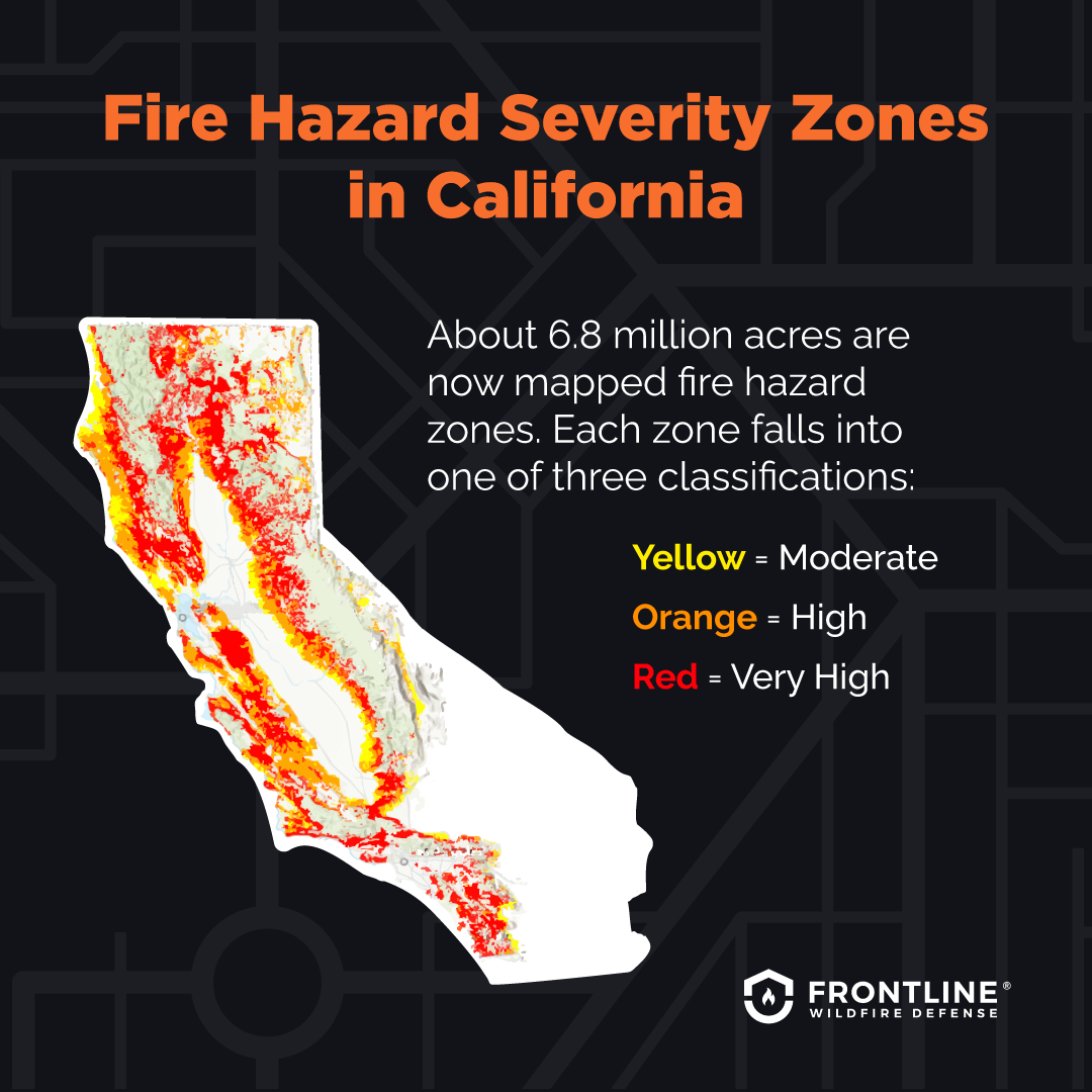
Southern California, with its arid climate and extensive urban-wildland interface, faces some of the most challenging fire conditions in the state. The region is characterized by chaparral, coastal sage scrub, and mountainous terrain that often presses close to densely populated areas.
- Mountain Ranges: Ranges like the San Gabriel Mountains and San Bernardino Mountains are highly susceptible. Fires here can threaten communities built within or adjacent to these wildlands.
- Inland Empire: Areas in the Inland Empire, known for their dry chaparral and proximity to populated centers, frequently experience significant wildfires.
- Coastal Scrublands: The dry, brush-covered hillsides along the Southern California coast can become tinderboxes during hot, windy conditions.
- Santa Ana Winds: This unique wind phenomenon, typically occurring in the fall and winter, can rapidly spread fires across Southern California, making containment extremely difficult and posing a significant threat to life and property. This can impact travel to and from major cities like Los Angeles and San Diego.
Safety and Preparedness for Travelers
Ensuring your safety and minimizing disruption when traveling in California, particularly during fire season, requires a proactive approach to preparedness.
Evacuation Procedures and Air Quality Awareness
In the unfortunate event of a wildfire impacting your travel plans, understanding evacuation procedures and air quality is paramount.
- Follow Official Instructions: If an evacuation order is issued for your area, comply immediately with all instructions from emergency personnel. This may involve specific routes to take.
- Know Your Evacuation Route: Familiarize yourself with primary and secondary evacuation routes for your location.
- Air Quality Index (AQI): Pay close attention to the AQI. Smoke from wildfires can cause respiratory problems and other health issues. If the AQI is unhealthy, it is advisable to stay indoors, close windows and doors, and use air purifiers if available.
- Protective Gear: If you must be outdoors in smoky conditions, consider wearing an N95 respirator mask to filter out fine particulate matter.
Emergency Contact Information and Resources
Having essential emergency contact information readily available can be a lifeline during a wildfire event.
- Cal Fire Website: For real-time incident maps and updates.
- Local Emergency Services: Know the non-emergency number for the local fire department or sheriff’s office for general inquiries. In an emergency, always dial 911.
- Red Cross: The American Red Cross provides shelter and assistance to those displaced by disasters.
- Your Accommodation Provider: Have the contact information for your hotel or rental agency. They may have important updates or be able to assist with accommodations if you are displaced.
By staying informed, being prepared, and remaining adaptable, travelers can still experience the wonders of California while navigating the challenges posed by its natural environment. The state’s resilience, coupled with informed visitor awareness, ensures that the allure of its destinations can endure, even in the face of wildfire season.
LifeOutOfTheBox is a participant in the Amazon Services LLC Associates Program, an affiliate advertising program designed to provide a means for sites to earn advertising fees by advertising and linking to Amazon.com. Amazon, the Amazon logo, AmazonSupply, and the AmazonSupply logo are trademarks of Amazon.com, Inc. or its affiliates. As an Amazon Associate we earn affiliate commissions from qualifying purchases.