
Understanding Colorado’s Air Quality Landscape for Travelers
Colorado, renowned for its breathtaking Rocky Mountain vistas and vibrant outdoor culture, occasionally experiences periods where the very air that defines its allure becomes hazy with smoke. For travelers planning a trip to the Centennial State, understanding the origins and implications of this smoke is paramount for an enjoyable and safe journey. Smoke plumes, often visible from great distances, can significantly alter the travel experience, impacting everything from scenic views to outdoor activity participation. The question, “Where is the smoke coming from?”, is a common and critical one for visitors.
The Dynamic Nature of Smoke in the Centennial State
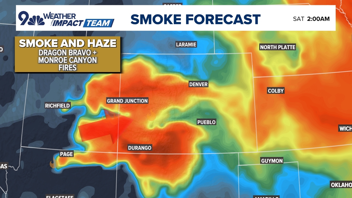
Smoke in Colorado is rarely a static phenomenon. Its presence and intensity can change dramatically within hours, influenced by wind patterns, fire activity, and atmospheric conditions. What might appear as clear skies in Denver in the morning could turn hazy by afternoon if winds shift, carrying smoke from a distant fire. Conversely, a heavily impacted area might clear quickly with a favorable change in weather. This dynamic environment necessitates that travelers remain vigilant and flexible with their itineraries. Monitoring current conditions, rather than relying solely on past reports, is key to navigating travel during smoky periods. The state’s varied topography, from the eastern plains to the towering peaks of the Continental Divide, also plays a role in how smoke settles and disperses, with inversions sometimes trapping smoke in valleys.
Primary Sources: Wildfires vs. Prescribed Burns
The primary culprits behind widespread smoke in Colorado are typically large wildfires, which can originate both within the state’s borders and from neighboring states, particularly Wyoming, Utah, or even California. Wildfires, often sparked by lightning or human activity, can burn for weeks or months, releasing vast quantities of smoke into the atmosphere. The direction and intensity of these fires dictate where the smoke travels. Beyond uncontrolled wildfires, another significant source of smoke comes from prescribed burns. These are intentionally set fires managed by land agencies (like the U.S. Forest Service or Bureau of Land Management) to reduce fuel loads, restore ecosystems, and prevent larger, more destructive wildfires. While essential for long-term forest health, prescribed burns can still produce substantial smoke that impacts air quality locally and downwind. Travelers should be aware of these planned events, as they are often announced in advance.
Navigating the Impacts: What Travelers Need to Know
For travelers, smoke isn’t just a visual nuisance; it can have tangible effects on health, activity choices, and the overall quality of their experience. Being informed allows for better preparation and adjustment.
Health Considerations and Air Quality Index (AQI)
The most critical impact of smoke is on air quality. Wildfire smoke contains fine particulate matter (PM2.5), which can penetrate deep into the lungs and cause various health issues, especially for sensitive groups. Travelers with pre-existing respiratory conditions like asthma or heart disease, as well as children and the elderly, are particularly vulnerable. The Air Quality Index (AQI) is an invaluable tool, providing a color-coded scale to indicate air cleanliness. A green AQI (0-50) is good, yellow (51-100) is moderate, orange (101-150) is unhealthy for sensitive groups, red (151-200) is unhealthy for everyone, purple (201-300) is very unhealthy, and maroon (301-500) is hazardous. Travelers should check the AQI for their planned destinations frequently and adjust outdoor activities accordingly. Wearing N95 masks can offer some protection against particulate matter if outdoor exposure is unavoidable in smoky conditions.
Visibility and Scenic Drives
One of Colorado’s primary draws is its stunning natural beauty and expansive vistas. Smoke can significantly impair visibility, turning what should be panoramic mountain views into hazy silhouettes. Iconic drives like the Peak to Peak Scenic Byway, Trail Ridge Road in Rocky Mountain National Park, or the route through Glenwood Canyon can lose their luster when obscured by smoke. Photographers, in particular, may find their opportunities limited. It’s important for travelers to manage expectations regarding views during smoky periods and consider alternative activities or destinations that might be less affected.
Outdoor Activities: Hiking, Biking, and Beyond
Colorado is an outdoor enthusiast’s paradise, with countless opportunities for hiking, mountain biking, climbing, and water sports. Smoke can severely impact these activities. Beyond reduced visibility, strenuous physical activity in smoky air can exacerbate respiratory issues. Many state and national parks, including sections of Rocky Mountain National Park or areas around Pikes Peak, may issue warnings or even close trails and campgrounds if smoke levels become hazardous or if fire danger is extreme. Before embarking on any outdoor adventure, check park websites, local advisories, and the AQI. Consider shifting to indoor alternatives or exploring areas with demonstrably clearer air.
Essential Resources for Real-Time Travel Planning
Staying informed is your best defense against smoke-related travel disruptions. Several reputable sources provide up-to-the-minute information.
Official State and Federal Fire Tracking Maps
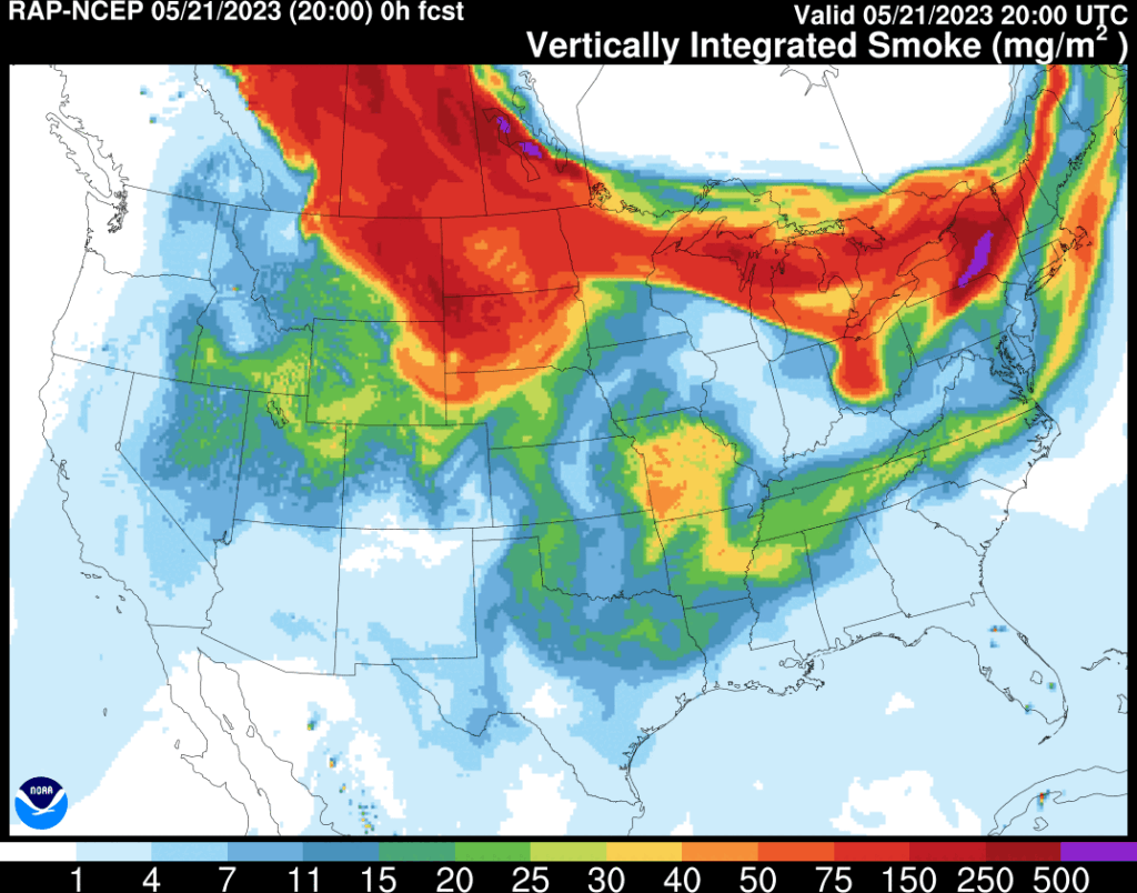
For comprehensive information on active wildfires and prescribed burns, travelers should consult official mapping tools. The Colorado Fire Tracker often provides a centralized resource for incidents within the state, detailing fire perimeters, containment levels, and evacuation orders. Federal resources, such as the National Interagency Fire Center (NIFC) or a more localized Colorado Fire Information site, can offer broader perspectives, including fires in neighboring states that might be contributing to Colorado’s smoke. These maps are dynamic and are updated regularly by emergency services and fire management teams.
Air Quality Forecasts and Alerts
Monitoring air quality is crucial. The Colorado Department of Public Health and Environment (CDPHE) operates a network of Air Quality Monitoring Sites and provides daily forecasts and alerts. Websites and apps dedicated to air quality, such as those that display the AQI for specific zip codes or cities like Colorado Springs, Boulder, or Aspen, are invaluable. These resources often provide not only current conditions but also 24-48 hour forecasts, helping travelers anticipate changes. Many weather apps also integrate AQI data, making it easily accessible.
Local Tourism Boards and Park Services
For hyper-local information, turn to the tourism boards of specific towns or regions you plan to visit, such as Visit Denver, Telluride Tourism Board, or Visit Estes Park. These organizations often provide updates on local conditions, road closures, and alternative activities. Similarly, the official websites for national parks like Rocky Mountain National Park or state parks like Golden Gate Canyon State Park will have specific alerts regarding smoke, trail closures, and visitor safety. Their information is often the most current and relevant for on-the-ground travel.
Adapting Your Colorado Itinerary Amidst Smoky Skies
Flexibility is a traveler’s best friend when facing environmental variables like smoke. Having contingency plans can save a trip from disappointment.
Embracing Indoor Attractions
When outdoor activities are curtailed by smoke, Colorado still offers a wealth of indoor attractions. Major cities boast world-class museums, like the Denver Art Museum or the Denver Museum of Nature & Science. Shopping districts, local breweries, distilleries, and art galleries provide excellent ways to experience local culture without outdoor exposure. Consider exploring historical sites or architectural tours in places like Georgetown or Leadville. Many ski resorts also offer indoor activities or attractions that are less smoke-dependent during the off-season.
Exploring Lower-Risk Regions or Higher Elevations
Sometimes, smoke patterns are localized, meaning one region of Colorado might be clear while another is hazy. For instance, the western slope or southern Colorado might be clear when the Front Range is smoky, or vice versa. Researching air quality across the state can reveal pockets of clearer skies. Additionally, higher elevations can sometimes be above inversion layers that trap smoke in valleys, offering a temporary reprieve, though this is not consistently reliable. Checking real-time webcams can also provide visual confirmation of conditions in different areas.
Flexibility and Contingency Planning
The most crucial advice for traveling during fire season in Colorado is to build flexibility into your plans. Opt for refundable bookings for accommodations and activities whenever possible. Have a list of alternative indoor activities or alternative destinations ready. Consider purchasing travel insurance that covers smoke-related disruptions, though review policies carefully to understand their scope. Embracing the unexpected and being willing to shift plans can transform a potentially disappointing smoky day into an opportunity to discover something new and unique.
A Proactive Approach to Colorado Travel
Even outside of immediate concerns, thinking ahead can enhance your Colorado travel experience.
Best Times to Visit for Clear Skies
While wildfires can occur at any time, Colorado’s primary fire season typically runs from late spring through late fall, peaking in summer and early autumn when conditions are driest and temperatures are highest. Travelers seeking the absolute clearest skies might consider visiting in late spring (May-early June) or early fall (late September-October), though even these periods are not immune. Winter brings snow, which significantly reduces fire risk, making it an excellent time for winter sports and clear, crisp air, especially in ski towns like Vail or Breckenridge.

Staying Informed Beyond Your Trip
Even after booking, continue to monitor news and weather reports related to Colorado’s fire season. Subscribing to email alerts from air quality agencies or following local news outlets on social media can keep you informed without constant active searching. Proactive monitoring ensures that you are prepared to adjust your plans well in advance, minimizing stress and maximizing your chances of a fantastic Colorado adventure, smoky skies or not.
LifeOutOfTheBox is a participant in the Amazon Services LLC Associates Program, an affiliate advertising program designed to provide a means for sites to earn advertising fees by advertising and linking to Amazon.com. Amazon, the Amazon logo, AmazonSupply, and the AmazonSupply logo are trademarks of Amazon.com, Inc. or its affiliates. As an Amazon Associate we earn affiliate commissions from qualifying purchases.