
The question “Where Were The California Fires?” often arises, particularly for those planning travel to the Golden State or seeking to understand the complex landscape of its natural environment. While the term “California Fires” might evoke a singular, overarching image of devastation, the reality is far more nuanced. California’s vastness, diverse ecosystems, and varied weather patterns mean that fire activity is not uniform across the state. Understanding the historical and geographical distribution of these fires is crucial for responsible tourism, informed planning, and appreciating the state’s dynamic natural beauty. This exploration delves into the regions most historically affected, the factors contributing to their vulnerability, and how travelers can stay informed.
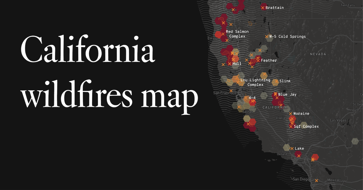
Understanding California’s Fire Landscape
California is a state defined by dramatic geographical contrasts, from the coastal ranges to the Sierra Nevada mountains, and from arid deserts to lush forests. These varied environments create distinct fire regimes, influenced by factors such as vegetation type, fuel load, topography, and climate. Historically, certain regions have experienced more frequent or intense wildfire activity due to a confluence of these elements.
Fuel Types and Fire Behavior
The type of vegetation present significantly dictates how fires behave. Densely forested areas, like those found in Northern California‘s redwood and mixed conifer forests, can support larger, more intense crown fires. In contrast, chaparral ecosystems, prevalent in Southern California‘s coastal mountains and foothills, are characterized by highly flammable, drought-tolerant shrubs that ignite quickly and burn intensely, often with rapid spread. Grasslands and agricultural areas, particularly during dry seasons, can also become highly susceptible to fast-moving surface fires.
Climate and Weather Patterns
California’s climate, with its Mediterranean pattern of hot, dry summers and mild, wet winters, creates a natural fire season. However, this season has been intensifying and lengthening due to climate change, leading to hotter temperatures, prolonged droughts, and drier fuels. Prevailing winds, such as the infamous Santa Ana winds in Southern California and the Diablo winds in Northern California, can dramatically accelerate fire spread, turning small ignitions into major conflagrations. These wind events are often associated with specific geographical corridors and canyons.
Topography and Fire Spread
Steep slopes can significantly influence fire behavior. Fires tend to spread uphill much faster than downhill because the flames preheat the fuel above them, increasing the rate of combustion. Mountainous regions, therefore, often present greater challenges for fire suppression. Canyons and ravines can also channel winds and funnel flames, exacerbating fire intensity and spread.
Historically Fire-Prone Regions
While wildfires can occur anywhere in California, several regions have consistently experienced higher frequencies and intensities of fire activity over the decades. Recognizing these areas helps in understanding the context of “California Fires.”
Southern California’s Coastal Mountains and Foothills
The mountainous areas surrounding Los Angeles, San Diego, and other major Southern California cities are particularly prone to wildfires. These regions are dominated by chaparral, a dense, shrubby vegetation that becomes highly flammable after long dry periods. The combination of flammable fuels, steep terrain, and the seasonal Santa Ana winds creates a perfect storm for rapid fire growth. Iconic areas like the Santa Monica Mountains National Recreation Area and the foothills of the San Gabriel Mountains have seen numerous significant fires. These fires can threaten densely populated communities, leading to widespread evacuations and considerable property damage. The proximity of these wildland-urban interfaces means that fires here often have a direct and immediate impact on human populations.
Northern California’s Forests and Wildlands
Northern California, with its extensive forests and wildland areas, is another region with a long history of wildfire activity. The Sierra Nevada mountain range, a vast expanse of coniferous forests, is particularly susceptible. These forests can accumulate significant fuel loads over time, especially when natural fire cycles are suppressed. When ignition occurs, these fuels can support intense, fast-moving fires that can impact national parks like Yosemite National Park and Sequoia National Park, as well as vast timberlands. Areas in counties like Shasta, Butte, and Plumas have experienced some of the state’s most destructive fires. The natural beauty of these regions, including popular destinations like Lake Tahoe, can be significantly impacted by wildfire events, often leading to temporary closures and altered visitor experiences.
The Central Coast and Inland Valleys

The Central Coast of California, with its rolling hills and chaparral interspersed with grasslands, also experiences regular wildfire activity. Areas around Santa Barbara and Monterey are susceptible. Inland valleys, especially when experiencing drought conditions, can see rapid spread of wildfires through dry grasslands and agricultural stubble. These fires, while sometimes less publicized than those in major mountain ranges, can still pose significant threats to communities and agricultural operations.
Factors Influencing Recent Fire Trends
While historical patterns provide context, understanding current and recent fire trends requires acknowledging the impact of climate change and human activity.
The Role of Climate Change
Scientists widely agree that climate change is exacerbating California’s wildfire problem. Prolonged droughts, record-breaking heatwaves, and earlier snowmelt are creating drier vegetation and extending the fire season. This means that fires are occurring more frequently, burning larger areas, and often with greater intensity than in previous decades. The conditions that previously made certain areas prone to fires are now amplified, leading to unprecedented fire events.
Human Causes and Prevention
A significant percentage of wildfires in California are caused by human activity, ranging from unattended campfires and discarded cigarettes to equipment malfunctions and arson. Understanding these causes is vital for prevention. Public awareness campaigns and strict regulations on activities during high-risk periods are crucial. However, natural ignitions from lightning strikes also play a role, particularly in remote wilderness areas.
Traveling Safely and Responsibly in Fire-Prone Areas
For travelers planning a visit to California, understanding the fire landscape is not just about geographical knowledge but also about safety and responsible tourism.
Staying Informed About Current Conditions
Before and during your trip, it is essential to check current fire conditions. Resources like the California Department of Forestry and Fire Protection (CAL FIRE) website, local news outlets, and official park service alerts are invaluable. These resources provide real-time information on active fires, evacuation orders, and air quality advisories. Many national and state parks will post closure information directly on their websites.
Air Quality Awareness
Wildfires produce significant smoke, which can travel hundreds of miles. Poor air quality can impact outdoor activities and pose health risks. Travelers should monitor the AirNow.gov website or similar air quality indexes for their intended destination. If air quality is poor, it’s advisable to limit outdoor exertion, wear an N95 mask if necessary, and consider indoor activities.
Planning for Potential Disruptions
Wildfires can cause road closures, power outages, and disruptions to services, impacting travel plans. It’s wise to have flexible itineraries and backup plans. If your travel plans involve areas known for fire activity, consider purchasing travel insurance that covers such events. Always heed evacuation orders immediately; they are issued for your safety.

Supporting Fire Recovery and Prevention Efforts
After a fire, many communities face long-term recovery challenges. Travelers can support these areas by visiting responsibly, patronizing local businesses, and contributing to reputable fire relief and prevention organizations. Understanding the delicate balance of California’s ecosystems also encourages a mindful approach to outdoor recreation, minimizing human-caused ignitions and respecting fire restrictions.
By understanding “Where Were The California Fires?”—acknowledging the specific regions, the contributing factors, and the ongoing trends—travelers can better navigate the state’s stunning landscapes, appreciate its resilience, and contribute to its long-term well-being. The beauty of California lies in its diverse environments, and a well-informed traveler is one who respects and protects these precious natural resources.
LifeOutOfTheBox is a participant in the Amazon Services LLC Associates Program, an affiliate advertising program designed to provide a means for sites to earn advertising fees by advertising and linking to Amazon.com. Amazon, the Amazon logo, AmazonSupply, and the AmazonSupply logo are trademarks of Amazon.com, Inc. or its affiliates. As an Amazon Associate we earn affiliate commissions from qualifying purchases.