
The question “Who found the Mississippi River?” seems straightforward at first glance, yet its answer is anything but simple. Like many foundational questions about North America’s natural landmarks, the narrative of discovery is deeply intertwined with differing perspectives, centuries of habitation, and the arrival of European explorers. To truly address this query, we must look beyond a single moment or individual, recognizing the river as an enduring presence that has shaped civilizations long before any European “discovered” it.
The Mississippi River is not merely a body of water; it is a colossal force of nature, an immense drainage basin that touches 31 U.S. states and two Canadian provinces. Stretching approximately 2,340 miles from its source at Lake Itasca in Minnesota to its delta in the Gulf of Mexico, it is the second-longest river in the United States and the fourth-longest in the world. Its sheer scale and the intricate network of tributaries it commands – including the Missouri River and Ohio River – have made it a vital artery for transportation, trade, and cultural development for millennia. Understanding who “found” this majestic waterway requires an appreciation of its profound historical and ecological significance as a pivotal landmark.
The River’s Ancient Inhabitants and Indigenous Knowledge
Long before European ships ever neared the shores of North America, the Mississippi River was a vibrant center of life for countless indigenous communities. For these peoples, the river was not something to be “found,” but rather an integral part of their existence, their cosmology, and their very identity. Their relationship with the river was one of deep knowledge, respect, and interdependence, far removed from the concept of colonial discovery.
A Lifeline for Millennia
Archaeological evidence indicates that human habitation along the Mississippi River dates back at least 12,000 years. Early nomadic groups followed the river’s bountiful resources, and over time, more complex societies emerged. The river provided abundant food resources, fertile agricultural lands, and a natural highway for trade and communication. Its annual floods, though sometimes destructive, also replenished the soil, creating rich floodplains perfect for cultivating crops like maize, beans, and squash.
These indigenous societies developed sophisticated systems for managing their environment, including understanding the river’s intricate cycles. They knew its currents, its depths, its seasonal changes, and its myriad resources. They built permanent settlements, intricate earthworks, and expansive trade networks that spanned vast distances, all facilitated by the river. The concept of “finding” the river would have been utterly alien to them; it was simply there, an immutable part of their world.
Pre-Columbian Societies and Their Deep Connection
Some of the most prominent pre-Columbian cultures that flourished along the Mississippi River include the Adena, Hopewell, and Mississippian cultures. The Mississippian culture, in particular, reached its zenith between 800 and 1600 CE, establishing complex chiefdoms and impressive urban centers. Cahokia, near modern-day St. Louis, Illinois, was the largest pre-Columbian city north of Mexico, a thriving metropolis of tens of thousands that relied entirely on the river for its sustenance and trade.
These societies built colossal earthen mounds, many of which are still visible today, reflecting their intricate social structures and spiritual beliefs. Their pottery, tools, and artistic expressions often depicted riverine life, underscoring their profound connection to the water. The indigenous peoples residing along the Mississippi (state) and its tributaries were the true discoverers and stewards of this landmark, developing a wealth of knowledge about its geography, ecology, and potential that far surpassed anything early European explorers would glean in their initial encounters.
Early European Encounters: The Spanish Quest
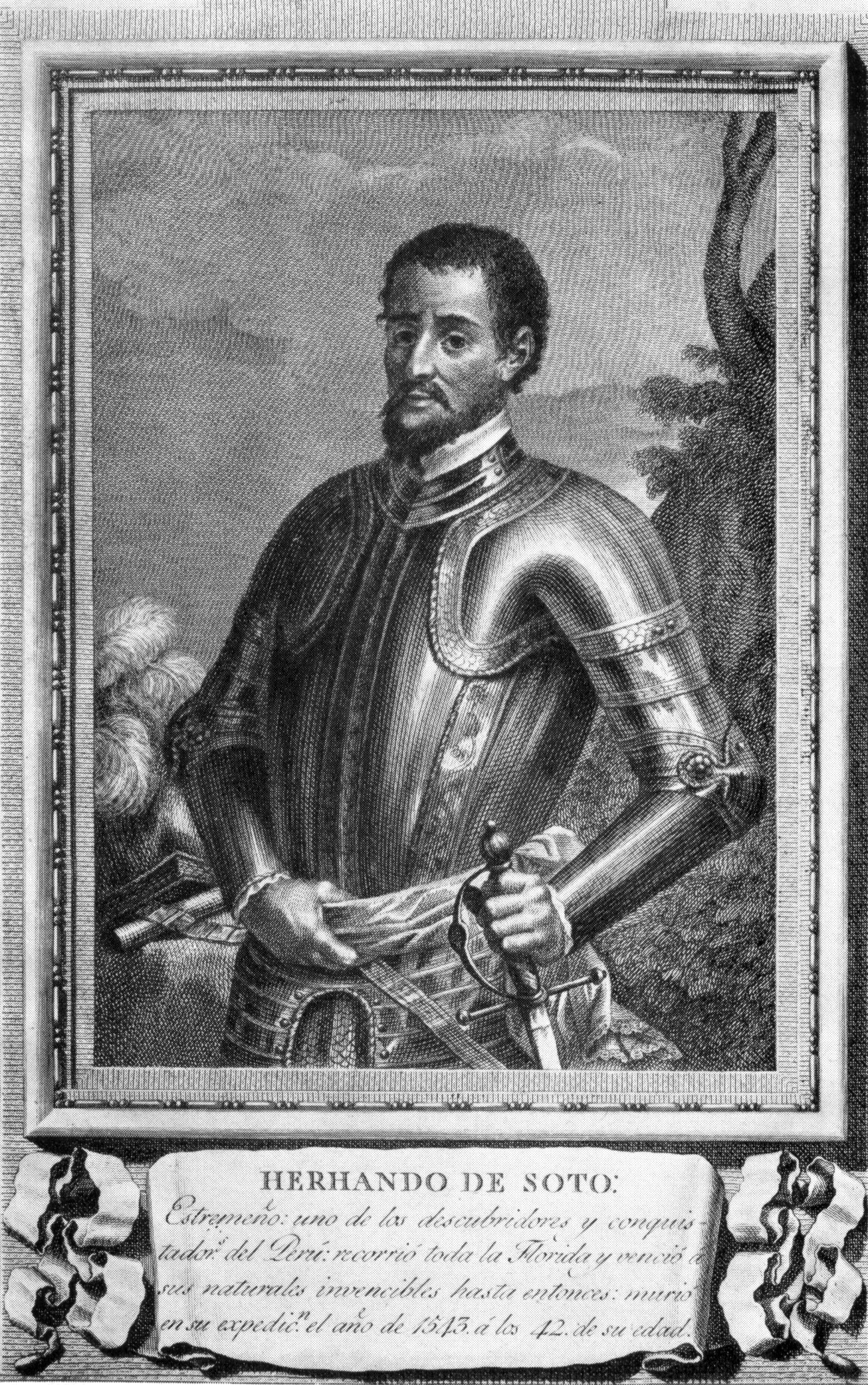
The conventional historical narrative often attributes the “discovery” of the Mississippi River to European explorers, specifically the Spanish. This perspective, while acknowledging their documented encounters, must always be framed within the context of the river’s millennia-long indigenous history. The first European to lay eyes on what is widely considered the main channel of the Lower Mississippi was the Spanish conquistador Hernando de Soto.
Hernando de Soto’s Expedition: A Controversial Claim
In 1539, Hernando de Soto embarked on a massive expedition from Cuba, landing in present-day Florida with an army of over 600 soldiers, hundreds of horses, and a relentless thirst for gold and glory. For three years, his expedition trekked through what would become the southeastern United States, including parts of Georgia, Alabama, Mississippi, and Arkansas.
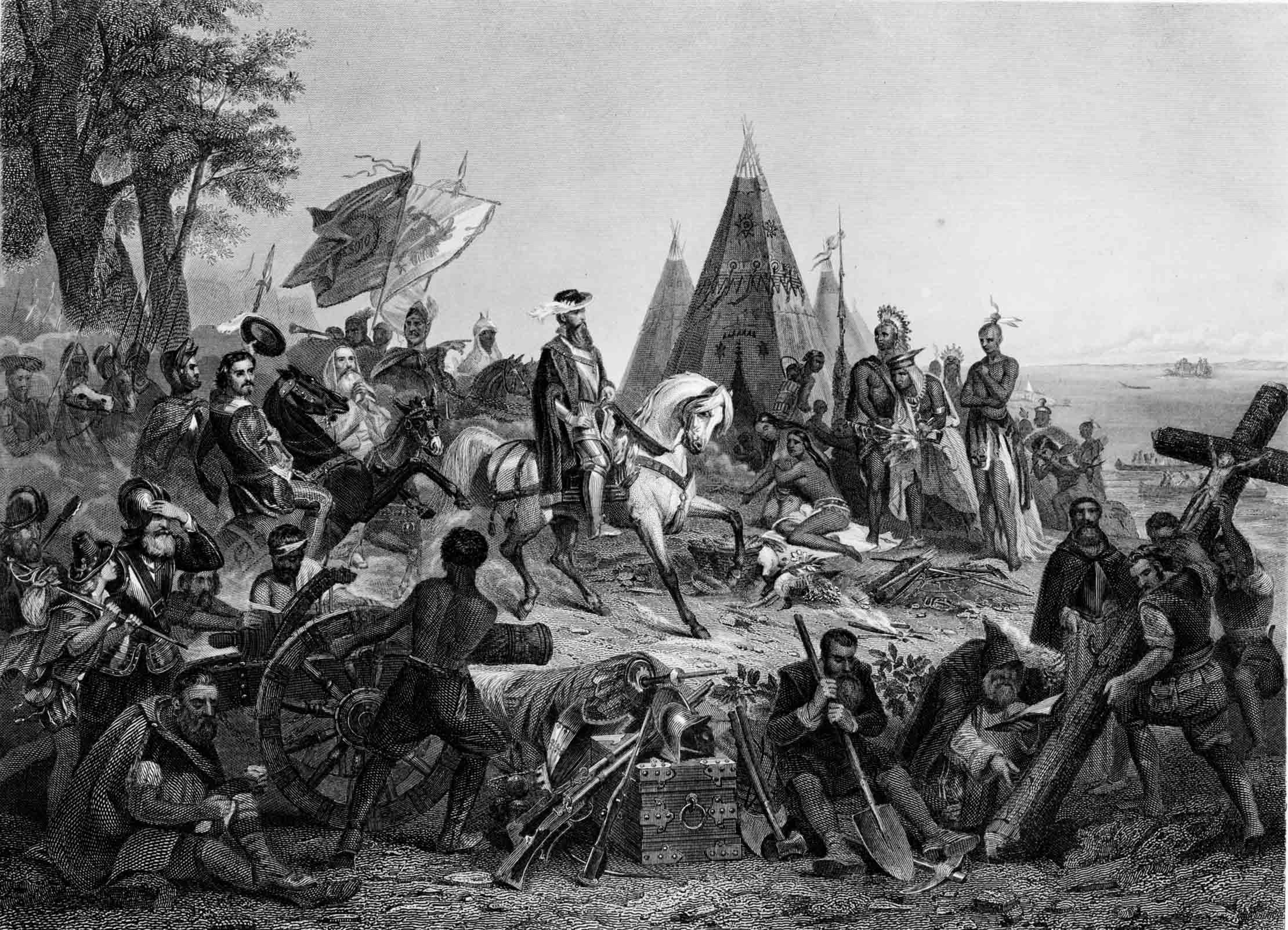
It was in May 1541 that de Soto’s worn-out expedition reached the banks of a vast river, which they called the “Rio del Espíritu Santo” (River of the Holy Spirit). This river is widely accepted to be the Mississippi River, likely near present-day Memphis, Tennessee. For the Spanish, this was a momentous discovery, a colossal natural barrier that presented both a challenge and an opportunity. They built barges to cross it, continuing their arduous and ultimately futile search for riches.
The Brutality of Discovery
De Soto’s “discovery” was marked by immense violence and hardship. The expedition engaged in numerous conflicts with indigenous tribes, often resorting to brutal tactics, enslavement, and the spread of disease. Many thousands of indigenous people perished as a result of the Spanish incursions. De Soto himself died of a fever in 1542 near the river he had “found” and was secretly buried in its waters to prevent his body from being discovered and desecrated by the local tribes he had terrorized.
While de Soto was the first European to officially document an encounter with the lower Mississippi River, his expedition did not lead to immediate European settlement or a comprehensive understanding of the river system. His primary goal was personal enrichment, not geographical exploration for its own sake. The Mississippi River remained largely unmapped and unexplored by Europeans for another century, even after this initial contact.
French Exploration and the Mapping of the Mighty River
More than a century after de Soto’s expedition, it was the French who truly began to systematically explore and map the northern reaches of the Mississippi River, laying the groundwork for a new colonial empire. Their approach, while still colonialist, often involved a different strategy of engagement with indigenous peoples, sometimes forming alliances rather than outright conquest.
Marquette and Jolliet: Charting the Northern Reaches
In 1673, two remarkable French explorers, Father Jacques Marquette, a Jesuit missionary, and Louis Jolliet, a fur trader and cartographer, embarked on a pivotal journey from St. Ignace in what is now Michigan. Guided by indigenous maps and knowledge, they aimed to determine the direction and destination of the “Great River” that many indigenous informants spoke of.
Paddling down the Wisconsin River from Green Bay, Wisconsin, they entered the Mississippi River near present-day Prairie du Chien on June 17, 1673. Marquette and Jolliet traveled by canoe for hundreds of miles, venturing as far south as the mouth of the Arkansas River. They meticulously recorded their observations, noting the wildlife, the landscape, and the numerous indigenous villages they encountered. They correctly deduced that the river flowed into the Gulf of Mexico and not the Pacific Ocean, a crucial piece of geographical knowledge at the time.
Their expedition was significant because it provided the first detailed and relatively accurate maps and descriptions of the northern and central Mississippi River valley, opening the region to further French exploration and trade. They established peaceful relations with many indigenous groups, which facilitated the subsequent establishment of French trading posts and missions.
La Salle’s Grand Vision: Claiming Louisiana
Following in the footsteps of Marquette and Jolliet, another French explorer, René-Robert Cavelier, Sieur de La Salle, embarked on an ambitious mission to complete the exploration of the Mississippi River to its mouth. In 1682, La Salle and his expedition traveled from the Great Lakes down the entire length of the river.
On April 9, 1682, at the mouth of the Mississippi River, La Salle formally claimed the entire Mississippi River basin for France, naming it “Louisiana” in honor of King Louis XIV. This act cemented France’s claim to a vast swathe of North America, stretching from the Appalachian Mountains to the Rocky Mountains. La Salle’s journey completed the European understanding of the river’s course and established a crucial strategic claim, paving the way for French colonization efforts, including the founding of cities like New Orleans.
The Mississippi: A Landmark of Geography and History
The successive “discoveries” by Hernando de Soto, Marquette and Jolliet, and La Salle were critical moments in European colonial history. They transformed the Mississippi River from a known, vital indigenous waterway into a landmark of intense geopolitical interest for competing European powers. These explorations laid the foundation for the complex history of the United States.
A Vital Artery of a Growing Nation
Following French claims and subsequent conflicts, the Mississippi River became a central feature in the westward expansion of the United States. The Louisiana Purchase of 1803, which saw the U.S. acquire a massive territory from France, was largely driven by the strategic importance of controlling the entire river and its critical port at New Orleans. The river was the primary transportation corridor for agricultural goods from the heartland, connecting the interior to global markets. Its control was paramount for economic prosperity and national security.
Steamboats revolutionized river travel in the 19th century, transforming the Mississippi into a bustling highway of commerce and human movement. The river became a symbol of American expansion, adventure, and the rugged frontier, immortalized in literature and folklore.
Enduring Legacy and Cultural Significance
Today, the Mississippi River remains one of the most significant natural landmarks in the United States. It continues to serve as a vital economic conduit, an ecological treasure, and a wellspring of cultural heritage. From the blues music born in its delta to the literary masterpieces inspired by its currents, the river has woven itself into the fabric of American identity.
However, recognizing who “found” the Mississippi River demands a holistic view. While European explorers brought it into the colonial gaze and mapped its course for Western expansion, countless indigenous peoples had already intimately known, navigated, and lived by its waters for thousands of years. Their profound connection and stewardship represent the true, enduring “discovery” and understanding of this magnificent landmark. Thus, the question of who “found” the Mississippi River is best answered by acknowledging both its ancient indigenous inhabitants and the subsequent European explorers who brought it into the broader historical record of the Western world. It is a landmark not just of geography, but of overlapping histories and enduring human relationships with the natural world.
LifeOutOfTheBox is a participant in the Amazon Services LLC Associates Program, an affiliate advertising program designed to provide a means for sites to earn advertising fees by advertising and linking to Amazon.com. Amazon, the Amazon logo, AmazonSupply, and the AmazonSupply logo are trademarks of Amazon.com, Inc. or its affiliates. As an Amazon Associate we earn affiliate commissions from qualifying purchases.