
The American landscape, a tapestry woven with distinct states and diverse cultures, often prompts curiosity about its seemingly arbitrary divisions. Among the more intriguing questions is the existence of North Dakota and South Dakota, two states that share a name, a border, and much of their early history, yet remain separate entities. Their genesis is not a simple tale but a complex narrative steeped in geography, population dynamics, political maneuvering, and the relentless march of westward expansion in the United States. Understanding this dual identity requires a journey back to the territorial era, uncovering the forces that compelled a single vast expanse to cleave into two distinct sovereign states. This exploration delves into the historical context, the practical considerations, and the political machinations that ultimately shaped the map of the Great Plains as we know it today.

The Vast Expanse: Origins of the Dakota Territory
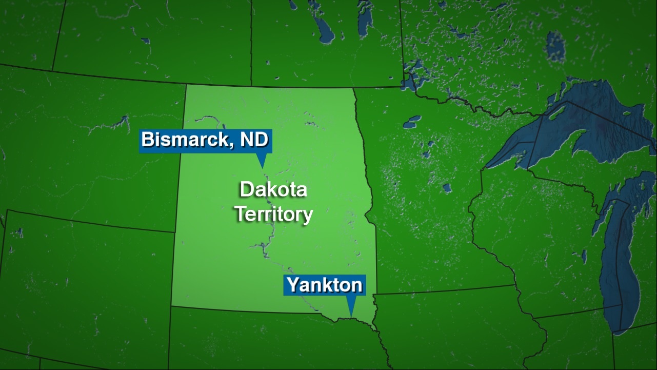
Before the iconic “North” and “South” adorned their names, this expansive region was known simply as the Dakota Territory. Its formation was a critical step in the nation’s westward development, setting the stage for the dramatic events that would lead to its eventual division.
Early Inhabitants and Exploration
Long before European settlers arrived, the lands that would become the Dakotas were home to various indigenous peoples, most notably the Sioux (or Dakota, Lakota, and Nakota peoples), from whom the territory would eventually derive its name. These tribal nations lived sustainably off the land, following the bison herds and utilizing the Missouri River as a vital artery for sustenance and travel.
The first significant American exploration of the region came with the Lewis and Clark Expedition in the early 19th century, following the monumental Louisiana Purchase of 1803. Their journals provided the first detailed accounts of the land’s geography, its natural resources, and its native inhabitants, opening the door for future American interest and settlement. For decades, however, the area remained largely undeveloped by non-indigenous populations, primarily serving as a hunting ground and a frontier buffer.
Formation and Governance
The formal establishment of the Dakota Territory came on March 2, 1861, signed into law by President James Buchanan just two days before Abraham Lincoln took office. This vast new territory, carved out of portions of the old Minnesota Territory and Nebraska Territory, initially encompassed what is now North Dakota, South Dakota, and large sections of Montana and Wyoming. Its initial capital was established at Yankton in the southeastern part of the territory.
The creation of the territory coincided with a period of intense national division and the eve of the Civil War. Despite the turmoil, the idea of westward expansion remained a powerful national imperative. The Homestead Act of 1862 further fueled this expansion, offering settlers 160 acres of land for free, provided they lived on and improved it for five years. This act, coupled with the end of the Civil War, spurred a significant influx of pioneers, driving agricultural development and laying the groundwork for the demographic shifts that would eventually necessitate a division. The territory’s sheer size, however, quickly became a challenge for effective governance, with its sparse population spread across thousands of square miles and diverse geographic zones.
Seeds of Division: Factors Leading to Separation
The Dakota Territory was simply too large and too diverse to remain a single political entity indefinitely. A confluence of geographic, demographic, and economic factors created distinct regional identities and interests, fostering an inevitable push for separation.
Geographic and Climatic Differences
One of the most fundamental reasons for the split was the inherent geographical and climatic divergence within the sprawling territory. The southern portion, particularly the area along the Missouri River and to its east, benefited from slightly warmer temperatures and more abundant rainfall. This made it more amenable to conventional agriculture, resembling the farming practices of neighboring Iowa and Minnesota, allowing for crops such as corn and wheat. The Black Hills in the southwest also offered mineral wealth, particularly gold, leading to a distinct mining economy and boomtowns like Deadwood.
In contrast, the northern reaches, further from the moderating influences of the Missouri River and closer to the Canadian border, experienced harsher, longer winters and often less predictable rainfall. While still fertile, this climate favored hardier strains of wheat and more extensive ranching. The northern plains also had different river systems and resource distribution. These differences led to varied economic priorities and settlement patterns, with settlers in the south gravitating towards mixed farming and mining, while those in the north focused more on large-scale wheat production and cattle.
Demographic Disparities and Settlement Patterns
The flow of settlers into the Dakota Territory was far from uniform. The southern part of the territory, being geographically closer to established states and having a more favorable agricultural climate, attracted a significantly larger population earlier. Towns like Yankton, Sioux Falls, and Rapid City grew rapidly. Many of these settlers came from the upper Midwest, bringing with them established farming practices and political sensibilities.
The northern half, while also experiencing growth, particularly after the arrival of railroads, developed somewhat differently. Settlements like Fargo, Grand Forks, and Bismarck emerged, often tied to railroad development and large-scale bonanza farms. The population in the north tended to be more concentrated along the Red River Valley and railroad lines, with vast stretches of land remaining sparsely populated for longer. This demographic imbalance meant that the southern part of the territory consistently outpaced the north in population and thus had greater political representation and influence within the territorial government, leading to resentment and a desire for separate governance in the north.
The Railroad’s Influence and Economic Diversification
The arrival of the railroads was a transformative force across the American West, and the Dakota Territory was no exception. Companies like the Northern Pacific Railway, the Milwaukee Road, and the Great Northern Railway laid tracks that connected the interior to the burgeoning markets of the East. However, these lines did not uniformly serve the entire territory.
The southern part saw significant early development of rail lines that facilitated the export of agricultural products and access to supplies. The Deadwood Gold Rush in the Black Hills in the 1870s further spurred railway construction to serve the mining communities. This diversified the southern economy beyond agriculture, adding mining, commerce, and tourism (eventually Mount Rushmore and Badlands National Park would draw visitors).
In the north, rail lines also arrived, enabling the massive growth of wheat farming, particularly in the Red River Valley. However, the north’s economy remained more singularly focused on agriculture, specifically grains. The disparate economic engines and trade routes further solidified the distinct identities and interests of the northern and southern halves, with each seeing its future tied to different external markets and internal infrastructure priorities.
The Political Landscape: A Drive for Statehood
By the late 1880s, the call for statehood from the Dakota Territory was deafening. The territory’s population had swelled, its economy matured, and its citizens felt ready for full representation in the United States Congress. Yet, the path to statehood was anything but smooth, entangled as it was in national partisan politics and internal regional squabbles.
Sectional Rivalries and Federal Politics
The demand for statehood from the Dakota Territory became a pawn in the larger game of national politics. At the time, the Republican Party largely dominated Congress and the presidency. They saw the admission of new Western states as an opportunity to solidify their power by adding more Republican senators and representatives. However, they also recognized that the vast Dakota Territory, with its growing and increasingly diverse population, could potentially generate two new states, doubling their legislative gain.
Internally, the northern and southern sections of the territory had long been at loggerheads. The more populous south, with its territorial capital at Yankton (and later Pierre), often felt it was unfairly dominating the political landscape, while the north felt neglected and underrepresented. This led to persistent calls from both sides for separate statehood, as neither wished to be governed by the other within a single state. The practical challenges of governing such a vast area from a single capital, especially without modern transportation and communication, also reinforced the logic of division.
The Omnibus Bill and Republican Ambitions
The breakthrough came with the 1888 presidential election, which saw Benjamin Harrison, a Republican, win the presidency, and the Republican Party secure majorities in both houses of Congress. This created a political alignment favorable to the admission of new states. The solution to the Dakota Territory’s statehood dilemma, and indeed that of several other territories, was the Omnibus Bill of 1889.
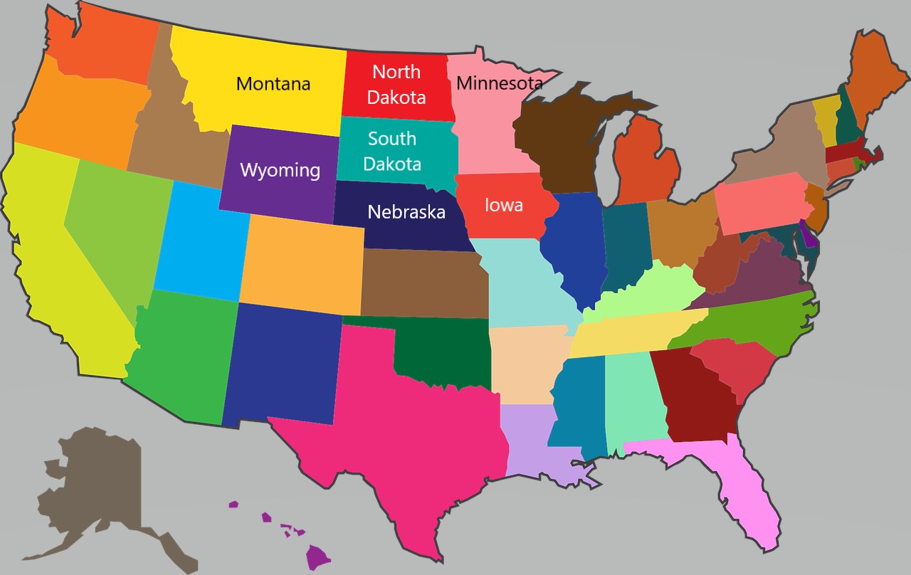
This bill was a legislative package designed to admit four new states simultaneously: North Dakota, South Dakota, Montana, and Washington. For the Dakota Territory, the bill formally authorized its division into two states, each drafting its own constitution and preparing for admission. This was a direct response to the long-standing internal divisions and the Republican desire to maximize their political gains by bringing in four new, likely Republican-leaning states.
A Divided Identity: The Birth of Two States
With the passage of the Omnibus Bill, the path was clear, but the final act of creating two states involved a unique historical quirk and solidified their distinct identities.
The Double Statehood Dilemma
On November 2, 1889, President Benjamin Harrison signed the proclamations admitting both North Dakota and South Dakota to the Union. A famous, perhaps apocryphal, story surrounds this event: to avoid showing favoritism or to prevent a dispute over which state was admitted first, President Harrison is said to have shuffled the two statehood proclamations and signed them blindly, never looking to see which one was on top. While the exact veracity of this tale is debated, it perfectly encapsulates the political delicacy of the situation and the desire to treat both nascent states equally. Technically, North Dakota is listed first alphabetically and thus often considered the 39th state, with South Dakota the 40th.
The formal division created two distinct capitals: Bismarck for North Dakota and Pierre for South Dakota. Each state immediately began to forge its own governance, laws, and infrastructure, reflecting the unique priorities and characteristics that had developed over decades.
Enduring Legacies and Distinct Characters
Even today, the legacy of this division is evident in the distinct characters of North Dakota and South Dakota. North Dakota often embodies the spirit of resilience, vast open spaces, and agricultural prowess. Its economy remains heavily reliant on wheat and other grains, as well as more recently, oil and gas extraction in the Bakken Formation. Its landscapes, from the Red River Valley to the rugged Badlands of Theodore Roosevelt National Park, speak to its unique geography.
South Dakota, while also agrarian, embraces its diverse economic base, which includes significant tourism revenue from icons like Mount Rushmore and the Badlands National Park, as well as its historic Black Hills region. The more varied climate and topography supported different settlement patterns and economic activities, creating a slightly different cultural and historical tapestry. While sharing a common heritage from the Dakota Territory days and the enduring presence of Native American cultures, each state has cultivated its own identity, celebrated in its landmarks, industries, and communities.
Conclusion: More Than Just a Line on a Map
The separation of the Dakota Territory into North Dakota and South Dakota was not an arbitrary act but the logical culmination of a century of development, shaped by the relentless forces of westward expansion. From the initial geographic and climatic differences that dictated settlement patterns and economic pursuits to the demographic imbalances and fierce political rivalries, every factor pointed toward the necessity of division. The final push for statehood, orchestrated through the Omnibus Bill and driven by national political ambition, simply formalized what had long been clear on the ground: the northern and southern Dakotas had evolved into distinct entities. Today, these two states stand as enduring monuments to their shared past and their separate, vibrant futures, each contributing its unique chapter to the grand narrative of the American frontier. Their story is a powerful reminder that the lines on our maps are rarely random but are often etched by history, geography, and the intricate dance of human endeavor.
LifeOutOfTheBox is a participant in the Amazon Services LLC Associates Program, an affiliate advertising program designed to provide a means for sites to earn advertising fees by advertising and linking to Amazon.com. Amazon, the Amazon logo, AmazonSupply, and the AmazonSupply logo are trademarks of Amazon.com, Inc. or its affiliates. As an Amazon Associate we earn affiliate commissions from qualifying purchases.