
Understanding the distance between two major American hubs like Chicago and Ohio is a fundamental step for any traveler planning an adventure or a business trip between these two significant regions. While the direct “as the crow flies” distance offers a baseline, the practicalities of travel involve various routes, modes of transportation, and the specific destinations within each state that dictate the actual journey time and mileage. Ohio, a state rich in history and diverse landscapes, shares a border with Illinois, making the transit between Chicago and various Ohioan cities both feasible and popular.
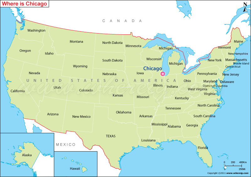
This exploration delves into the driving distances, typical travel times, and considerations for flying, offering a comprehensive overview for those looking to traverse this corridor. Whether you’re heading to the bustling metropolis of Cleveland, the state capital of Columbus, or the scenic shores of Lake Erie, knowing the geographical expanse is crucial for efficient planning.
Driving Distances and Times
The most common method of travel between Chicago and Ohio is by car, offering flexibility and the opportunity to experience the changing scenery along the way. The precise distance and estimated travel time will vary significantly depending on your exact starting point in Chicago and your chosen destination within Ohio.
To Northern Ohio: Cleveland and Toledo
For those aiming for the northern tier of Ohio, cities like Toledo and Cleveland are the closest major metropolitan areas.
Toledo, Ohio
- Distance: The distance from downtown Chicago to downtown Toledo is approximately 240-250 miles.
- Estimated Driving Time: Under normal traffic conditions and without significant stops, this drive typically takes around 3.5 to 4 hours. The primary route is usually I-80/I-90 E (the Ohio Turnpike).
- Considerations: This route is largely interstate highway, making for a straightforward drive. However, traffic can be a factor, especially when leaving the Chicagoland area and approaching Toledo during peak hours. Tolls are associated with the Ohio Turnpike.
Cleveland, Ohio
- Distance: Traveling from Chicago to Cleveland involves a greater span, with the distance being approximately 350-360 miles.
- Estimated Driving Time: This journey generally takes between 5.5 to 6.5 hours of driving time, again, assuming favorable traffic and minimal interruptions. The route often follows I-80/I-90 E, also known as the Ohio Turnpike.
- Considerations: This is a substantial drive, and planning for at least one significant stop for rest and refreshments is advisable. The Ohio Turnpike is a toll road, and travelers should be prepared for these costs. Road construction can also impact travel times, particularly during warmer months.
To Central and Southern Ohio: Columbus and Beyond
For destinations in the heart of Ohio, such as its capital city, Columbus, or further south, the driving distance increases considerably.
Columbus, Ohio
- Distance: The drive from Chicago to Columbus measures around 360-370 miles.
- Estimated Driving Time: Expect this drive to take approximately 5.5 to 6.5 hours of pure driving time. The route typically involves taking I-90 E, then transitioning to I-65 S, I-74 E, and finally I-70 E, or variations thereof that might utilize parts of the Ohio Turnpike.
- Considerations: This route involves a mix of interstates and can be more complex than heading directly east to Cleveland. Traffic around Indianapolis, if that route is taken, or through suburban Chicago can add to travel time.

Cincinnati, Ohio (Southern Ohio)
- Distance: Reaching Cincinnati in southwestern Ohio from Chicago covers a greater distance, approximately 350-360 miles.
- Estimated Driving Time: This journey typically takes about 5.5 to 6.5 hours of driving. The most common routes involve heading southeast through Indiana, often using I-65 S to I-70 E and then south towards Cincinnati via I-71 S.
- Considerations: Similar to the route to Columbus, this drive traverses multiple states and interstates. It’s a route that can be affected by congestion in and around major urban centers in Indiana.
General Driving Tips
- Tolls: Be aware that significant portions of the interstates in Ohio, particularly the I-80/I-90 corridor (Ohio Turnpike), are toll roads. Have cash or an electronic toll pass ready.
- Fuel Stops: Plan your fuel stops in advance. While interstates offer numerous service areas, it’s wise to refuel before your tank gets too low, especially if traveling during off-peak hours or in more rural stretches.
- Traffic: Always check traffic conditions before and during your drive. Websites and apps like Google Maps or Waze can provide real-time updates and suggest alternative routes to avoid congestion, particularly around Chicago and other major cities.
- Weather: Ohio experiences a range of weather conditions throughout the year. Winter driving can be challenging due to snow and ice, while summer can bring thunderstorms. Always check the forecast before departing.
Flying: A Quicker Alternative
For travelers prioritizing speed and efficiency, flying offers a significantly faster way to get from Chicago to Ohio. Both states are well-served by major airports, making air travel a convenient option.
Major Airports
- Chicago: The primary airports serving the Chicagoland area are O’Hare International Airport (ORD) and Midway International Airport. O’Hare is one of the busiest airports in the world, offering a vast network of domestic and international flights.
- Ohio: Major airports in Ohio include Cleveland Hopkins International Airport (CLE), John Glenn Columbus International Airport (CMH), Port Columbus International Airport (CMH) (now known as John Glenn Columbus International Airport), and Cincinnati/Northern Kentucky International Airport (CVG), which serves the Cincinnati metropolitan area.
Flight Durations and Logistics
- Direct Flights: Numerous direct flights operate daily between Chicago airports and major Ohioan cities.
- Flight Time: The actual flight time for a direct flight is typically very short, usually ranging from 1 hour to 1 hour and 30 minutes.
- Total Travel Time: It’s important to factor in the total travel time, which includes getting to the airport, check-in procedures, security screening, boarding, the flight itself, deplaning, and then traveling from the destination airport to your final location. This can add several hours to the journey, often making the total door-to-door time for a flight comparable to a long drive if your destination is close to a major highway exit.
- Booking: Airlines such as United Airlines, American Airlines, Southwest Airlines, and Delta Air Lines frequently service these routes. Booking in advance can often secure better fares.
Train Travel: A Scenic but Slower Option
While less common for this particular route compared to driving or flying, train travel is an option provided by Amtrak. It offers a more relaxed pace and a chance to see the landscape without the stress of driving.

Amtrak Routes and Schedules
- Key Routes: The primary Amtrak routes connecting the region often involve travel through Indiana. For instance, the Capitol Limited route runs between Washington D.C. and Chicago, with stops in northern Ohio such as Elyria and Sandusky. Other routes might connect through Indianapolis to reach cities like Cincinnati.
- Travel Time: Train journeys are significantly longer than driving or flying. A trip from Chicago to Cleveland by train can take upwards of 8-10 hours, and to Columbus or Cincinnati could be even longer, often requiring transfers.
- Considerations: Train travel is ideal for those who prefer not to drive, enjoy a more leisurely pace, and want to avoid airport hassles. It can be a comfortable way to travel, with options for sleeping accommodations on longer journeys. However, the extended travel time makes it less practical for short trips or those with strict time constraints. Passengers should consult the Amtrak website for specific schedules, routes, and booking information, as routes and times can change.
In summary, the distance between Chicago and Ohio is not a single, fixed number but a range that depends on the chosen mode of transport and the specific endpoints within each state. Whether embarking on a road trip, a quick flight, or a scenic train ride, understanding these distances and travel times is the first step to a well-planned and enjoyable journey.
LifeOutOfTheBox is a participant in the Amazon Services LLC Associates Program, an affiliate advertising program designed to provide a means for sites to earn advertising fees by advertising and linking to Amazon.com. Amazon, the Amazon logo, AmazonSupply, and the AmazonSupply logo are trademarks of Amazon.com, Inc. or its affiliates. As an Amazon Associate we earn affiliate commissions from qualifying purchases.