
The journey between Phoenix and Los Angeles is one of the most traveled corridors in the United States. Connecting the heart of the Sonoran Desert with the sprawling metropolitan coast of California, this route serves as a vital artery for commerce, tourism, and lifestyle transitions. Whether you are planning a weekend getaway to the beach or a business trip to the “Valley of the Sun,” understanding the logistics, distance, and transit options is essential for a smooth experience.
While the distance remains constant, the time it takes to traverse this stretch of the American Southwest varies significantly based on your mode of transport and the time of day you choose to travel. From the high-altitude views of a commercial flight to the rugged beauty of the Interstate 10 highway, the transition from Arizona to the Pacific coast is a study in changing landscapes and urban evolution.
Analyzing the Distance and Travel Times
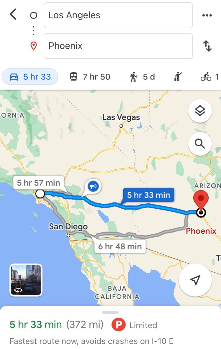
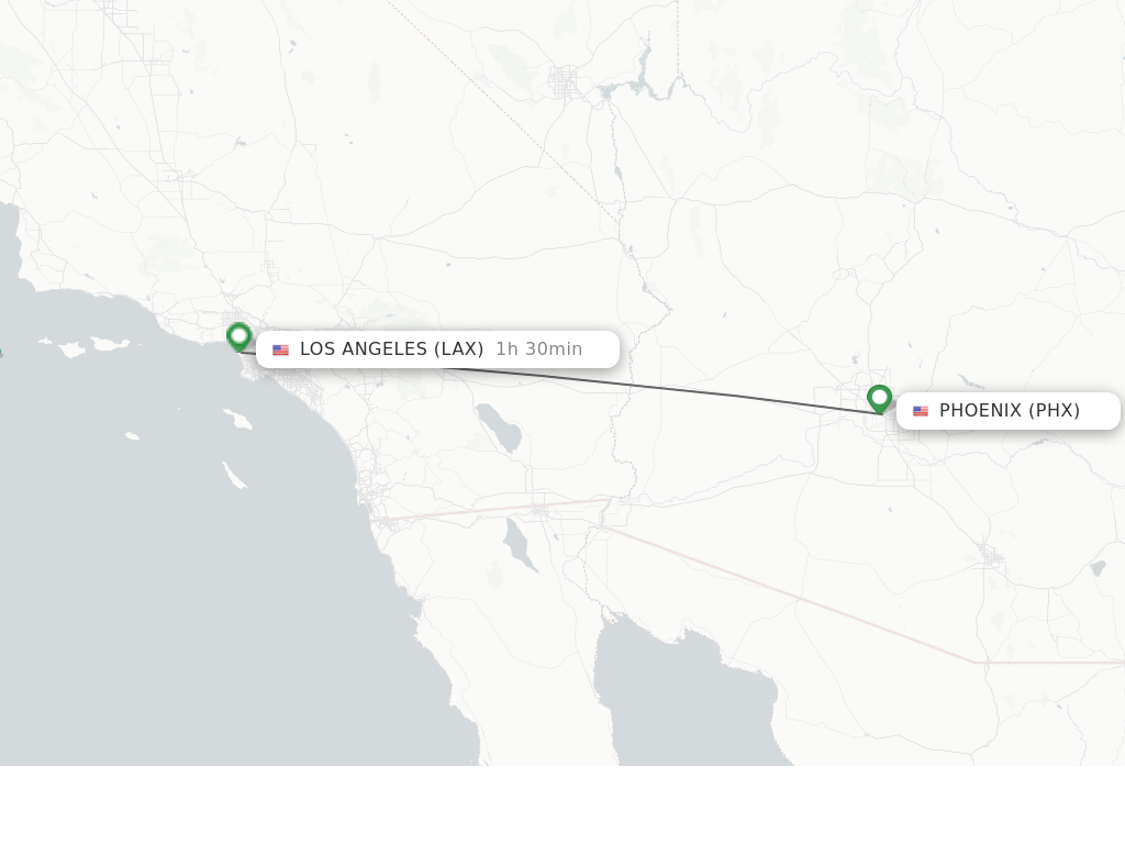
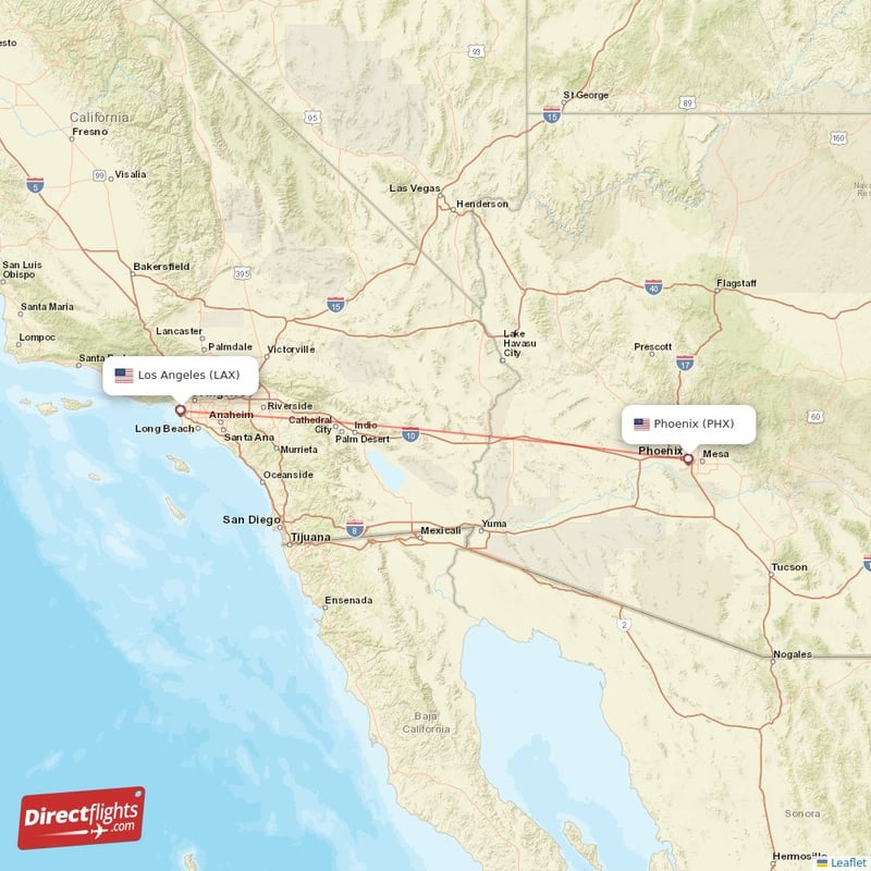
When asking “how far is Phoenix to Los Angeles,” the answer depends on whether you are measuring “as the crow flies” or by road mileage. Geographically, the straight-line distance between the two cities is approximately 357 miles. However, because travel follows established infrastructure, the actual distance covered by most travelers is closer to 370 or 380 miles.
Driving from Phoenix to Los Angeles
For many residents of Maricopa County, driving is the preferred method of reaching Southern California. The driving distance is roughly 372 miles when traveling from downtown to downtown. Under ideal conditions, this trip takes approximately 5.5 to 6 hours. However, those familiar with the Los Angeles basin know that traffic is a massive variable.
Entering the Inland Empire during rush hour can easily add two hours to your journey. The drive is characterized by long stretches of open desert, punctuated by the climb through the San Gorgonio Pass. This route is almost exclusively handled via Interstate 10, a major highway that runs from the Pacific Ocean all the way to Florida.
Flying: The Quickest Route
If time is of the essence, flying is undoubtedly the most efficient way to bridge the gap. A direct flight from Sky Harbor International Airport in Phoenix to Los Angeles International Airport (LAX) typically takes about 1 hour and 20 minutes in the air. When you factor in security, boarding, and baggage claim, the total door-to-door time is usually around 3.5 to 4 hours.
Several major carriers, including American Airlines, Southwest Airlines, and United Airlines, operate dozens of daily flights. Travelers can also look into alternative airports such as Hollywood Burbank Airport or Long Beach Airport to avoid the congestion of LAX.
Alternative Transport: Bus and Rail
For those who prefer not to drive or fly, bus services like Greyhound or FlixBus offer affordable alternatives. These trips generally take between 7 and 9 hours depending on the number of stops in cities like Blythe or Riverside.
While there is no direct commuter rail that mirrors the highway, Amtrak provides service via the Sunset Limited line. This train connects Maricopa (the closest station to Phoenix) to Union Station in Los Angeles. While slower than driving, the train offers a scenic and relaxing way to view the Mojave Desert landscape.
The Best Driving Routes and Road Trip Logistics
The vast majority of travelers choose the road trip experience. This route is more than just a commute; it is a transition through some of the most unique geological formations in North America.
The Interstate 10 Corridor
The Interstate 10 is the backbone of travel between these two hubs. Leaving Phoenix, you head west through Buckeye and out into the expansive desert. This stretch is known for its wide-open vistas and the occasional “dust devil” swirling across the horizon. As you approach the border of California, you will cross the Colorado River.
Once in California, the road continues through the Colorado Desert. It is important to ensure your vehicle is in good condition, as summer temperatures in this region can frequently exceed 110 degrees Fahrenheit. Service stations are relatively frequent, but there are stretches where help is several miles away.
Scenic Detours via Joshua Tree
For those who have extra time, a slight detour can turn a standard drive into an unforgettable adventure. By exiting the Interstate 10 near Chiriaco Summit, travelers can head north toward Joshua Tree National Park.
This park is famous for its twisted, bristled Joshua Trees and massive granite boulders. Driving through the park from the south entrance and exiting through Twentynine Palms adds about two to three hours to the trip but offers some of the most iconic scenery in the West. From there, you can rejoin the main route via Hwy 62 and head into the Coachella Valley.
Top Stops and Attractions Along the Way
Breaking up the five-hour drive makes the journey more enjoyable and allows you to experience the local culture of the desert towns that sit between these two giants.
Quartzsite and the Arizona Border
Just before leaving Arizona, you will pass through Quartzsite. This small town becomes a major hub in the winter months when thousands of gem and mineral enthusiasts descend for the annual Quartzsite Sports, Vacation & RV Show. It is a quirky, fascinating place to stop for gas and browse through outdoor markets filled with crystals, fossils, and antique oddities.
Palm Springs and the Coachella Valley
As you descend into the Coachella Valley, the scenery shifts from rugged wilderness to manicured greenery and mid-century modern architecture. Palm Springs is the perfect halfway point or lunch stop. Known for its luxury resorts, golf courses, and the Palm Springs Aerial Tramway, it offers a sophisticated contrast to the surrounding desert. If you have time for a meal, Downtown Palm Springs features world-class dining that rivals anything found in Beverly Hills.
Cabazon Dinosaurs and Outlet Shopping
One of the most recognizable landmarks on the drive is the Cabazon Dinosaurs. These massive roadside sculptures, featuring a Brontosaurus and a Tyrannosaurus Rex, have appeared in numerous films and are a favorite stop for families.
Directly adjacent to the dinosaurs are the Desert Hills Premium Outlets. This is one of the premier shopping destinations in California, featuring high-end brands like Gucci, Prada, and Saint Laurent. It is an excellent place to stretch your legs and perhaps pick up some designer gear before arriving in the fashion capital of Los Angeles.
Practical Tips for a Seamless Desert Crossing
Traveling across the desert requires a bit more preparation than a standard coastal drive. The environment is beautiful but can be harsh if you are unprepared.
Avoiding Traffic in Los Angeles and Phoenix
The biggest hurdle for this trip is urban congestion. Phoenix experiences significant traffic during the morning and evening commutes, particularly on the I-10 and Loop 101. However, Los Angeles traffic is in a league of its own.
To minimize delays, try to depart Phoenix very early in the morning (around 4:00 AM or 5:00 AM) to arrive in Los Angeles before the afternoon rush. Alternatively, leaving late in the evening can provide a clear run, though you will miss the desert views. On weekends, be aware that Sunday afternoons see heavy traffic heading back toward Los Angeles as vacationers return from Las Vegas and Palm Springs.
Best Seasons for Travel
The best time to make the drive is during the late fall, winter, or early spring. During these months, the temperatures are mild, ranging from 60 to 80 degrees Fahrenheit. The desert landscape often comes alive with wildflowers in the spring, particularly after a rainy winter in the Anza-Borrego Desert State Park region nearby.
Summer travel (June through September) requires caution. Ensure your vehicle’s cooling system and air conditioning are in top shape. It is also wise to carry extra water and a portable charger. While the roads are well-maintained, the extreme heat can put significant stress on tires and engines.
Final Thoughts on the Journey
The distance between Phoenix and Los Angeles represents more than just miles; it is a bridge between the mountain-guarded valleys of Arizona and the coastal energy of the Pacific Southwest. Whether you choose the speed of a flight or the freedom of the open road, the trip offers a glimpse into the vast diversity of the American landscape.
By planning your stops at landmarks like Joshua Tree National Park or the Cabazon Dinosaurs, and timing your arrival to miss the peak Los Angeles gridlock, you can turn this 370-mile journey into a highlight of your travel itinerary. From the neon lights of Hollywood to the tranquil sunsets of the Sonoran Desert, the path between these two cities is a classic Western adventure waiting to be explored.
LifeOutOfTheBox is a participant in the Amazon Services LLC Associates Program, an affiliate advertising program designed to provide a means for sites to earn advertising fees by advertising and linking to Amazon.com. Amazon, the Amazon logo, AmazonSupply, and the AmazonSupply logo are trademarks of Amazon.com, Inc. or its affiliates. As an Amazon Associate we earn affiliate commissions from qualifying purchases.