
Arizona, often synonymous with vast deserts and perpetual sunshine, holds a unique place in the climatic tapestry of North America. Its dramatic landscapes, from the awe-inspiring depths of the Grand Canyon to the iconic saguaros of its southern regions, are intimately shaped by its intense, arid climate. Understanding the extremes of this natural environment, particularly its record-breaking heat, is crucial to appreciating the history and formation of Arizona’s most cherished natural landmarks. The question of “Arizona’s hottest day” isn’t merely a meteorological trivia point; it’s a gateway to exploring the fundamental forces that define the state’s very essence. These climatic pinnacles reveal the incredible resilience of its ecosystems, the enduring processes that sculpt its geology, and the historical forces that continue to shape this remarkable corner of the American Southwest.
Defining Arizona’s Climatic Pinnacle: The Record-Breaking Heat
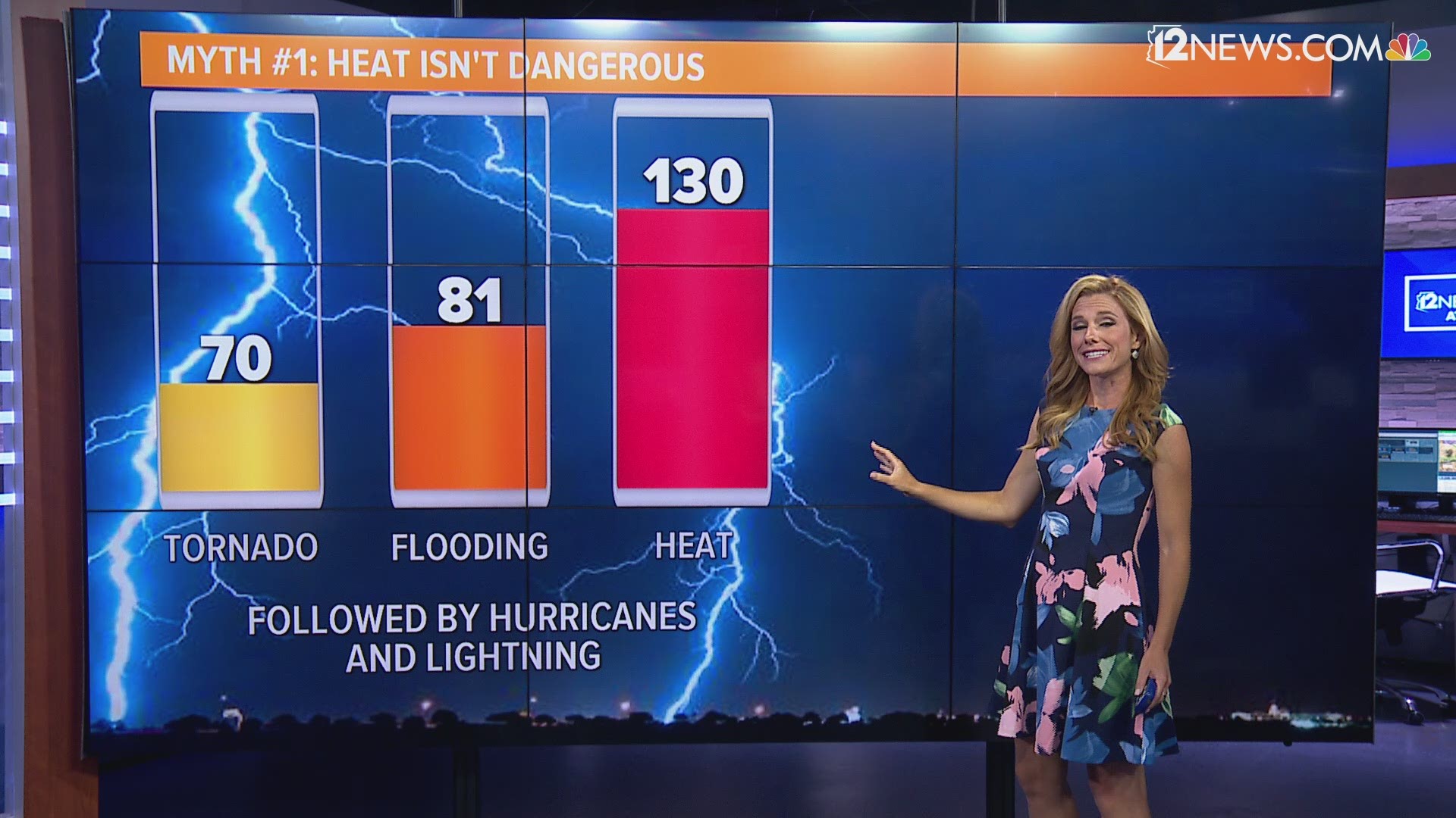
The pursuit of “Arizona’s hottest day” leads us to a fascinating investigation into the state’s meteorological records, showcasing the raw power of its desert climate. While single days often capture public attention, the underlying conditions that allow such extreme temperatures to occur are a testament to Arizona’s unique natural setting. These record-breaking events are not isolated anomalies but rather exaggerated manifestations of the persistent climatic patterns that have sculpted its landscape for millennia.
Phoenix‘s Searing Summer of 1990 and the 122°F Mark
For many, the enduring memory of extreme heat in Arizona points to Phoenix. As the state’s capital and largest metropolitan area, its weather records are closely observed, often becoming benchmarks for the entire region. The city’s most infamous summer arrived in 1990, culminating in an unprecedented high. On June 26, 1990, the official weather station at Sky Harbor International Airport in Phoenix recorded an astonishing 122°F (50°C). This temperature stands as the highest ever officially recorded in Phoenix, a landmark in the city’s climatic history.
This event was more than just a number; it represented a profound challenge to the urban environment, testing infrastructure and human endurance alike. The extreme heat of that day highlighted how profoundly human settlements in the desert are intertwined with their natural surroundings. It underscored the concept of the “urban heat island effect,” where vast expanses of concrete, asphalt, and buildings absorb and re-emit solar radiation, exacerbating already high natural temperatures. This 122°F milestone in Phoenix became a cultural touchstone, a vivid reminder of the Sonoran Desert’s formidable power and a benchmark against which all subsequent hot summers are measured.
The Broader Context: State Records and Geographical Variations
While Phoenix’s 122°F record is iconic, the absolute highest temperature ever recorded in Arizona actually occurred elsewhere. On July 5, 1994, Lake Havasu City, situated along the Colorado River on the state’s western border, registered a blistering 128°F (53.3°C). This colossal temperature represents the undisputed state record, a testament to the unique geographical and meteorological conditions prevalent in that particular basin. The lower elevation and proximity to the Mojave Desert contribute to Lake Havasu City’s propensity for extreme heat, often surpassing that of Phoenix.
Arizona’s diverse topography ensures that while extreme heat is common, its intensity varies significantly across the state. In contrast to the searing desert floors, higher elevation cities like Flagstaff, nestled in the Coconino National Forest at nearly 7,000 feet, experience remarkably cooler summers. The highest temperature ever recorded in Flagstaff is a relatively mild 97°F (36.1°C), highlighting the dramatic influence of elevation on local climates. This geographical variation is a fundamental aspect of Arizona’s natural character, shaping not only human habitation but also the distribution of its diverse flora and fauna, and the weathering processes that sculpt its geological landmarks. From the hot, dry basins to the cooler, forested mountains, each region presents a unique facet of Arizona’s natural heritage, deeply influenced by the dance of temperature and topography.
The Natural Forces Shaping Arizona’s Desert Landscape
The extraordinary temperatures experienced in Arizona are not arbitrary events but the direct result of a powerful interplay between geographical features and atmospheric phenomena. These forces have, over geological timescales, sculpted the very landscape and defined the unique ecosystems that characterize the state’s most iconic natural landmarks. Understanding these underlying mechanisms is key to appreciating the profound natural history of Arizona.
Geographical Features and the “Heat Island” Effect
Arizona’s position in the subtropics, combined with its basin-and-range topography, sets the stage for extreme heat. Much of the state lies within a broad desert basin, characterized by low elevations surrounded by mountain ranges. This creates a “bowl” effect, where air heats up and becomes trapped, leading to intense radiative heating from the sun-baked ground. The scarcity of moisture in the atmosphere means that solar radiation is absorbed directly by the land, which then re-radiates heat, dramatically warming the air above it.
Furthermore, the prevalence of clear skies throughout much of the year allows for maximum solar insolation. Without cloud cover to reflect sunlight, the sun’s energy directly impacts the surface. This effect is compounded by dry air, which has a lower specific heat capacity than moist air, meaning it heats up faster. In urban centers like Phoenix and Tucson, this natural heating is amplified by the urban heat island (UHI) effect. Concrete, asphalt, and building materials absorb and store vast amounts of heat during the day, releasing it slowly at night, keeping temperatures elevated long after sunset. This artificial modification of the natural landscape demonstrates how human activity can inadvertently create new “climatic landmarks” within the desert environment, impacting everything from local weather patterns to energy consumption and public health.
The Sonoran Desert: A Cradle of Extreme Adaptations
The Sonoran Desert, covering a significant portion of southern Arizona, is one of the hottest and most biologically diverse deserts in the world. Its ability to host such a rich tapestry of life in the face of extreme temperatures is a testament to millions of years of evolutionary adaptation. This desert is defined not just by its heat but also by its unique bimodal rainfall pattern, receiving precipitation both in winter and during the summer monsoon season. This allows for a greater variety of plant life, including the iconic saguaro cactus, which is a true natural landmark of the region.
The plants and animals of the Sonoran Desert have evolved remarkable strategies to cope with the scorching heat and aridity. Cacti, with their thick, waxy skins, reduced leaf surface areas (spines), and ribbed structures for expansion and contraction, are master water hoarders and heat dissipators. Desert animals, from the smallest insects to larger mammals, exhibit nocturnal behavior, burrowing habits, and specialized physiological mechanisms to regulate body temperature. These adaptations are not merely survival tactics; they are fundamental characteristics that define the Sonoran Desert as a dynamic, living landmark. The very presence of these resilient life forms, shaped by the unrelenting forces of heat and drought, makes the Sonoran Desert a profound natural testament to life’s capacity to thrive even in the most extreme conditions.

How Extreme Heat Interacts with Arizona’s Iconic Natural Landmarks
The pervasive heat, occasionally peaking in record-breaking days, is more than just a climatic statistic for Arizona; it is an active agent in shaping its most renowned natural landmarks. From the colossal geological formations to the tenacious life within its national parks, the relentless sun and high temperatures dictate the pace of weathering, the patterns of erosion, and the very survival strategies of its unique ecosystems.
Sculpting the Grand Canyon and Other Geological Wonders
The Grand Canyon, perhaps Arizona’s most famous landmark, is a monumental testament to geological forces, including the subtle but persistent work of extreme temperatures. While the Colorado River is the primary sculptor, the daily and seasonal temperature fluctuations, particularly the intense heat, play a significant role in weathering the canyon’s exposed rock layers. The immense diurnal temperature swings in the canyon, especially during summer, cause rocks to expand and contract repeatedly. This constant stress, known as thermal fatigue, contributes to the fracturing and breakdown of rock surfaces, creating cracks and loosening fragments.
Over vast expanses of time, this process, combined with infrequent but intense rainfall events that cause flash floods, meticulously carves out the canyon’s intricate side drainages and contributes to its staggering dimensions. Similar processes are at work across other geological formations in Arizona, from the red rock formations of Sedona to the isolated buttes and mesas dotting the desert landscape. The unrelenting sun bakes the exposed rock, preparing it for the erosive power of wind and water, effectively acting as an invisible hand continuously reshaping these ancient natural landmarks.
Life Thrives: Resilience in Saguaro National Park and Beyond
Saguaro National Park, a designated landmark protecting the iconic saguaro cactus, perfectly exemplifies how life adapts and thrives in Arizona’s extreme heat. These majestic cacti, some standing over 50 feet tall and living for centuries, are perfectly engineered for survival in the Sonoran Desert. Their accordion-like ribs allow them to expand to store water during wet periods and contract during droughts, minimizing surface area exposure to the sun. The waxy coating on their skin reduces water loss through evaporation, and their extensive shallow root systems efficiently capture sparse rainfall.
Beyond the saguaro, the entire ecosystem of the national park demonstrates remarkable resilience. Desert tortoises burrow deep into the ground to escape the midday sun. Packrats build elaborate middens that insulate them from heat. Many plants engage in CAM photosynthesis, opening their stomata at night to minimize water loss. These intricate adaptations make places like Saguaro National Park living laboratories, natural landmarks where the struggle and triumph of life against extreme environmental conditions are on full display. The heat, far from being solely destructive, is a fundamental evolutionary pressure that has forged these unique biological wonders.
The Petrified Forest National Park: Ancient Heat, Modern Extremes
The Petrified Forest National Park offers a captivating glimpse into Arizona’s ancient past, where geological processes over millions of years transformed a prehistoric forest into vibrant, fossilized wood. While the petrification itself occurred under vastly different climatic conditions—a humid, subtropical environment some 225 million years ago—the park’s present-day landscape is profoundly influenced by Arizona’s modern-day extreme heat and arid conditions.
Today, the exposed petrified logs and the surrounding Painted Desert badlands are subject to the same intense solar radiation and temperature fluctuations that define other parts of the state. This current climate continues the process of erosion, gradually exposing new fossilized wood from the soft, easily erodible Chinle Formation. The absence of extensive vegetation, a direct result of the arid heat, allows for unparalleled visibility of these ancient natural landmarks. The colors of the Painted Desert itself are a product of mineral variations in the exposed strata, further accentuated by the stark, clear light of the desert sun. Thus, the extreme heat of modern Arizona serves as a constant backdrop, continuing the geological narrative that began in a distant, tropical past, revealing and shaping these unique paleontological treasures.
Documenting a Legacy: The Historical Significance of Arizona’s Climate
The record-breaking heat days in Arizona are not just singular events but crucial data points in a larger historical narrative. They contribute to our understanding of the state’s natural history, providing insights into climatic patterns, the resilience of its ecosystems, and the long-term changes impacting its iconic natural landmarks. This documentation is essential for both appreciating the past and planning for the future of Arizona’s unique heritage.
Meteorological Record-Keeping and Understanding Climatic Shifts
The establishment of official weather stations across Arizona, dating back to the late 19th and early 20th centuries, has created an invaluable archive of climatic data. Records from locations like Phoenix, Tucson, and Flagstaff allow climatologists to analyze long-term trends, identify patterns, and pinpoint extreme events such as the 122°F day in Phoenix or the 128°F state record in Lake Havasu City. This historical data reveals that while Arizona has always been a land of heat, there are discernible shifts occurring.
Scientists use these records to understand phenomena like prolonged droughts, the intensity of monsoon seasons, and the frequency of extreme heat waves. These climatic shifts have direct implications for the state’s natural landmarks. Changes in temperature and precipitation patterns can affect the Colorado River’s flow through the Grand Canyon, impact the health of saguaro forests, and influence the rates of erosion in the Painted Desert and Petrified Forest National Park. By meticulously documenting these events, we gain a historical perspective that informs contemporary conservation efforts for these natural treasures.
Preserving Arizona’s Unique Natural Heritage for Future Generations
The insights gleaned from understanding Arizona’s hottest days and its broader climatic history are fundamental to the preservation of its natural heritage. The state’s deserts, mountains, and canyons are not static; they are dynamic systems constantly interacting with the environment. As climate patterns evolve, the stresses on these natural landmarks intensify. Conservation strategies for Saguaro National Park, the Grand Canyon, and other protected areas must consider these climatic realities.
Efforts range from managing water resources to protecting vulnerable habitats and promoting sustainable practices that mitigate human impact on these delicate ecosystems. The historical data on extreme heat helps in predicting future vulnerabilities and developing adaptive management plans. By recognizing the intrinsic connection between Arizona’s record temperatures and the ongoing evolution of its landscapes, we ensure that the awe-inspiring natural landmarks that define this state will continue to captivate and educate future generations, serving as enduring testaments to the power and beauty of the natural world. The hottest day in Arizona is more than just a memory; it’s a critical piece of its natural history, demanding our ongoing respect and stewardship.
LifeOutOfTheBox is a participant in the Amazon Services LLC Associates Program, an affiliate advertising program designed to provide a means for sites to earn advertising fees by advertising and linking to Amazon.com. Amazon, the Amazon logo, AmazonSupply, and the AmazonSupply logo are trademarks of Amazon.com, Inc. or its affiliates. As an Amazon Associate we earn affiliate commissions from qualifying purchases.