
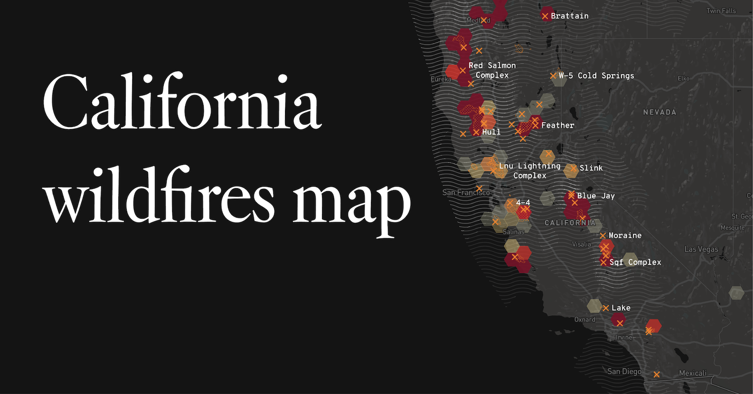
The question “Where Are The California Fires Map?” is a critical one, not just for residents and emergency responders, but also for travelers planning trips to the Golden State. While the immediate focus of fire maps is on safety and evacuation, understanding the geographical and temporal patterns of wildfires in California is crucial for informed travel planning. This guide aims to provide a comprehensive overview of how to access and interpret these vital resources, framed within the context of travel and outdoor exploration.
Understanding California Wildfire Dynamics for Travelers
California is a vast state, blessed with diverse landscapes ranging from sun-drenched beaches to towering Sierra Nevada peaks, and from arid deserts to lush redwood forests. This very diversity, combined with a Mediterranean climate characterized by hot, dry summers and mild, wet winters, creates conditions ripe for wildfires. For travelers, understanding these dynamics is not about avoiding California altogether, but about being aware and prepared.
Seasonal Patterns and Risk Areas
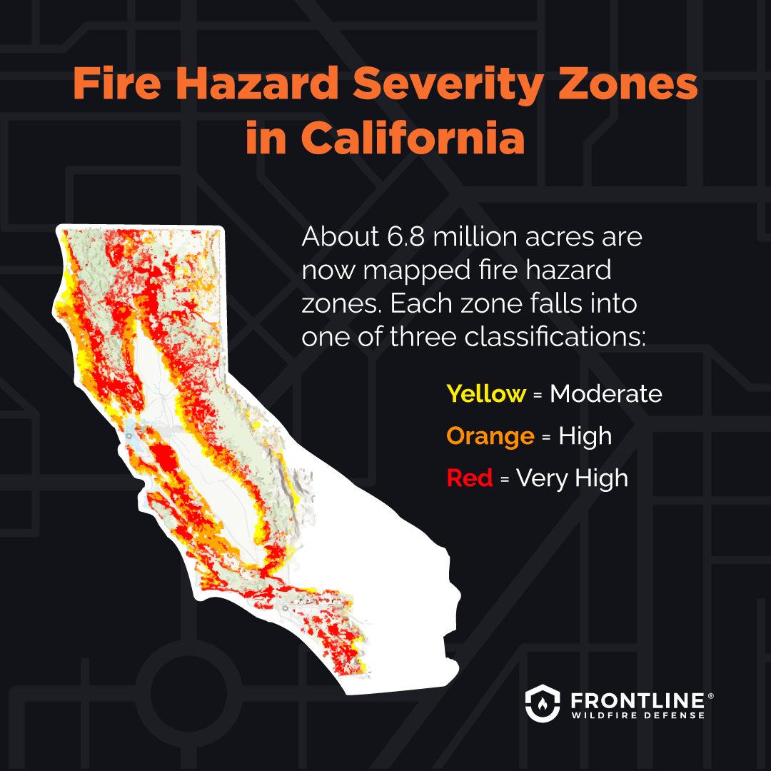
Wildfire season in California typically runs from late spring through fall, peaking in the hotter, drier months of July, August, and September. However, unusual weather patterns can shift these timelines. Historically, certain regions have been more prone to significant fire activity due to their vegetation, topography, and prevailing winds. These often include:
- Southern California’s chaparral-covered foothills: Areas around Los Angeles and San Diego are susceptible to Santa Ana winds, which can rapidly spread fires.
- Northern California’s forested regions: Counties like Shasta, Butte, and Napa have experienced devastating fires due to dense vegetation and specific wind patterns.
- The Sierra Nevada foothills: These areas, often popular for hiking and camping, can also be vulnerable.
For travelers, recognizing these patterns means being extra vigilant when planning trips to these areas during the peak season. It doesn’t mean canceling your Yosemite adventure, but it does necessitate checking fire conditions before and during your visit.
Human vs. Natural Causes
While lightning can ignite fires, the vast majority of wildfires in California are human-caused. This can range from unattended campfires and discarded cigarettes to equipment malfunctions and arson. Understanding this emphasizes the importance of traveler behavior in fire prevention. Adhering to fire restrictions, properly extinguishing campfires, and being mindful of equipment use in dry, vegetated areas are paramount.
Accessing Real-Time California Fire Maps
The most direct answer to “Where Are The California Fires Map?” lies in utilizing official and reputable sources that provide up-to-the-minute information. These maps are invaluable for assessing current risks and making informed decisions about travel routes and destinations.
Official Fire Incident Websites
Government agencies are the primary custodians of wildfire information. These sites are designed for public safety and often offer detailed interactive maps.
CalFire’s Incident Information Page
The California Department of Forestry and Fire Protection (CalFire) is the leading state agency responsible for fire suppression and prevention. Their website features an “Incident Information” page that is a go-to resource.
- Interactive Maps: CalFire provides detailed maps that display active incidents, their perimeters, containment status, and projected spread. These maps are often layered with additional data such as weather conditions, evacuation zones, and road closures.
- Incident Details: Beyond the map, each incident is usually accompanied by a detailed report including acres burned, personnel assigned, resources deployed, and estimated containment dates. This granular information is vital for understanding the severity and progress of a fire.
- Alerts and Notifications: Users can often sign up for alerts or view real-time updates on major incidents directly from the CalFire website.
Other Federal and Local Agencies
Depending on the location of the fire, other agencies might be involved and provide complementary information:
- U.S. Forest Service (USFS): For fires occurring on federal lands, such as national forests, the USFS will have incident information and maps. These are often linked or integrated with CalFire’s resources.
- National Park Service (NPS): For fires within national parks like Yosemite, Sequoia, and Death Valley, the NPS website will provide specific updates and maps.
- Local Fire Departments and Emergency Management: For smaller, localized fires, or for specific evacuation orders within a county, local fire departments or county emergency management agencies often have their own websites or social media feeds with the most pertinent local information.
Third-Party Mapping Platforms
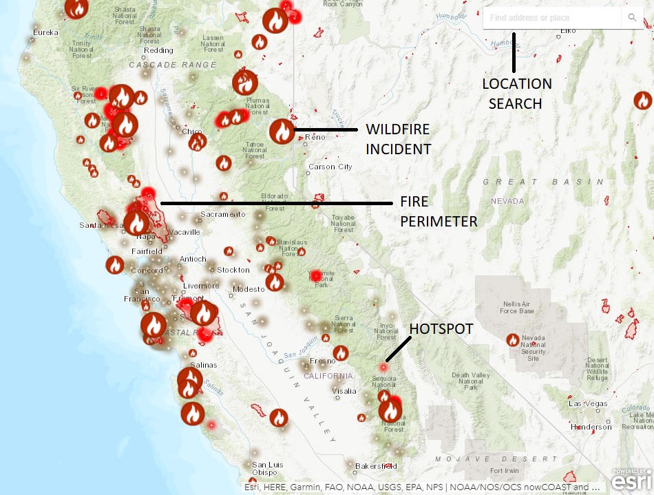
While official sources are authoritative, several third-party platforms aggregate wildfire data from various official sources, offering user-friendly interfaces and additional features.
Fire Information for Resource Management System (FIRMS)
Run by NASA, the FIRMS system provides near real-time satellite data of active fires.
- Satellite Imagery: FIRMS uses thermal imagery from satellites to detect active fire hotspots. While it doesn’t show fire perimeters in the same way as ground-based incident maps, it’s excellent for identifying the initial ignition points and the general area of activity, particularly in remote regions.
- Data Access: FIRMS offers various ways to access data, including web-based maps and downloadable datasets, which can be useful for more in-depth analysis.
Major News Outlets and Weather Services
Many reputable news organizations and weather services provide dedicated sections for wildfire tracking, often incorporating data from official sources into easily digestible formats.
- Real-time Updates: These platforms are excellent for staying informed on major events, road closures, and evacuation orders impacting travel routes.
- Contextual Information: They often provide narrative context, expert interviews, and analysis that can help travelers understand the broader impact of fires on their planned trip.
Interpreting Fire Maps for Travel Planning
Simply looking at a map isn’t enough; travelers need to understand how to interpret the information to make sound decisions.
Key Map Features and What They Mean
When you access a wildfire map, pay attention to these elements:
- Incident Location: Clearly marked with icons or colored polygons.
- Fire Perimeter: The boundary of the active fire, often shown as a colored line. Note that this is a dynamic line that changes as the fire grows or is contained.
- Containment Percentage: Indicates how much of the fire’s perimeter is secured and no longer expected to spread. A higher percentage means better control.
- Acres Burned: The total area affected by the fire. This provides an indication of the scale of the incident.
- Evacuation Zones: Areas where residents and visitors are ordered to leave. These are critical for understanding potential travel disruptions and safety concerns.
- Road Closures: Essential for planning driving routes. Always check for real-time updates as closures can change rapidly.
- Wind Direction and Speed: Many advanced maps will overlay weather data, which is crucial for understanding the potential spread of the fire.
Making Travel Decisions Based on Fire Information
- Pre-Trip Research: Before booking any accommodations or planning any hikes, check current fire activity in your intended destination and along your travel route.
- Flexibility is Key: Wildfires are unpredictable. Be prepared to alter your itinerary if your destination or a significant portion of your route becomes affected. Have alternative plans or destinations in mind.
- Respect Evacuation Orders: If an area is under an evacuation order, do not attempt to enter. This is for your safety and to allow emergency personnel to do their jobs.
- Check Air Quality: Even if a fire is not directly impacting your travel route, smoke can travel hundreds of miles. Check air quality indexes (AQI) for your destination and along your route, especially if you have respiratory sensitivities. Apps like AirNow.gov or local news outlets can provide this.
- Stay Informed During Your Trip: Continue to monitor fire conditions daily. Local news, radio stations, and official agency websites are your best bet for real-time updates.
Beyond the Map: Preparedness and Responsible Tourism
While maps provide the “where,” responsible travel in fire-prone areas involves understanding the “how” and “why” of fire safety.
Fire Prevention Best Practices for Travelers
- Campfire Safety: If campfires are permitted, ensure they are in designated fire rings, cleared of all flammable materials, and fully extinguished before leaving. Drown, stir, and feel for heat.
- Vehicle Maintenance: Ensure your vehicle is in good working order, especially if traveling on unpaved roads. A dragging chain or a hot exhaust can easily ignite dry grass.
- Fireworks Prohibition: Fireworks are a major cause of wildfires. Do not use them in California, especially during dry periods.
- Proper Disposal of Smoking Materials: Never discard cigarettes carelessly. Ensure they are fully extinguished.
Supporting Local Communities
Wildfires can devastate local economies, particularly those reliant on tourism.
- Stay Updated on Reopening: Once an area is safe and reopened after a fire, consider visiting. Your tourism dollars can be vital for recovery. Always check official advisories before traveling to a recently affected area.
- Choose Local Businesses: Support local restaurants, shops, and tour operators in communities that have been impacted.
- Be Patient and Understanding: Communities recovering from wildfires may face infrastructure challenges. Patience and understanding go a long way.
By integrating fire map information into travel planning and adopting responsible practices, travelers can continue to experience the unparalleled beauty and diverse attractions that California has to offer, ensuring both their safety and the preservation of these treasured landscapes.
LifeOutOfTheBox is a participant in the Amazon Services LLC Associates Program, an affiliate advertising program designed to provide a means for sites to earn advertising fees by advertising and linking to Amazon.com. Amazon, the Amazon logo, AmazonSupply, and the AmazonSupply logo are trademarks of Amazon.com, Inc. or its affiliates. As an Amazon Associate we earn affiliate commissions from qualifying purchases.