
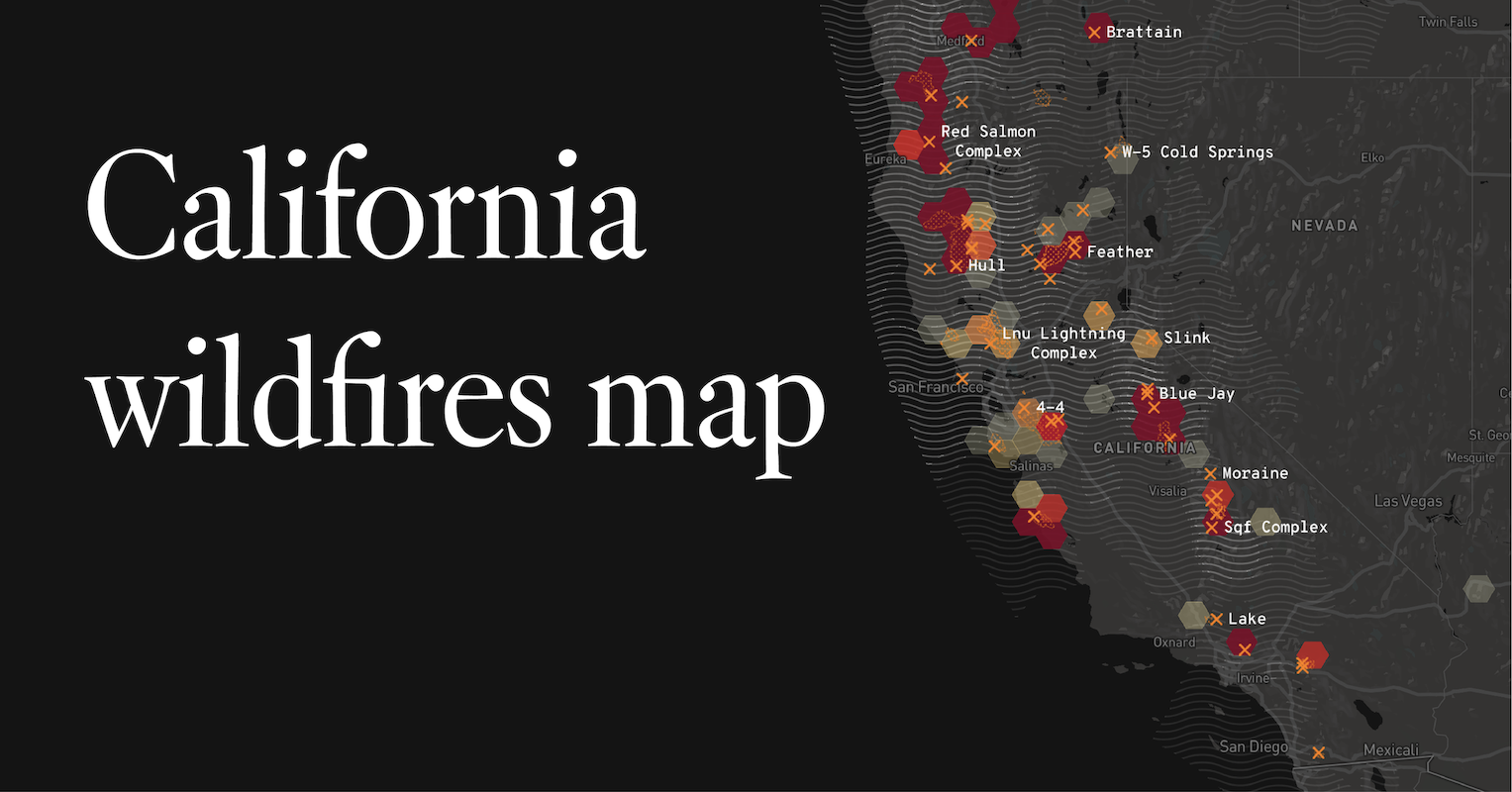
The question “Where are the wildfires in California?” is one that resonates deeply with residents and visitors alike, particularly during the state’s dry season. While California’s allure as a premier travel destination remains undiminished, understanding the current wildfire situation is crucial for safe and enjoyable exploration. This article delves into the factors influencing wildfire occurrences, provides insights into how to stay informed, and offers guidance for travelers planning their California adventures.
Understanding Wildfire Dynamics in California
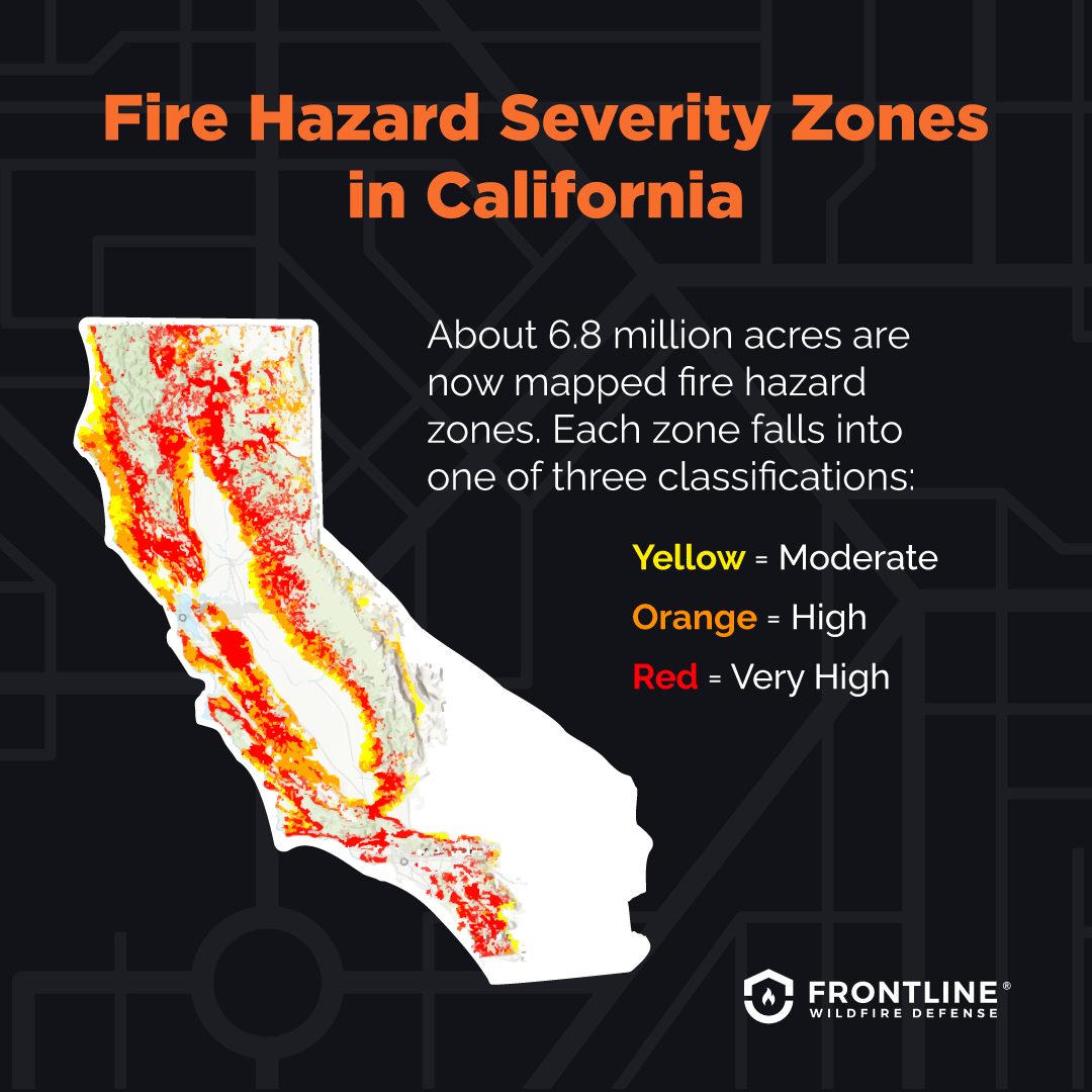
California’s landscape, a tapestry of coastal ranges, vast deserts, and mountainous interiors, is inherently susceptible to wildfires. This susceptibility is amplified by a confluence of natural and human-induced factors.
Natural Contributing Factors
- Climate and Weather Patterns: California experiences a Mediterranean climate characterized by hot, dry summers and mild, wet winters. This prolonged dry period, often extending from late spring through fall, creates a tinderbox environment where vegetation becomes highly flammable. Prevailing winds, such as the notorious Santa Ana winds in Southern California and the Diablo winds in Northern California, can rapidly spread even small fires into infernos. Drought conditions, which have become more frequent and severe in recent years due to climate change, further exacerbate this risk by drying out vegetation to an extreme degree.
- Vegetation Type and Fuel Load: The state’s diverse ecosystems harbor a wide array of vegetation, much of which is adapted to fire. However, dense forests, chaparral, and grasslands can accumulate significant amounts of dead and dry organic matter – known as fuel load. When this fuel ignites, it can sustain intense and fast-moving fires. Overgrown vegetation, often a result of decades of fire suppression policies, can create more hazardous conditions than natural fire cycles would typically allow.
- Topography: Steep slopes and canyons can influence fire behavior, with fires often spreading uphill at accelerated rates. The complex terrain of many of California’s wilderness areas can also make firefighting efforts more challenging and dangerous.
Human-Influenced Factors
- Ignition Sources: While lightning can spark wildfires, the vast majority of ignitions in California are human-caused. These can range from accidental sources like discarded cigarettes, malfunctioning equipment, and sparks from vehicles, to intentional acts of arson. Electrical transmission lines have also been identified as a significant cause of some of the state’s most devastating fires.
- Urban-Wildland Interface: A growing number of communities in California are located in or adjacent to wildland areas, known as the wildland-urban interface (WUI). This proximity increases the risk of structures igniting from embers carried by the wind and puts more residents in the path of approaching fires, leading to complex evacuation challenges.
Staying Informed About Current Wildfire Activity
For travelers, staying informed about the current wildfire situation is paramount to ensuring safety and making informed decisions about travel plans. Several reliable sources provide real-time information.
Official Agencies and Resources
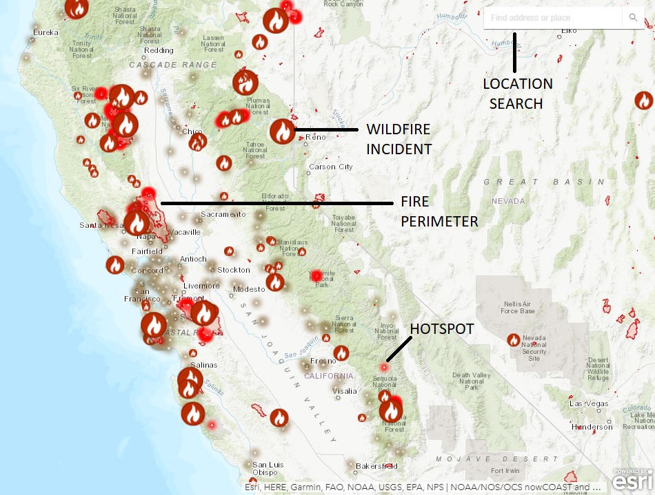
- CAL FIRE: The California Department of Forestry and Fire Protection, commonly known as CAL FIRE, is the primary state agency responsible for wildfire prevention, response, and management. Their website (fire.ca.gov) offers an interactive map displaying current fire incidents, their containment status, and associated evacuation orders. They also issue public alerts and updates.
- National Forest Service (USFS): For fires occurring within national forests, such as the Angeles National Forest or the Sierra National Forest, the U.S. Forest Service is the lead agency. Their websites and local ranger district offices provide incident information specific to these vast public lands.
- Local Emergency Services: County and city emergency management agencies often provide localized information on evacuations, road closures, and shelter locations. These can be found through county websites or local news outlets.
Technology and Tools for Travelers
- Air Quality Monitoring: Wildfires not only pose a direct threat but also significantly impact air quality. Websites and apps like AirNow.gov provide real-time air quality index (AQI) readings, allowing travelers to assess the air quality in their intended destinations and take necessary precautions, such as wearing N95 masks.
- Satellite Imagery and Mapping: Services like Google Maps and specialized wildfire tracking websites utilize satellite data to depict active fire perimeters and smoke plumes, offering a visual representation of the situation.
- Social Media and News Outlets: Reputable news organizations and official social media accounts of fire agencies are valuable for timely updates. However, it is essential to rely on verified sources to avoid misinformation.
Planning Your California Adventure Amidst Wildfire Season
California’s allure as a travel destination is vast, encompassing everything from the vibrant cityscape of Los Angeles and the iconic Golden Gate Bridge in San Francisco to the natural wonders of Yosemite National Park and the beaches of San Diego. While wildfire season (typically late spring through fall) can present challenges, with careful planning, most trips can proceed safely.
Choosing Your Travel Time and Location
- Consider the Season: While fires can occur year-round, the highest risk period is generally from May through October. Traveling during the shoulder seasons (spring and early winter) can sometimes offer a lower risk of encountering significant fire activity, along with fewer crowds and potentially milder weather.
- Research Specific Regions: Different parts of California have varying wildfire risk profiles and peak seasons. For instance, Southern California’s brush-covered hills are particularly prone to fires driven by Santa Ana winds in the fall, while Northern California’s forests face risks throughout the summer and fall. Researching the specific region you intend to visit is crucial.
- Coastal vs. Inland: Coastal areas often experience less severe wildfire impacts compared to inland mountainous or foothill regions, though smoke can still drift.
Essential Preparations and Precautions
- Flexible Itinerary: Build flexibility into your travel plans. Be prepared to alter your route or adjust activities if wildfire conditions or evacuation orders affect your intended destinations. This might mean having alternative attractions or cities in mind.
- Accommodation Choices: When booking accommodation, consider properties in areas less prone to immediate wildfire impact or those with robust safety plans. Hotels in major metropolitan areas like Sacramento or along the coast might offer a greater degree of separation from active fire zones.
- Transportation Awareness: Be mindful of potential road closures due to fires or firefighting efforts. Major highways, such as portions of Interstate 5 or State Route 99, can be impacted. Monitor traffic and road condition apps regularly.
- Pack Accordingly: Beyond typical travel essentials, consider packing items to mitigate smoke exposure, such as high-quality air filter masks (N95 or higher). Also, ensure you have charged electronic devices and power banks for communication, as power outages can occur.
- Heed Evacuation Orders: The safety of yourself and others is paramount. If an evacuation order is issued for your area, follow the instructions of emergency personnel immediately and without delay. Do not attempt to return to an evacuated zone until officially declared safe.
Exploring Beyond the Fire Lines: California’s Enduring Appeal
Despite the challenges posed by wildfires, California’s spirit of adventure and its breathtaking natural beauty remain a powerful draw. The state is vast, and often, the impacts of wildfires are localized, allowing much of the state to remain accessible and enjoyable.
Unaffected Regions and Activities
- Pacific Coast Highway: Much of the iconic Pacific Coast Highway (Highway 1) often remains open and offers stunning ocean views, with areas like Big Sur providing unparalleled natural beauty. However, it’s always wise to check for any specific localized closures.
- Major Cities: Urban centers like San Francisco, Los Angeles, and San Diego are generally less directly impacted by wildfires themselves, though they can experience the effects of smoke. These cities offer a wealth of attractions, from world-class museums and dining to theme parks and cultural experiences.
- Wine Country: While vineyards in regions like Napa Valley and Sonoma County have experienced wildfire impacts in the past, many wineries and tasting rooms continue to operate, often showcasing resilient spirit and offering unique visitor experiences.
- Desert Landscapes: Regions like Joshua Tree National Park and the Mojave National Preserve are naturally arid and have different fire dynamics. While they are not immune, their landscape characteristics can mean they are less prone to the types of large-scale forest fires seen elsewhere.
Responsible Tourism Practices
As travelers, we have a role to play in respecting California’s natural environment and supporting its recovery.
- Leave No Trace: Adhere strictly to Leave No Trace principles when visiting natural areas. This includes packing out everything you pack in, staying on designated trails, and being mindful of fire restrictions.
- Support Local Communities: If your travel plans are affected by wildfires, consider visiting neighboring communities that may not be directly impacted. Supporting local businesses helps economic recovery.
- Educate Yourself and Others: Understanding the causes and impacts of wildfires can foster greater respect for fire-prone landscapes and encourage more responsible behavior.
By staying informed, planning meticulously, and maintaining flexibility, travelers can continue to experience the unparalleled diversity and beauty that California has to offer, even during wildfire season. The key lies in proactive preparation and a commitment to safety and responsible exploration.
LifeOutOfTheBox is a participant in the Amazon Services LLC Associates Program, an affiliate advertising program designed to provide a means for sites to earn advertising fees by advertising and linking to Amazon.com. Amazon, the Amazon logo, AmazonSupply, and the AmazonSupply logo are trademarks of Amazon.com, Inc. or its affiliates. As an Amazon Associate we earn affiliate commissions from qualifying purchases.