
Nestled deep within the majestic San Juan Mountains of Southwest Colorado, Pagosa Springs is a captivating destination renowned for its natural hot springs and unparalleled access to the pristine wilderness. Its geographical coordinates place it precisely in Archuleta County, at approximately 37.265° N latitude and 107.009° W longitude. This prime location, often described as the “Heart of the San Juans,” positions it strategically for travelers seeking an authentic Colorado mountain experience, blending relaxation with high-octane adventure.
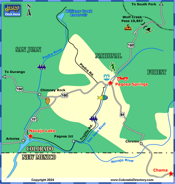
The town itself is situated at an elevation of around 7,126 feet (2,172 meters) above sea level, contributing to its distinct four-season climate and the crisp mountain air that invigorates visitors. It lies along U.S. Route 160, a major east-west artery traversing southern Colorado, making it accessible while still retaining its secluded charm. To its west, approximately 60 miles, lies the vibrant city of Durango, another popular Southwest Colorado hub. To the east, the road ascends dramatically over Wolf Creek Pass, famous for its abundant snowfall and the renowned Wolf Creek Ski Area. This unique positioning is what grants Pagosa Springs its dual identity as both a tranquil spa town and a gateway to some of the most rugged and beautiful landscapes in the American West.
A Geographical Gem in the San Juan National Forest
Pagosa Springs’ location is inextricably linked to the vast expanse of the San Juan National Forest, which literally envelops the town. This immediate proximity to millions of acres of protected forest land defines much of the travel experience here. The San Juan National Forest provides a dramatic backdrop of towering peaks, dense evergreen forests, and alpine meadows, offering an endless playground for outdoor enthusiasts.
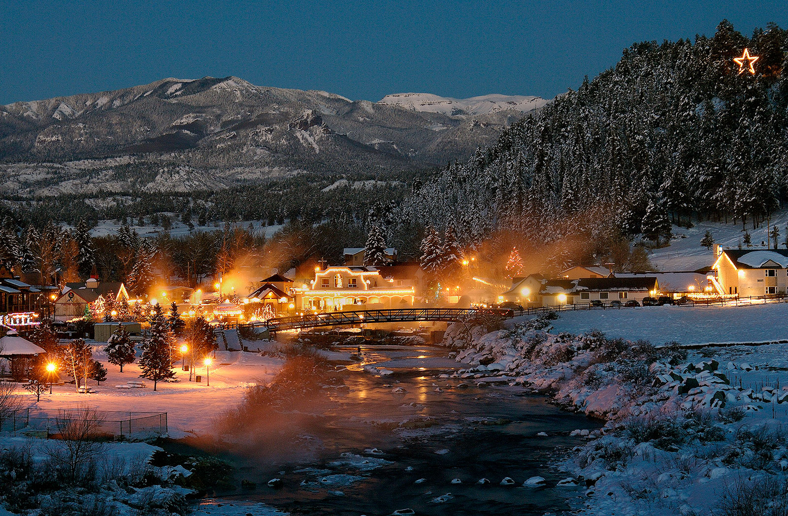
The town sits at the convergence of three major geographical features: the San Juan River basin, the towering peaks of the San Juan Mountains, and the southern edge of the Colorado Plateau. The San Juan River itself flows directly through the heart of town, providing not only scenic beauty but also opportunities for recreation right on its banks. The geological forces that shaped this region are also responsible for the town’s defining feature: the geothermal hot springs that bubble up from deep within the earth, attracting visitors from across the globe.
Navigating the Local Terrain
Travelers to Pagosa Springs will quickly notice the distinct topographical changes as they explore the surrounding area. From the relatively flat river valley where the town is situated, the landscape quickly rises into foothills and then into the majestic peaks of the continental divide. This varied terrain means that within a short drive, visitors can transition from riverside strolls to high-altitude mountain trails.
The presence of significant mountain passes like Wolf Creek Pass underscores the mountainous nature of the region. While U.S. Route 160 provides reliable access, travelers planning winter trips should be prepared for mountain driving conditions, as heavy snowfall is common and contributes to the area’s reputation as a winter sports paradise. Understanding this geographical context is crucial for planning any trip to this beautiful corner of Colorado.
Accessibility: How to Reach This Mountain Oasis
Reaching Pagosa Springs involves understanding its position within the broader transportation network of the Western United States. While it feels wonderfully remote, it is nevertheless well-connected, making it an achievable destination for various types of travelers.
By Air
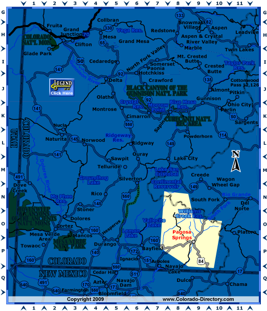
For those traveling from further afield, air travel typically involves flying into a regional airport and then driving to Pagosa Springs. The most convenient option is the Durango-La Plata County Airport (DRO), located approximately 55-60 miles west of Pagosa Springs. DRO offers direct flights from major hubs such as Denver, Dallas/Fort Worth, Phoenix, and Salt Lake City, serviced by airlines like United Express, American Eagle, and Frontier Airlines. From DRO, travelers can rent a car and enjoy a scenic drive eastward on U.S. Route 160 to reach their destination.
Another viable, albeit longer, option is the Albuquerque International Sunport (ABQ) in New Mexico. ABQ is about a 3 to 3.5-hour drive (approximately 170 miles) north of Pagosa Springs. While it requires a longer drive, ABQ often offers more flight options and potentially more competitive fares for travelers originating from diverse locations across the United States.
By Car
Driving is arguably the most popular and flexible way to arrive in Pagosa Springs, allowing travelers to fully immerse themselves in the scenic beauty of Colorado. As mentioned, U.S. Route 160 is the primary highway leading directly into the town.
- From Denver and Northern Colorado: The journey typically takes around 5-6 hours. Travelers will head south on I-25 to Walsenburg, then west on U.S. Route 160 over the scenic La Veta Pass and Wolf Creek Pass before descending into Pagosa Springs. This route offers breathtaking mountain vistas, especially over Wolf Creek Pass.
- From Santa Fe and New Mexico: The drive is approximately 3-3.5 hours, generally following U.S. Route 84 north to its junction with U.S. Route 160 near Chama, New Mexico.
- From Durango and Western Colorado: A straightforward and relatively flat drive of about an hour along U.S. Route 160 east.
It is crucial to note that winter travel, particularly over Wolf Creek Pass, can be challenging. Road closures due to heavy snowfall are possible, and all-wheel drive or four-wheel drive vehicles with appropriate tires are highly recommended, if not required, during certain periods. Travelers should always check road conditions with the Colorado Department of Transportation (CDOT) before embarking on their journey.
Pagosa Springs as a Travel Hub
Beyond its intrinsic appeal as a destination, the location of Pagosa Springs makes it an excellent base for exploring the wider Southwest Colorado region and even parts of northern New Mexico. Its central positioning within the San Juan Mountains allows for convenient day trips to a myriad of other attractions.
Proximity to National Parks and Monuments
Travelers staying in Pagosa Springs can easily access several significant national landmarks:
- Chimney Rock National Monument: Just a short 30-minute drive west on U.S. Route 160, this ancestral Pueblo site offers a fascinating glimpse into ancient civilizations and stunning views of the surrounding landscape.
- Mesa Verde National Park: Approximately 1.5-2 hours west of Pagosa Springs, this UNESCO World Heritage Site is home to some of the best-preserved cliff dwellings in North America, offering an unparalleled historical and cultural experience.
- Great Sand Dunes National Park and Preserve: Roughly 2 hours north-east of Pagosa Springs over Wolf Creek Pass, this unique geological wonder features the tallest dunes in North America, an extraordinary sight against the backdrop of the Sangre de Cristo Mountains.
This advantageous location transforms Pagosa Springs from merely a stop on a journey into a central hub for an expansive Southwest Colorado adventure. Whether the goal is serene relaxation in the famous hot springs, thrilling outdoor activities in the San Juan National Forest, or exploring ancient cultures, Pagosa Springs’ location is key to unlocking a memorable travel experience.
LifeOutOfTheBox is a participant in the Amazon Services LLC Associates Program, an affiliate advertising program designed to provide a means for sites to earn advertising fees by advertising and linking to Amazon.com. Amazon, the Amazon logo, AmazonSupply, and the AmazonSupply logo are trademarks of Amazon.com, Inc. or its affiliates. As an Amazon Associate we earn affiliate commissions from qualifying purchases.